
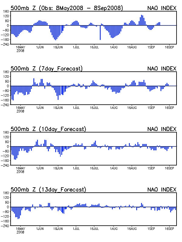
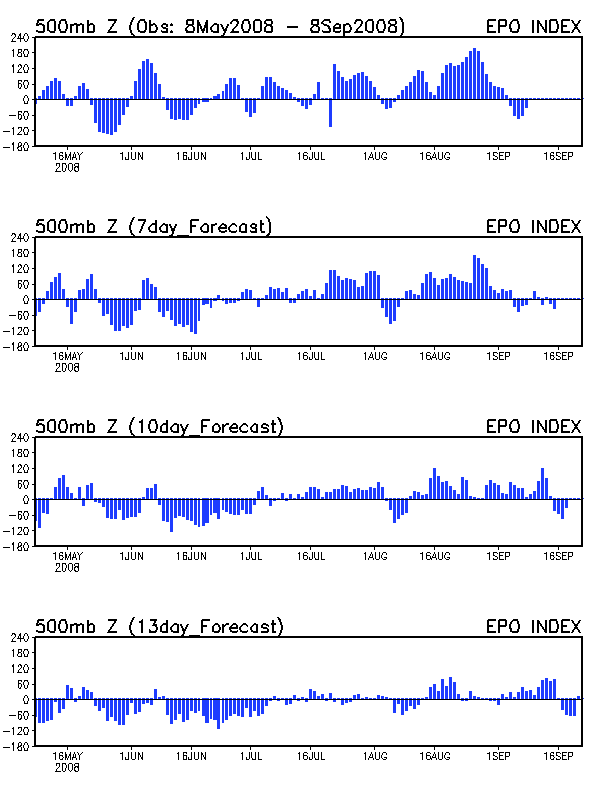
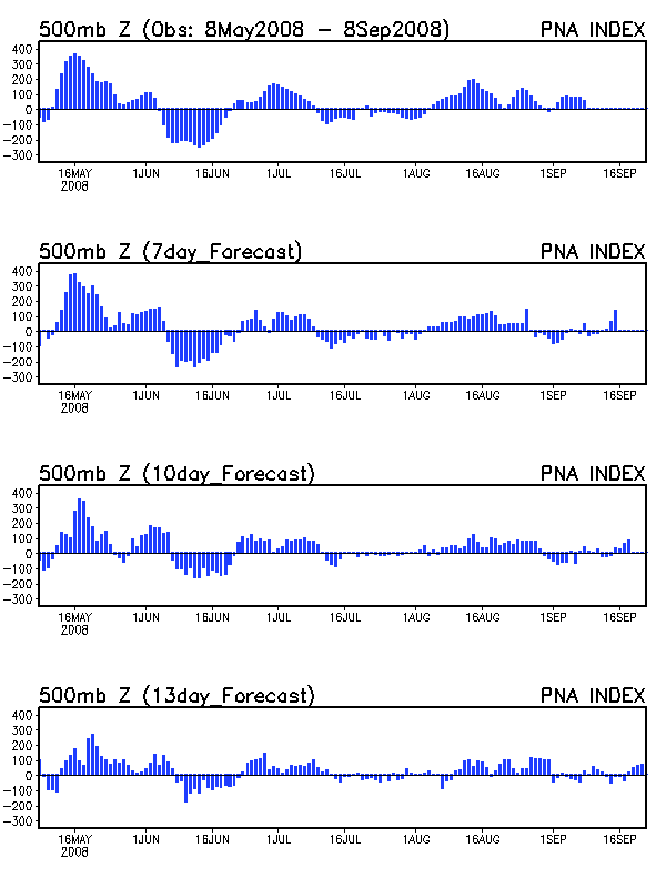
The last post mentioned that the heat wave this week would be short-lived due to a negative NAO that would develop mid-week. This negative NAO will now combine with a negative EPO and positive PNA to bring an “Autumn preview” to the Great Lakes and a welcome cool snap to the Mid-South, along with a good chance of some precipitation.
As I’ve mentioned here before, the best teleconnection setup for cold weather in the Mid-South is a negative NAO, negative EPO, and postive PNA. When the three teleconnections are in this phase, there is usually a deep trough located over the Great Lakes that can bring cP air from Canada to our region. During winter, this would mean arctic air and a chance at snow, but during summer, this means a cool, refreshing air mass that allows you to turn off the AC for a few days. As you can see, the NAO, EPO, and PNA are all projected to be in the appropriate phase for next weekend.
Today, you can see the heat ridge starting to build eastward. High temperatures in the Dallas area are expected to be 105-107 degrees. Monday and Tuesday, the ridge will expand into the Mid-South, although temperatures are only expected to be in the 92-96 degree range (rather than the 96-100 which was modeled last week). Around Wednesday, a cold front will slowly push southward across the Mid-South, bringing the possibility of precipitation. A reinforcing cold shot will arrive Friday-Saturday, as a closed-off vortex at 500 mb is expected to form over the Great Lakes. This kind of vortex (which is rare for August) will bring fall-like weather to the eastern Great Lakes (a breezy, cloudy day with showers and highs in the upper 60s) while the Mid-South will cool off to highs in the lower 80s. The 850 mb temps fall off a cliff, as they fall from around 24C on Tuesday to around 12C on Saturday.
This “polar vortex” pattern for the East will linger through the middle of the month, which means temperatures should remain below normal to normal for the Mid-South through at least the 15th. This is supported by the recent 6-10 day and 8-14 day outlooks of the NWS. The big concern about this pattern is that the suppressed flow in the East will allow a big heat ridge to develop in the central and western U.S. When the NAO goes positive, the East Coast trough will lift and allow this heat to spread eastward, so a return to 95+ seems likely in the Mid-South for at least part of the 2nd half of August.