
No, it sure isn’t. Hopefully by tonight, this upper-level system will be out of our area, giving us a breather from the annoying continuation of snow (in all shapes and sizes) falling from the skies. It seems as though another system could possibly impact the area by this weekend, we will wait until closer to that time to break down the development of this. Let’s have a look at whats going on:
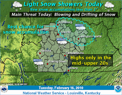
Northwest flow has continued to pour clouds and scattered snow across the area. As the low pressure system continues to shift to the NE today, the strong winds and snow will finally give way and exit the region by late tonight. Minor accumulations are still possible throughout the day, but don’t expect much of anything. High right around 30 today will dip to the lower 20’s tonight. For tomorrow, expect partly sunny skies with the temperatures staying the same. Winds will still be present, but not near as strong as what we experienced yesterday/today. We should see a mix of sun and clouds through the rest of the week, until the next weather event enters the region Friday. Stay warm and enjoy the rest of your work week!