For the past several days, we Kentuckians have been stuck with the same aggravatingly hot conditions generated by this more or less stationary ridge over the southeast. Bowling Green started off fall with the mercury tying a record high temperature of 95°F today. Forunately, these hot conditions may only have another day left, as a long-anticipated cold front associated with a mid-latitude cyclone moving across the northern part of the country will bring cooler conditions to the area on Saturday, along with a chance of thunderstorms as the front moves through Friday afternoon.. Forecast highs over the next week should drop into the low 70s by Monday, with a slight rebound towards the upper 70s by the end of next week. This should also bring a fair amount of precipitation into the region, with the National Weather Service calling for a 40% chance of rain on Monday.
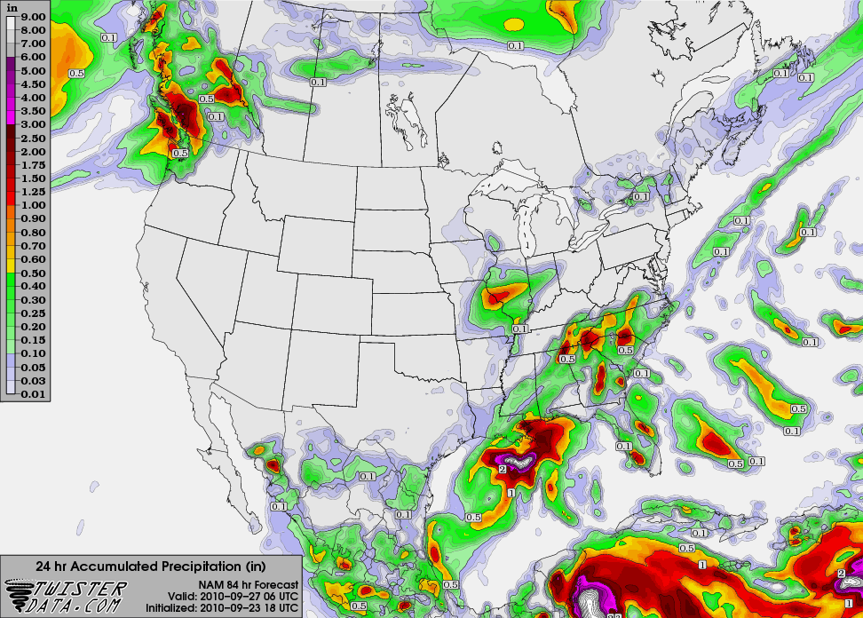
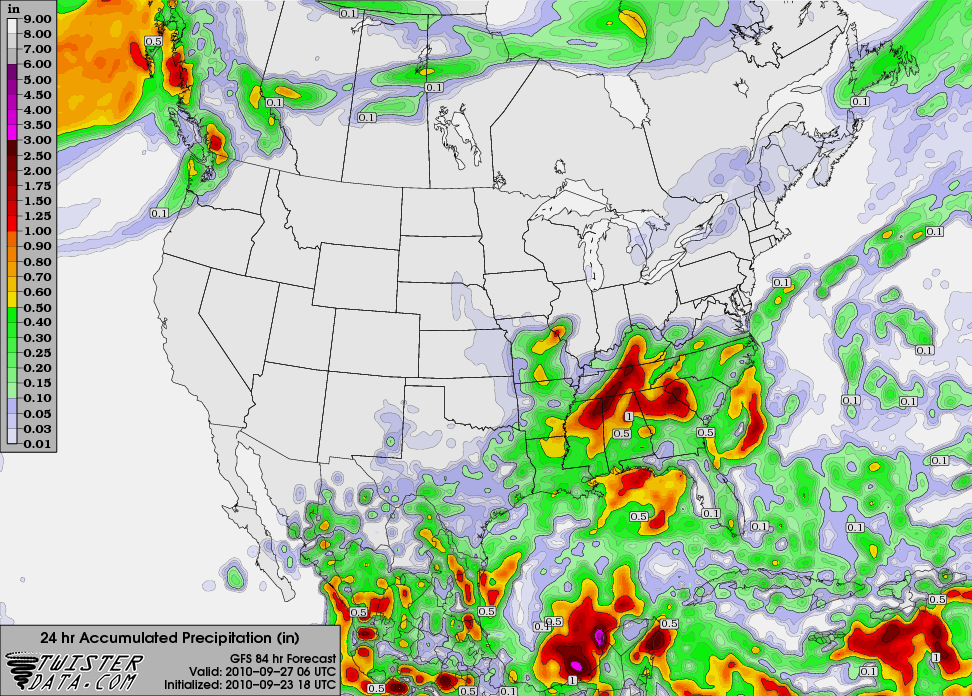
Of particular interest is the way that the GFS and the NAM are handling the increased odds of a precipitation event on Monday. The NAM, shown below on top, does not call for any rain immediately over Bowling Green, instead favoring precipitation falling more or less everywhere around it. On the contrary, the GFS, on the bottom, is calling for upwards of 2 inches in the Warren County area. While chances are that the GFS is overestimating the amount of precipitation associated with this airmass, it is indicative that our dry spell may finally be coming to an end.