Highlights:
-Major rainmaker on tap for Thursday
-Cooler temperatures on Friday
-Active pattern setting up for next week
Forecast:
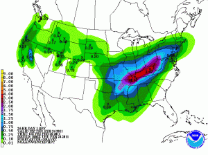
Warm front will move north past Bowling Green early Thursday Morning, bringing warmer temperatures and raising dew points. Moisture will be streaming northward in front of a center of low pressure that will deeping in Oklahoma. By noon this front will stall somewhere near the Ohio River and a sheild of precipitation will spread in coverage across Kentucky. By later in the evening, the low will ride up along this boundary and bring another round of heavy precip. Most of Kenucky is set to recieve widespread rainfall amounts of 2″+. The axis of heavier precipitation will reside along the Ohio river, where the greatest forcing exists along the stalled warm front. A potential exists in southern Kentucky for thunderstorms (with a small possiblility of severe) with heavy rain and strong winds being the main threat. Instability (energy) will be minimum at best, so as of now only thinking there will be a few rumbles of thunder and heavy rainfall. A cold front will andvance eastward, with this center of low pressure, and precipitation should come to an end Fri. morning. Temperatures on Fri will remain cool with highs only reaching the upper 40’s and lows Fri. night in the mid 30’s. Saturday looks to be dry and seasonalby warm with highs in the middle 50’s and lows in the 40’s. With a chance of rain returning on Sunday.