
According to the Storm Prediction Center, the Bowling Green area has a chance of seeing severe weather each of the next 3 days. Here’s the convective outlook for tomorrow:
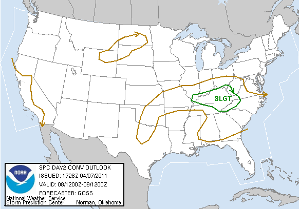
The severe threat tomorrow looks to be marginal. Some degree of instability is forecast to be in place along with moderate wind shear, but upper level ridging will tend to suppress widespread convection. Also, the energy that could provide lift for storms is expected to move through during the late morning to early afternoon hours, which isn’t optimal timing for severe storm formation. However, if storms can fire, they will be capable of producing some hail and strong winds.
Saturday’s outlook:
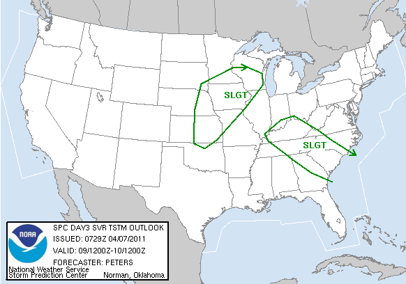
On Saturday, a shortwave is forecast to ripple through the upper-level ridge over the area and provide lift for storms to develop. With moderate instability and shear in place, these storms will also have the potential to be severe. However, timing will once again be an issue, as this system is also expected to move through during the early afternoon hours, before optimal daytime heating occurs. This will tend to cut down on severe chances for Saturday.
The main event is still expected to unfold Sunday night into Monday morning, when a deep trough ejects from the Rockies into the central part of the country. A strong surface low is expected to develop and track from the central Plains to the Great Lakes, bringing a cold front through the Bowling Green area. At this point, it looks like another squall line with possible embedded supercell structures will move through the area early Monday morning, but this event is still a long way out. The timing and severity of the threat will be better known later this weekend.