
After a beautiful start to the week, the weather will turn dreary tomorrow. An upper-level disturbance and associated surface low will progress through the region, bringing widespread rainfall and holding high temperatures in the mid 50s. A few embedded thunderstorms also can’t be ruled out. Anywhere between a quarter and a half inch of rainfall is expected before the system exits the area tomorrow night.
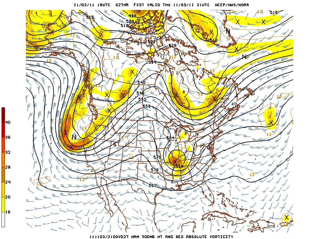
NAM 500mb height and vorticity forecast for 4 PM tomorrow, showing upper level low over the region
After the system clears the area tomorrow night, high pressure will quickly build back in from the west. This will result in a return to pleasant weather and seasonable temperatures for the weekend, with highs around 60 on Friday increasing to the mid 60s on Saturday and Sunday. Nighttime temperatures will not be quite as cold as they were earlier this week, with lows in the upper 30s and lower 40s expected over the weekend.