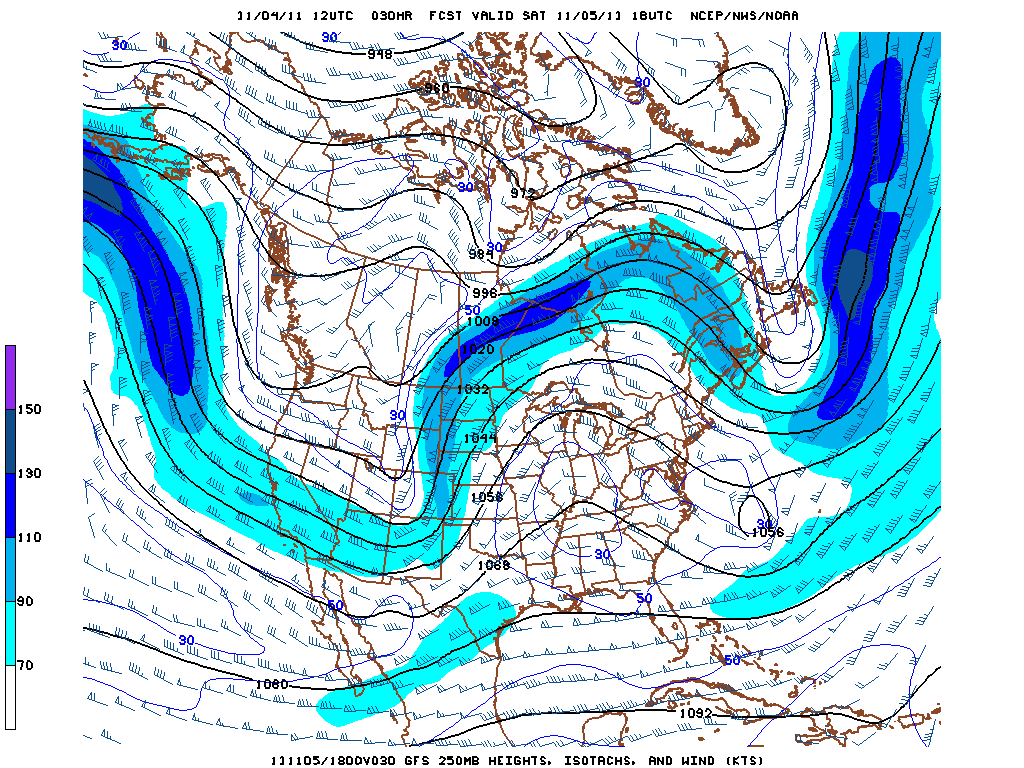
A broad upper level ridge will dominate the pattern over the eastern half of the U.S. for the next several days, leading to picture perfect fall weather over the weekend for the mid-South. Highs in the middle to upper 60s are expected tomorrow and Sunday under mostly clear skies. These clear skies and light winds will provide ideal radiational cooling conditions, so overnight lows are expected to drop down into the middle 30s tonight and tomorrow night. These conditions will also be favorable for cold air drainage into Kentucky’s valleys and large overnight temperature spreads between adjacent ridgetops and valleys. This phenomenon can be monitored in real time using temperature data at the Kentucky Mesonet web site.

GFS 250 mb height and wind speed forecast for 1:00 PM Saturday, showing upper level ridging over the eastern U.S.
With quiet weather the rule locally and nationally, this is a good time to share a few links to other web sites that may be of interest to readers of this blog. The first link is to the University of Wisconsin’s Cooperative Institute for Meteorological Satellite Studies (CIMSS) blog, which provides selected satellite imagery of current meteorological events and provides a sampling of the numerous applications that satellite-derived products can have in weather analysis and forecasting. Another great source of information on current weather events is Dr. Jeff Masters’ blog at Weather Underground; Dr. Masters does a great job of compiling information and statistics and gears his writing toward a general audience while remaining faithful to the science of meteorology. Closer to home, the WKU StormTopper Network is a great source of information on local weather, and the network also maintains Facebook and Twitter pages. Finally, you can “like” the new Western Kentucky University Meteorology Facebook page to receive meteorology stories of interest in your Facebook news feed.

