
Today proved to be difficult in terms of an obvious forecast, but we took advantage of several opportunities to travel and explore new areas for our trip across the southwest US and document even more severe weather. We had a couple of different options for our target area; one being the southwest Texas panhandle near Snyder, TX where outflow boundaries and other thunderstorm ingredients were present, and northeast New Mexico between Clayton and Des Moines. This region favored convective activity throughout consistent model runs on the HRRR and NAM 4K, our favored high resolution models.
We voted on heading to New Mexico this morning after a lot of debate, due to the fact that despite lower instability and moisture values, upper-air support favored thunderstorm activity on the leeward side of the mountains in this region. Below is a surface analysis that covers a few fundamental forecast variables we discussed.
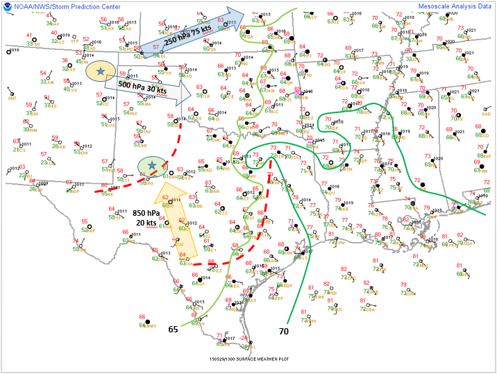
Surface analysis showing observations valid at 1200 Z and upper-air diagnostics valid for 0000 Z today.
Red dashed lines show the locations of two outflow boundaries from previous thunderstorm activity, and the arrows show the general direction and magnitude of jet stream flow across the area. Our two initial target areas are shown by the stars.
Northwest flow across the panhandle is that primary reason we decided to head northwest and take advantage of the photogenic landscape of the High Plains. Turns out convective models were correct in their output throughout the day and we had several opportunities to grab some very scenic views in NE New Mexico.

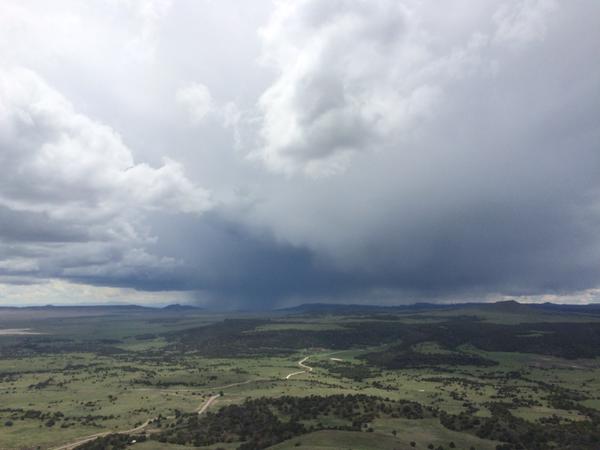
The view of the landscape in NE New Mexico as we made our way to our selected target
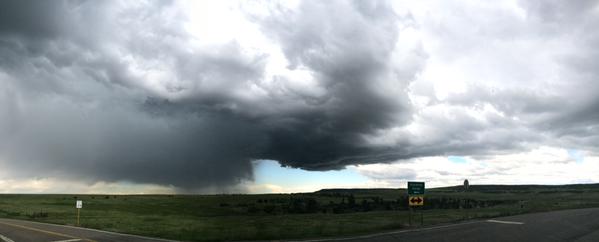
A great bit of luck allowed us the opportunity to explore the Capulin Volcano, where we were able to view a severe thunderstorm producing hail and gusty winds from over 8,000 ft in elevation! This was very enjoyable because we got to hike up to the top of the rim and look into the caldera of the extinct volcano, what a view!
View from atop the Capulin Volcano in NE New Mexico
After departing from the Capulin volcano, we drove through the northern portion of New Mexico and entered Colorado where we saw the beautiful snow capped Rocky Mountains. After driving along the interstate for sometime, convection started coming off the mountains and of course we decided to chase it!
Second storm we chased for the day north of Trinidad, CO
This cell soon fizzled out and we kept trucking along towards the city of Denver, our stop for the night. Before reaching Denver, more storms initiated to our northeast and we chased them. The first one fizzled out before reaching it. The second one produced 4-6 inches or more of accumulated hail and made the Colorado countryside look as if it were covered in snow!

Hail along a roadway in central Colorado
After plowing through over 4+” of hail accumulation, it was time to fuel up and head for our hotel south of Denver, CO where we were able took look back on our day, and our trip in general. The atmosphere seems to be quietening down for tomorrow, which will likely be used as a day travel, and any observations of storms along the way. We’ve had a very busy couple of weeks in The Plains and have seen many different forms of severe weather.
Stay tuned to @wkustormchase on Twitter for live updates throughout our journey and see what we may get ourselves into tomorrow! – AS, MM