
This Evening: Low- 48
Today has been the coolest day we’ve had in a while. We’ve been having a few showers throughout the afternoon. Our high was in the mid-70’s. There’s a chance for scattered showers this evening.
Tomorrow: High- 70 Low- 47
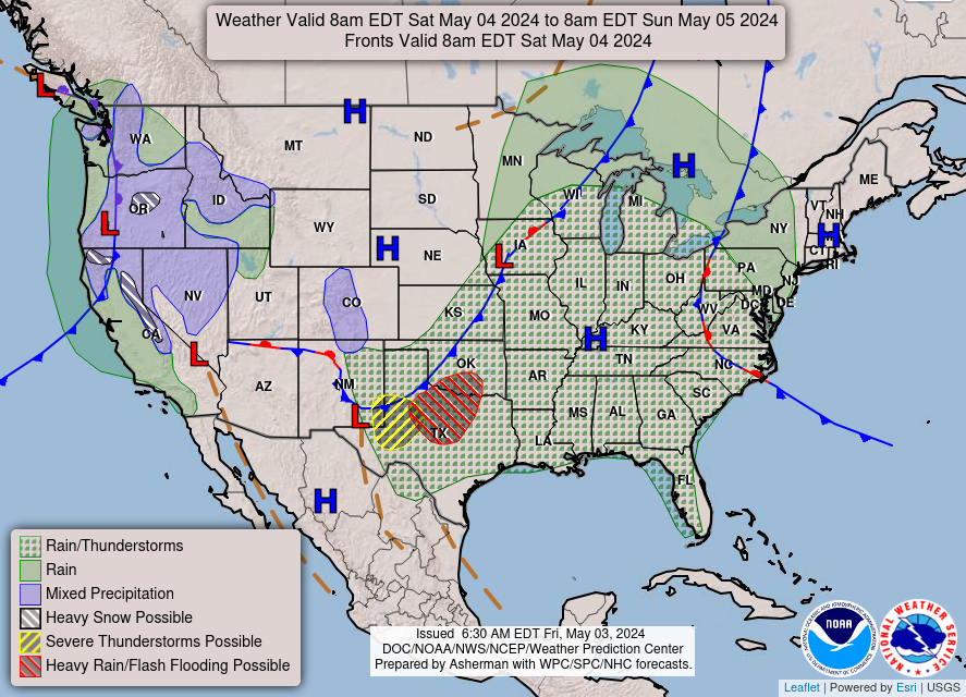
NWS National Forecast
Monday: High- 80 Low- 53
Weekly Outlook:
Tonight: Scattered showers and thunderstorms before 7pm, then isolated showers between 7pm and 9pm. Partly cloudy, with a low around 47. Northwest wind 5 to 8 mph becoming calm after midnight. Chance of precipitation is 30%.
Sunday: Sunny, with a high near 72. Calm wind becoming northwest 5 to 7 mph in the morning.
Sunday Night: Clear, with a low around 47. Northwest wind around 5 mph becoming calm in the evening.
Monday: Sunny, with a high near 78. Calm wind becoming south around 6 mph in the afternoon.
Monday Night: Mostly clear, with a low around 54. Southeast wind around 5 mph becoming calm in the evening.
Tuesday: Sunny, with a high near 82.
Tuesday Night: Mostly clear, with a low around 58.
Wednesday: Mostly sunny, with a high near 85.
Wednesday Night: Partly cloudy, with a low around 61.
Thursday: Mostly sunny, with a high near 87.
Thursday Night: Partly cloudy, with a low around 63.
Friday: Mostly sunny, with a high near 87.
Friday Night: A 30 percent chance of showers and thunderstorms. Mostly cloudy, with a low around 66.
Saturday: A 40 percent chance of showers and thunderstorms. Mostly cloudy, with a high near 84.