Morning observations indicated a stalled cold front along I-10 corridor, and model data suggested this front would be weakening throughout the day. Therefore, this cold front would become less of a forcing factor in afternoon thunderstorms. Yesterday’s convection along and south of the front also stabilized the atmosphere, so very little instability existed except in far west Texas where storms had been spotty the day before and cloudiness was reduced so ample heating could occur. This area of marginal instability coincided with the location of the center of convergence that had dropped into northern Mexico overnight, and indicated the area most likely to produce thunderstorms. We initially decided to target Big Bend National Park, since we needed topography and convergence to provide lift because of the greatly reduced instability.
The 11:30 AM CST SPC Convective Outlook update lowered the slight risk over our target area to marginal due to further reduction of expected instability and the persistent cloudiness that prevented surface heating. The only area that retained a slight risk was the El Paso region and the upper Mission Valley area. This, in conjunction with consistent HRRR data prompted us to change our target to the El Paso region by 12:30 AM CST.
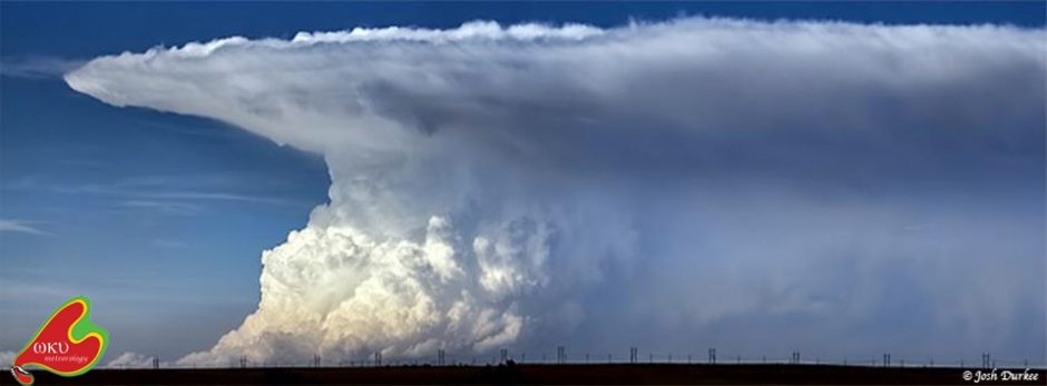
We stopped briefly in Van Horn, TX after lunch in Fort Stockton, TX to await convection initiation and for those initiated storms to cross the border. Initiation occurred in northern Chihuahua, Mexico at around 4:30 pm CST, and we began our intercept course. Intercept occurred south of Alamo Alto, TX, less than 1/3 of a mile from the banks of the Rio Grande. Although the storm was neither tornadic nor severe, it was impressive to see the storm cross the Samalayuca Dune Fields to the south (Figure 1) and the structure of the storm provided some excellent photo opportunities (Figure 2).
As the storm crossed our path, we drove through the rain core to the other side. The back of the storm gave us a show in the form of a vivid double rainbow (Figure 3). With storms further to our south disintegrating after crossing the border, losing topographic lift, and entering a strongly capped environment, we headed north to El Paso for dinner at Rudy’s BBQ (Figure 4) and a well-deserved rest.
The next few days look like some tourist-travel days as we wait for high pressure across the Central Plains to vacate and moisture to return to middle America. We plan to head north along I-25 and perhaps make a stop in White Sands, NM on our way to Colorado for the night. Stay tuned!
-Isaac Bowers
Click on this link to view an interactive chase map!


