
Evening all, the middle of October has arrived and it sure has been a warm start to the week! High temperatures across Kentucky have reached into the upper 80s today and will continue to do so through Wednesday and potentially Thursday for some parts of the state.

WPC Forecast Map for Z Tuesday (Monday evening local time)
As the high pressure that has been lingering over the south eastern part of the United States continues to stall along East coast keeping the warmer temperatures across the southern part of the United States, a cold front located in the central plains, where a center of low pressure currently lies. This cold front will move across the plains and mid-west regions into Kentucky over the next two days, bringing rain showers and cooler high temperatures into our region by Wednesday night.
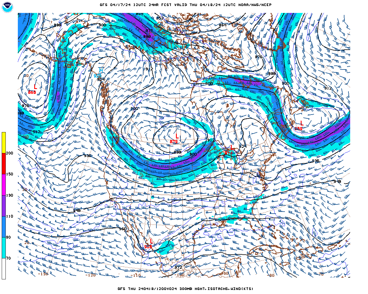
NCEP/NWS/NOAA GFS 300 millibar heights for 00Z Tuesday
Currently a ridge located along the east coast and a meridional (horizontal flowing) upper level jet moves most of the United States thus providing no change in the warm temperatures for Kentucky. However, over the next couple of days a trough will increase in depth while moving east towards Kentucky which will bring the chances of rain to the area.
So Looking Ahead:
Tonight: Clear with temperature reaching a low of around 66 degrees Fahrenheit with around 5 to 10 mph winds from the south.
Tuesday: Sunny and clear with a high around 89 degrees and winds from the south west around 5 to 10 mph. Wind gusts of around 20 mph are possible.
Tuesday night: Clear with temperatures reaching a low of around 63 degrees and winds from the south west around 5 to 15 mph.
Look for Wednesday to bring a clearer forecast on when to expect some rain chances.