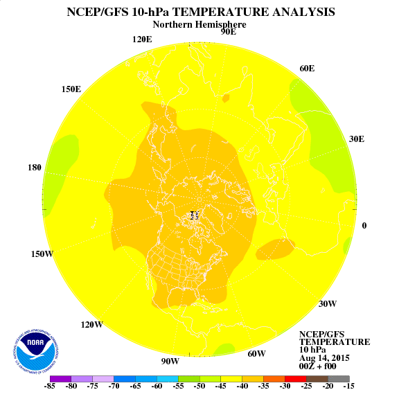
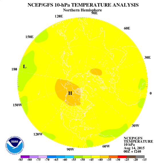
Over the past few months since the 1st of November we have been in a very unfavorable pattern for sustained wintry weather. Concerns over the – PNA in my winter outlook lead to a revised outlook for cold in the Rockies/west with warmth in the southeast and above normal precip over our region which has verified so far. For now I would cut back on snow over the great lakes some as the lake effect hasn’t been found yet. I’ve eliminated some of the analogs which had a cold December, others however may still prove OK given a stratospheric warming event affecting the January weather pattern. So far the climate models which had a blowtorch winter such as the ECMWF and CFS are spot on. However I expect this to change due to rapid warming in the stratosphere over the pole regions. The QBO which measures winds over the poles is tanking toward values which favor stratospheric warming episodes. The GFS model of stratospheric warming is showing a fair deal of warming in stratosphere over the next 10 days.

current above, day 10 below

Stratospheric warming typically lead to a much colder pattern across the United States about 2-3 weeks in the future with a switch in the AO to negative. Recall the past two winters featured a Negative AO throughout. A feature analog in my winter forecast was 2008-09 which had a stratospheric warming event in January, December was very mild and then February was warm overall. I expect much the same this winter.
Here are a look at some past January’s with regards to surface temperatures in which those months had stratospheric warming events
And a close look at 08-09
Displace the cold further southwest and decrease in magnitude given a stronger cold PDO ( ridge off the west coast) for Dec.
Again this is only one factor that could influence our weather come January say around the 2nd week. Untill then I don’t see much change in the weather pattern with warm rain systems followed by quick shots of seasonable air then more warm-ups and rain. refer above to the short term for more.
Forecaster: MWG


