We’re on the snow board now with 1.4 inches for the season. The talk of a snowless winter actually ended Jan 2 where .2 inches of snow fell officially where many just saw flurries.
Hope you enjoyed the snow b/c we’re going back to the same old pattern I’ve hated all winter.

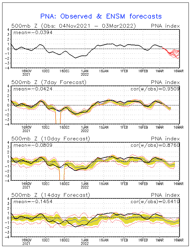
This – PNA forces a southeast ridge and dumps any cold into the west, it’s back where it was in NOV. And is the reason why any systems the next few weeks cut well to our west and most days are very mild through the end of Jan once this airmass in place leaves. Any cold shots are brief.
1. Monday will see a return to southwesterly flow which will cause some week isentopic lift to take place leading to increase in clouds, a light rain shower can’t be ruled out the best chance Monday should be from Little Rock to Indy where the isentopic lift is more pronounced. Lows should be in the mid 30′s and Highs should climb into the low 50′s. Winds will pick up from 10-20 mph.
2. A low pressure tracks in the lakes Tuesday bringing with it a strong cold front. Ahead of the front SW flow will lead to steady or rising temperatures Monday night. Will lean to the ECMWF with this since it handled the new years front well. Temperatures should rise into the low 50′s south and upper 40′s north Monday night. Southwest winds of 15-25 mph. Periods of rain showers will accompany the front, the SREF has .25-.5 of rain across the region I could see a few amounts near or just over an inch along I-71 which is well north of us. I’m going with the slower frontal passage on all models not named the GFS. This should allow for a temperature spike from 60-65 on Tuesday for highs.
3. temperatures crash fast Tuesday night into the 20′s with highs getting close to 40 Wednesday. Skies will clear as the wind direction temporarily turns back to the northwest. Thursday may be interesting with a chance of light rain or snow. After that we should really warm-up, good thing my trip to New Orleans for the American Meteorological society is next weekend and I won’t miss any winter. Another blog author will be updating that week.
4. I continue to think around the 7th of FEB the pattern should change as we get another 10 mb warming event over the poles and the latest euro weekly forecast turns cooler around this time as well. The end of this month should be a transition from the peak of warmth around the 23rd several storms will cut into the lakes, maybe some severe weather as well.

adding chance thunder to the forecast for Tuesday.