
We are keeping a close eye on an strong October mid-latititude cyclone that has been brewing in model forecasts for a few weeks now. This system is currently located over Nebraska bringing several inches of snow to Wyoming, and South Dakota. This system looks to arrive for us in central Kentucky late Saturday night into early Sunday morning brining a multi-cellular broken squall line across the eastern United States. The main threats appear to be damaging winds and an isolated hail chance. With the continued model consensus that the surface low will move to our north over the Great Lakes region, we can expected a much more dampened severe storm concern as the best ingredients will remain to the north along the warm front/surface low region. This does not rule out all chances for some storms to reach severe limits as instability looks to be more favorable than earlier this week with a strong cold front for ample forcing.
 |
| NAM forecast composite reflectivity (Left) and GFS MSLP and precipitation (Left) comparison valid for 06 z (1 am CDT) Sunday. |
The NAM and GFS models agree fairly well on timing for this system entering around 1 am. They are also in good agreement about the mode being linear with the most intense sections of the line being to our north where better ingredients will be in play. The strong cold frontal boundary will pass through around lunchtime Sunday after the rain and storms move through brining a drop in temperature and a more October feel to the first part of next week.
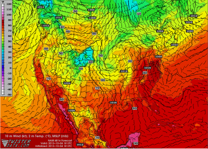 |
| NAM surface temperatures valid for 18z (1 pm) for Sunday showing sharp temperature gradient associated with cold frontal boundary. |
Forecast Update:
Saturday: High, 82. Chance of precipitation increasing into the day. Some locally-strong storms possible.
Saturday Night: Low, 62. Chance of precipitation increasing into the night with a cool off after frontal passage.
Sunday: High, 68. Storms strong to severe in morning. Largest threat damaging winds and small hail.
Rain chances decreasing after front passes around lunchtime/early afternoon.
Sunday Night: Low, 45. Cooling off with the passage of the front. Cloudy with lingering rain showers into the early morning Monday.
Forecaster: Emily Thornton
Next Update: Sunday October 6th.