Under the influence of high pressure aloft and at the surface, the weather across the Bluegrass State is beautiful. For the next few days, the conditions outside aren’t going to change much, if any at all. Enjoy the nice weather while it lasts, because the models are suggesting the potential for some tropical moisture to infiltrate the area and possibly bring rain to the Bluegrass region and eastern Kentucky.
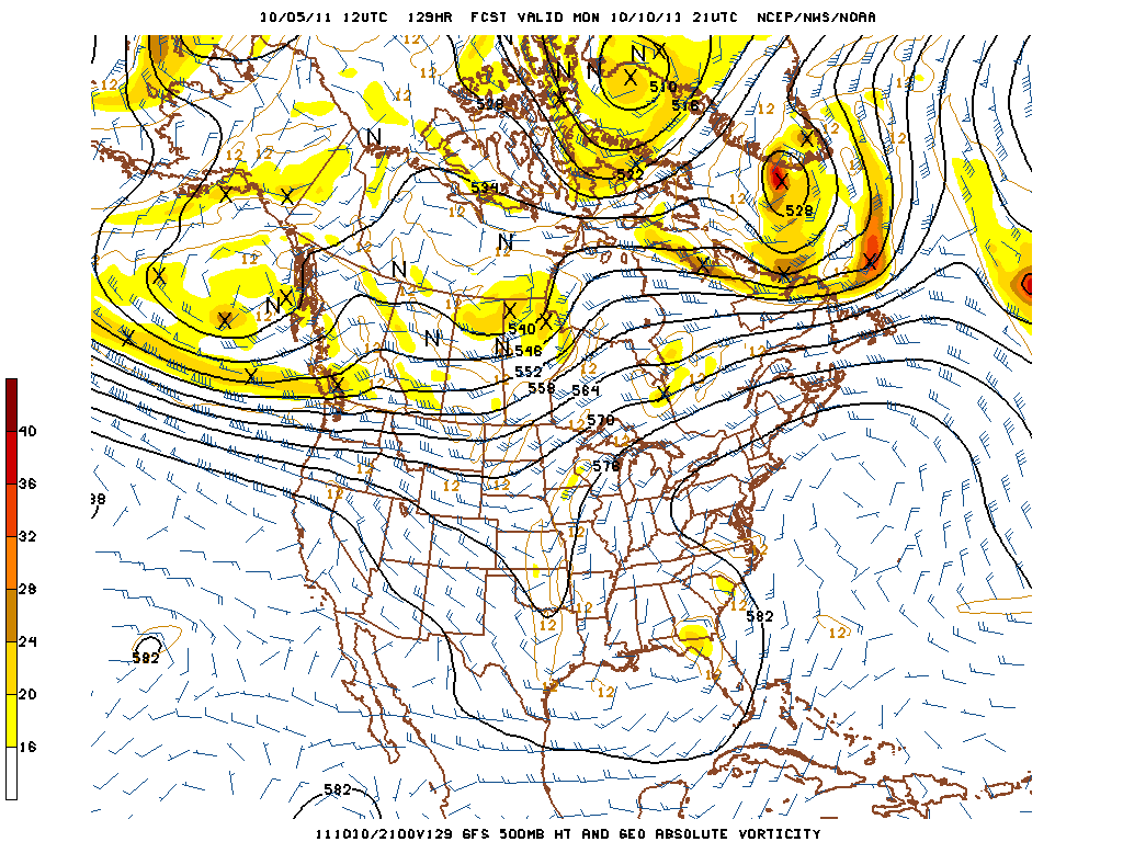
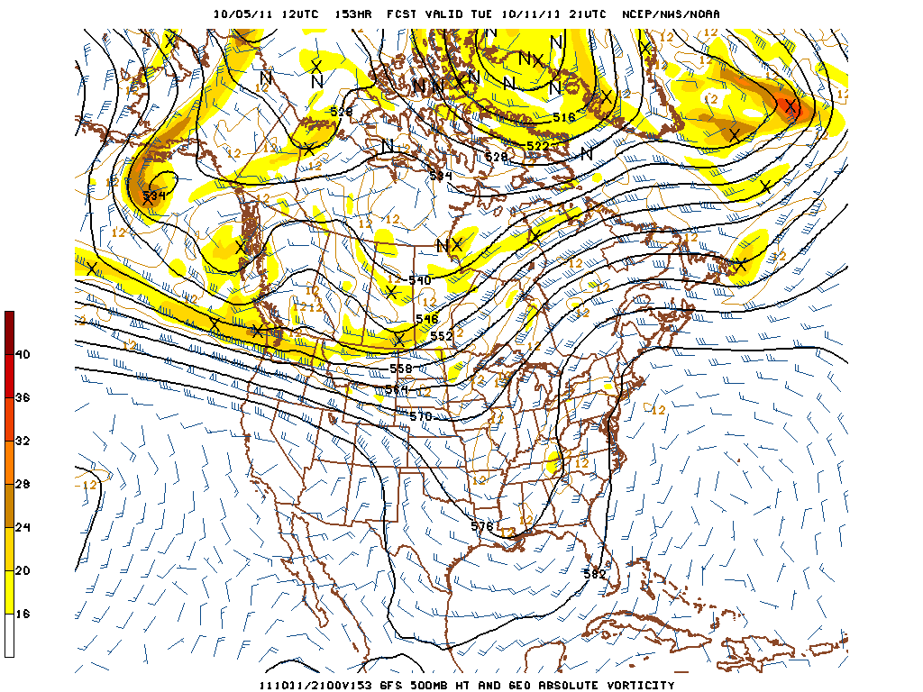
Gradual height falls heading into the middle of next week show the onset of a trough digging into the area from the Dakotas. This looks to be a pretty potent trough at this point but with no real moisture advection off of the Gulf of Mexico, any significant rain chances will be dependent on what could be a named tropical system moving in. Note the area of vorticity near Florida.
The 500 mb height contours show this vorticity maxima following almost a perfectly south-to-north track up toward the Appalachians.
As this area of rotation moves up the southeast, the majority of moisture associated with it looks to stay in the Bluegrass and eastern Kentucky areas. Places like Lexington, London, Pikeville, Georgetown and others should at least see clouds increase with the passing system, and possibly some showers. Until this happens, though, keep enjoying the beautiful weather that we’ve had and will keep having through the weekend and early into next week!


