
The 2nd in a series of weakening cold fronts will bring about a pattern change that will end the early-season heat wave and bring about a return to cooler weather. The first front will cross the Mid-South Tuesday and will knock 5 degrees off our highs (90 instead of 95) for Wednesday-Friday. The second front will cross the Mid-South Saturday and will knock another 5 degrees off our highs Sunday – Wednesday (85 instead of 90). By mid-June, most models show that a trough will return to the eastern United States, which will bring about cooler weather and possibly some rain.
The first front can be seen cross the region Tuesday afternoon although the air mass behind the front is still warmer than normal. At the same time, you can see a very strong winter storm over the Pacific Northwest. This storm will weaken as it moves to the northeast and will bring a stronger cold front across the northern plains and western Great Lakes by Thursday. This front should bring severe storms and heavy rains to the flood-ravaged states of Iowa and Wisconsin. By Saturday, the energy from this system will be well north into Canada, but the cold front will bring scattered showers and thunderstorms to the Mid-South. This front will usher in a more zonal flow for early next week which will keep temperature at a more seasonable level.
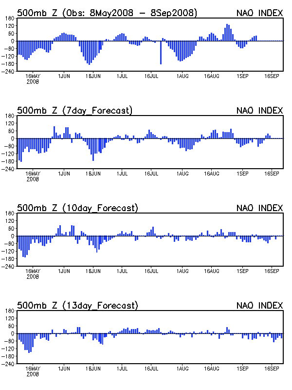
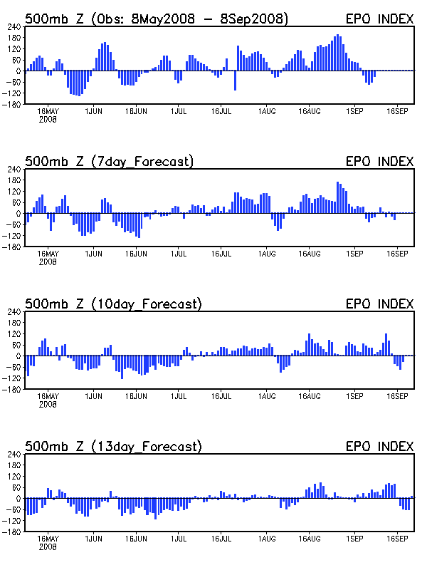
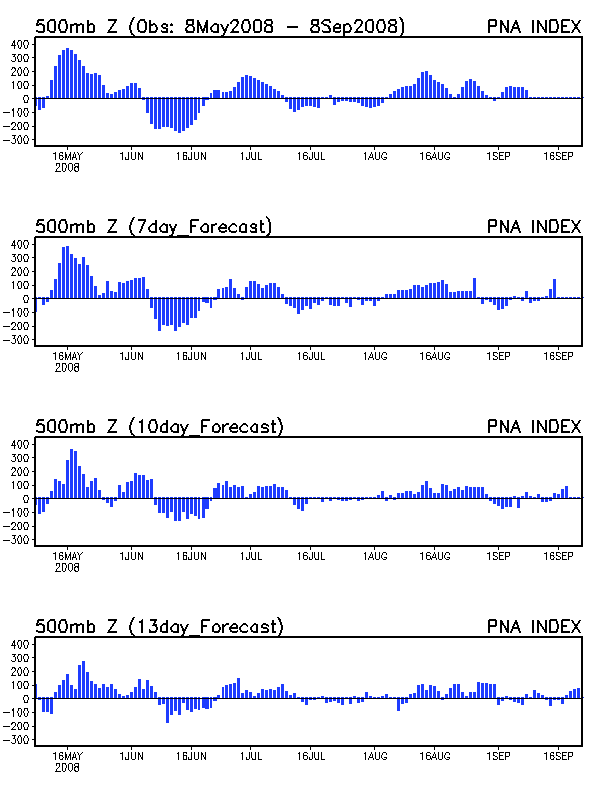
The big pattern change comes later in the week. The GFS shows that by Day 10 a deep trough has evolved over the eastern United States. The European agrees with the idea of a trough but is less deep. Supporting the idea of the trough in the East are the NAO and EPO. Remember that the reason for this heat wave was the switch to a positive NAO around June 1st, which lengthened the wavelength and allowed hot air from the southern Plains to overspread the region. The models now show that both the NAO and EPO will return to a negative phase after June 15th. When both the NAO and EPO are in the negative phase (like in April and May), the eastern United States typically has below normal heights and an active pattern. The PNA will remain in the negative phase, which unfortunately teleconnects to a strong SE ridge.
If this all happens as currently forecast, the 2nd half of June could end up cooler than normal due to a NW flow, but we may not see very much in the way of precipitation.