
One small change in the value of a teleconnection is all that was needed to change our weather from cool and wet to hot and dry. This is a perfect example of why seasonal forecasting is so difficult.
Here is my discussion of the cold PDO from my summer outlook from last week.
The cold PDO results in cold ocean temperatures off the west coast of North America which creates a mean trough over the NW quadrant of the United States and forces a downstream ridge over the Southeast (sound familiar??). This jetstream pattern creates the familiar storm track we have seen all winter/spring with cold and snowy weather over the Midwest and cold and rainy weather over the Mid-South (with dry conditions in the Southeast). This pattern was allowed to persist into May by the fact that there has been a split flow pattern around since April. This split flow pattern has featured a zonal sub-tropical jet with a very meridional polar jet with a very sharp baroclinic zone. A meridional polar jet is prone to blocking (negative NAO) which has allowed the recent severe weather pattern over the central United States to be so persistent. As the cold pool over central Canada is eventually exhausted in June, the polar jet stream will become more zonal, which will allow the Southeast Ridge to exert a stronger influence. By itself, the cold PDO during summer should result in a summer that is warmer and drier than normal.
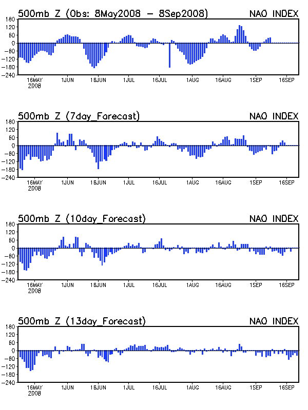
The upper-air pattern that brought the cool and wet weather to the central U.S. over April and May has not changed except for one simple thing. The NAO has gone positive over the past week which has increased the wavelength and allowed for a more zonal flow. This released a heat ridge from the desert Southwest that is currently baking the country south of 40 degrees N. In essence, we have reverted to the same pattern we had back in Jan-Mar, which also had a positive NAO, trough in the NW US and a Southeast Ridge. The difference now is that the baroclinic zone has shifted 200 miles north due to the transition to summer, which means that most of the Mid-South is under the ridge. Keep in mind that even though much of the country was very cold this winter, areas south of the baroclinic zone (Gulf Coast states) were very warm this winter. The biggest surprise to this pattern change was that even though the models were hinting that the NAO would turn positive during the first week in June, no one believed it since the NAO forecast models had been performing very poorly all winter. So there are summer forecasts that were made during the last week of May that look very foolish right now, including both private forecasters and NOAA.
So how long will the heat wave last? Unfortunately, the weather pattern over the past six months has been one of “locked-in” patterns, which means that much of the Mid-South, especially Bowling Green and points southward, could bake for awhile. The GFS and other models show a very similar synoptic pattern from Day 1 to Day 4 to Day 7 to Day 10. The 8-10 day GFS and ECMWF means also both show ridging across the eastern U.S. Even the long-range GFS ensembles show a similar pattern. Both the 6-10 day and 8-14 day outlooks from NOAA show the core of heat right over the Mid-South.
Based on the evidence, it looks like the Mid-South should expect 90-95 for highs and 70-75 for lows through at least mid-June. Considering that the average temperature for this time of year is 73, we will have anomalies of around +10 by June 15, which means that the last two weeks of June will have to average -10 anomalies to verify the NOAA June forecast. So rather than a cool/wet June like many people (including myself) predicted, there is almost a sure bet that June 2008 will end up among the warmest Junes ever.