
Even though my last post mentioned a warm start to November, the 06Z and 12Z runs of the operational GFS suggest quite the opposite. In fact, if either of the morning runs of the GFS were to verify it is possible that south-central KY could have its first early November snowfall since 1966.
Let me start by saying that this is very much speculation at this point and stress that all of the forecast models are still uncertain even on the Day 2-3 forecast of our current cut-off low over the southern plains. That being said, the 200+ hour runs of the models can often be a decent gauge of forecast trends (e.g. the GFS predicted the current storm from over 10 days out).
Using the 180 hr forecast of the 10/22/07 12z run of the GFS, you can see that at this point nothing exceptional is happening. All of the arctic air is confined to Canada and the U.S. is in a zonal flow. What starts the trend toward colder is the building ridge over Alaska on Day 9. A jet max that will pass over this ridge will carve out a broad trough over the northern plains that will allow arctic air to sink into the northern states on Day 10. Shortwaves rounding the base of the trough on Day 11 and Day 12 could lead to snow showers over the Great Lake states and possibly rain/snow showers over the Mid-South. The 850 mb temps of -6C and the 1000-500 mb thickness of 522dm would probably support snow even into Bowling Green with highs in the upper 30s/lower 40s and lows in the upper 20s. The GFS even throws in a reinforcing shot of arctic air a few days later.
Now, anytime there is an anomalous event like this on the models, it is important to look at supporting evidence.
In support of the arctic blast:
1) Precedent – 2007 has been the year of extremes in the Mid-South with a bitterly cold February, record cold Easter, record warm August, and a bad drought
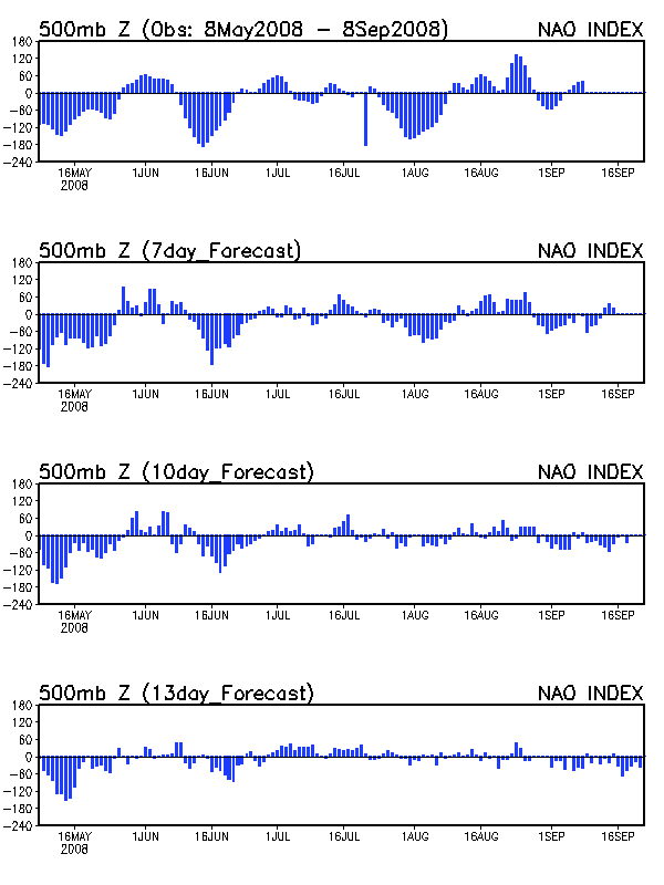
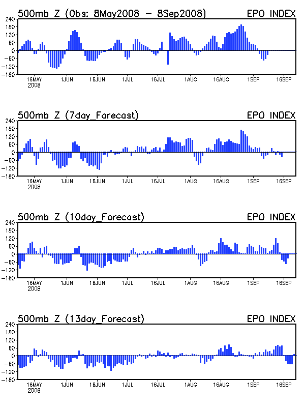
2) Teleconnection support – Both the NAO and the EPO are forecast to go strongly negative in early November. The NAO and EPO were also strongly negative for the February and early April cold blasts.
Against the arctic blast:
1) Lack of model support – Look at the comparison of the 8-10 day height anomalies of the ECMWF (left) and GFS (right). The ECMWF (European model) suggests above normal temps for early November.
2) Lack of GFS ensemble support – The GFS ensembles represent the same model physics with slightly different initial assumptions. Note that very few of the ensemble runs show anything remotely similar to the operational GFS (upper left corner).
Right now, the potential arctic blast is nothing more than just model speculation, and even the Climate Prediction Center is predicting above normal temps for the Mid-South during the Day 8-14 period. If the arctic pattern repeats over the next several days and other models and the GFS ensembles start to support it, I’ll begin to get more excited.