
Today is the same story as has been the past few days. Clear skies with warm, comfortable temperatures in the low to mid 70’s. A high pressure is parked out over the central plains and is bringing down northerly winds which will help cool us down for the remainder of the weekend. Now yesterday I mentioned how the ECMWF, GFS and NAM were not in agreeing on the output for Sunday. ECMWF had rain moving into the area late Saturday night and Sunday morning, where as GFS and NAM did not. All three models are agreeing now that a little disturbance will swing by affecting the area of Cincinnati northward along the Ohio River into Pennsylvania. Here is the latest 12z NAM run:
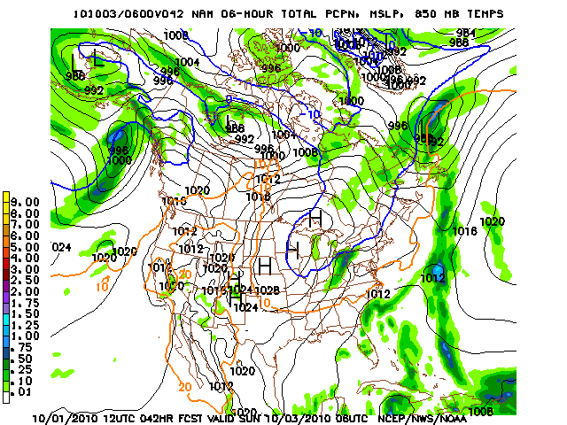
Valid: 10-03-2010 06Z
I am going to bump the chances of showers down to 20%, I feel it’s better to keep the chance in there due to previous runs not agreeing with each other. It will be curious to see how the models agree in later runs. I will update the blog again tomorrow and let you know what to expect for your Saturday evening and Sunday morning.
Here is the 850 hPa map from the same 12z NAM run valid for 10-03-2010. You can see the tongue of cold air building its way down near the Ohio Valley. You can see the zero degree line for 850 hPa reaching down into central Indiana and Illinois.
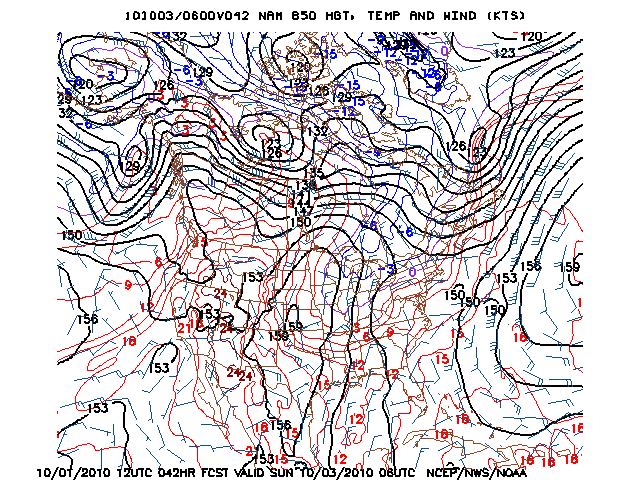
Valid: 10-03-2010 06Z
Today expect the high to be in the low to mid 70’s with a low tonight in the low 40’s. Saturday expect a high in the low 70’s along with a low of around 40. I will keep checking the models and update you, I just don’t think enough moisture will be present to bring any showers to the area. Enjoy your weekend!