
It is a good day because we would see a chance of sprinkles during day time and the high temperature will be near to 89 °F. I currently hear the wind moving the tree`s branches with speed about 9 to 13 mph. Scatter cirrus clouds are dominated at this time which mean we could say it is sunny and it will remain sunny and mostly clear at this night due to high pressure and hot ridge over the region (see figure 1) which keep dry and relatively warm weather for this day and next day.
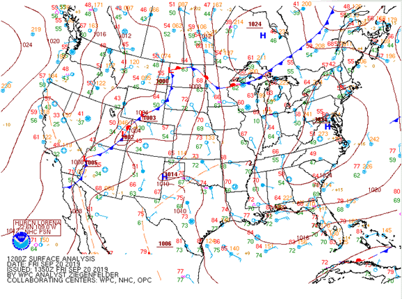
Figure 1: surface map (WPC)
The synoptic analysis gives us a good news for next few days. The 500 mb`s map (see figure 2) illustrates a trough and becoming positively tilt during next week bushing toward Great Lakes and Central or Ohio Valley. This will bring a chance of rain for most of Ohio Valley but still the chance of precipitation will be weak over South- Central of Kentucky to just 20-30% on Monday because the precipitation will split and disintegrate south and east and will not be concentrated in one side.
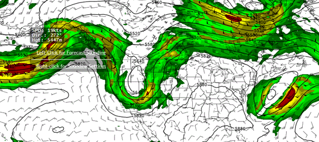
Figure 2: 500 mb (GFS)
Summary
| Time | High (°F) | Low (°F) |
| Friday night (Mostly Clear) | 62 | |
| Saturday (Sunny) | 90 | |
| Saturday Night (Mostly Clear) | 64 | |
| Sunday (Mostly Sunny) | 92 | |
| Sunday night(Chance T-storms | 65 |