
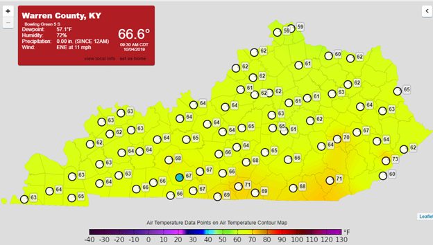
We finally will start feeling cold due to cold front passing the area during this day. The high temperature will be lower 80 °F and sunny with some scattered high clouds. It is a perfect day because people could walk without feeling hot. I remember one-woman last week in Owensboro`s Smothers Park, she said to me “definitely, there is no Fall this year”. I could see her when she was sweating while she watched her children play in the playground and she was unhappy about her situation. I believe that this woman will change her main after few days.
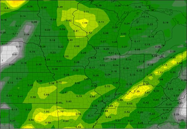
The ridge over Kentucky will continue moving to east as a cooler and dry air dips the low temperature on Saturday morning to mid and upper 40s with some exception in some area with above 50s. therefore, Saturday will be calm since the ridge is dominated over Kentucky but Sunday is another story. A line of storms will be observed over Ohio River and Tennessee Valley until early morning on Monday. This is because a strong upper trough will cross the area at that time. The trough will enhance the lifting across the region and then will give chance of shower and thunderstorm. I think everybody in Bowling Green are waiting for rain therefore, there will be a significant amount of rainfall on Sunday. Figure 2 shows the forecast of precipitation amount over our area.
Summary
| Day | Sky | High (°F) | Low (°F) |
| Friday night | Mostly Clear | 53 | |
| Saturday | Sunny | 87 | |
| Saturday night | Mostly clear then chance showers | 63 | |
| Sunday | Chance showers then showers | 80 | |
| Sunday night | Showers | 53 |