
Good afternoon, everyone!
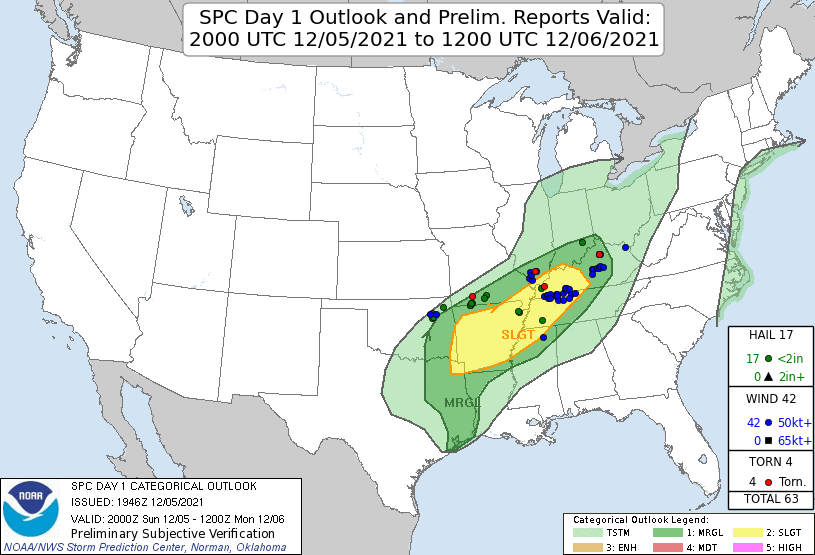
On Sunday, the Storm Prediction Center (SPC) had our county within the slight risk for severe weather. As shown in the graphic below, wind was the primary threat of the system that moved through our region, with winds reaching over 50 knots. Moreover, two tornadoes were reported in the state of Kentucky, one in the northern part and the other in the southwestern. This was the outcome of a line of storms ahead of a cold front along a zone of enhanced low-level convergence. Values of mixed layer convective available potential energy (MLCAPE) ranged from 1000 to 1200 J/kg and 0-6 km shear peaked at 40 knots.
We hope you enjoyed today’s post! Good luck on finals!
Thanks Olivia,
Nice Post!