
Hello everyone! I wanted to take a quick moment to introduce myself. My name is Harmony Guercio and I’m a sophomore here at WKU studying to become a Meteorologist. I’ve wanted to be a Meteorologist as long as I can remember and, according to my parents, I’ve wanted to be a Meteorologist ever since I could talk. Fun Fact: Today, the day of my first weather blog, is my 20th birthday! I will be bringing your weekly Wednesday weather report and some recent wild weather events because I find those to be the most interesting. I really hope that you enjoy reading my blogs.
Today’s Forecast
Good morning, and happy Wednesday! I hope everyone is having a great week so far, and staying warm! This morning will start off mild and windy with showers tapering off by the afternoon. Highs start out in the 50s, but by tonight it will be cooling off into the lower 40s and upper 30s. A wind advisory is in effect until this evening with winds of up to 15-25 mph and gusts of 35-45 mph expected. These winds could blow around unsecured objects, along with knocking out tree limbs and/or causing power outages. Temperatures will continue to drop coming into Thursday with snow showers and flurries on and off throughout the day. No major accumulation is expected.
Recent Wild Weather
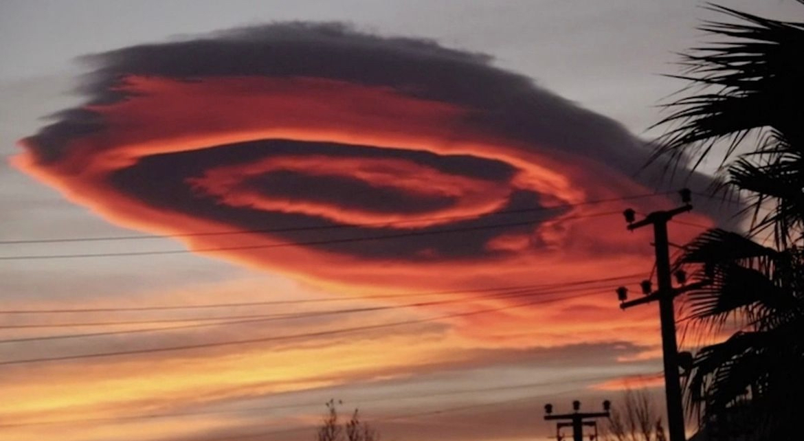
This past week there have been a few wild weather moments. One that stood out to me was the famous cloud shaped like a UFO that was spotted last Friday (January 20th) over Turkey. Some may ask, how can a cloud even look like this? Lenticular clouds are most commonly formed in crests and valleys of mountainous terrain. Due to the topography of the mountains, you get different waves in the atmosphere. As air rises and winds blow over the hills and mountains, clouds form and layers are created that are shaped like lens or saucers giving the illusion of something wild, just like this past cloud that has gone viral.
Wild Weather this Day in History
On this day in history, 47 years ago, an icy rain hit Buffalo NY, causing a coating of ice on the runways at the Buffalo Airport. This coating of ice caused a shutdown of flight operations for 2 hours. A little further northeast, this same icy rain affected the Monroe County airport in Rochester. A single engine aircraft’s windshield formed ice and caused them to miss the runway by 50 ft.
Stay warm, and continue to have a nice rest of the week!