
Today’s Forecast
Good morning and happy Wednesday! Hopefully most of you have enjoyed these cooler fall-like weather days. If you haven’t, you’re in luck. As a warm front moves through later tonight and into tomorrow, temperatures will rise to the upper 60s and lower 70s. Unfortunately, this will bring more rain into our area as well. Before the warm front moves through our area, expect most of today to be sunny with some clouds here and there. As we go into tonight, chances for showers rise, but ultimately remain low. Temps will get up to the lower 70s and fall to the lower 50s. Going into tomorrow and tomorrow night, showers are likely and temps will get up to upper 60s/lower70s and fall down to the lower/mid 50s.
Recent Wild Weather
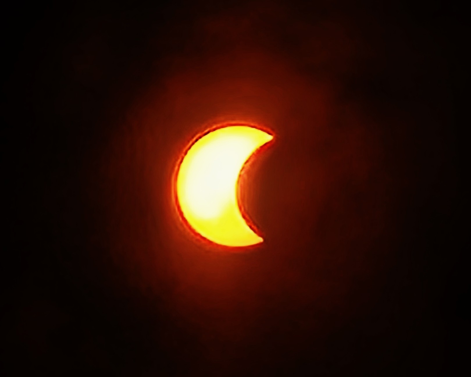
This week’s wild weather brought us a ring of fire! Well, some of us! This year’s annual solar eclipse was on Saturday, October 14th and began over the Pacific Ocean. It would eventually reach land over Oregon and stretch all the way to Texas in the United States. From there it continued on its path south to Central America and Brazil. Unless you were in the direct path of this year’s annual solar eclipse, you would only get the viewpoint of a partial solar eclipse. The entirety of the event lasted over 3 hours, but the annularity (the maximum point of the eclipse) only lasted for 5 minutes. Where we are located here in Bowling Green I was not able to see the eclipse due to the heavy cloud coverage, nor did I have my solar eclipse glasses with me to protect my eyes even if I had a good view of it. It is imperative to wear protection on your eyes, as prolonged exposure to the sun can cause retinal burns or even blindness. Luckily, my eyewear was back at home with my mom in Knoxville, Tennessee and she was sending me updated pictures as the event occurred. Fun fact: in my hometown of Knoxville, TN, during the annual solar eclipse of 2017 (that we were in the direct path of) the school system that I attended school in closed for the day so we could all enjoy this rare occurrence. That is a really cool experience that I will never forget.

Wild Weather this Day in History
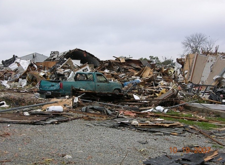
On October 18, 2007 an EF3 tornado made landfall in Nappanee, Indiana in the late evening hours. It would reach maximum intensity winds estimated at 165mph. The tornado was on the ground for about 2 miles, extending to a maximum width of a half mile as it passed over the city. It caused widespread severe damage to homes and businesses alike along its path. Over 100 structures suffered significant damage or were completely destroyed in Nappanee. The tornado would continue moving northeast of Nappanee, and eventually weaken to EF1/EF0 before lifting. Amazingly enough, only minor injuries were reported from this extremely damaging weather event.
I hope everyone has an amazing rest of the week and can keep dry from all the rain!
Sources: https://www.theatlantic.com/photo/2023/10/photos-a-ring-of-fire-eclipse-over-the-americas/675652/ https://www.exploratorium.edu/eclipse/2023-annular-eclipse-guide https://www.weather.gov/iwx/20071018_tornado