
Today’s Forecast
Good morning and happy Wednesday! I hope everyone is having an amazing 2024 so far! Today will be another cool and rather cloudy day with highs in the mid 40s and lows in the lower 30s. Luckily, no precipitation is expected, so it should stay dry! Tomorrow will be much like today, but, with some more sun peeking out, we’ll see some warmer temps with highs in the upper 50s and lows in the upper 30s. Moving into the weekend, temps continue to rise and the sun continues to come out, that is until Saturday night. Saturday night into Sunday there are some slight chances for rain, but temps should remain in the upper 50s.
Recent Wild Weather
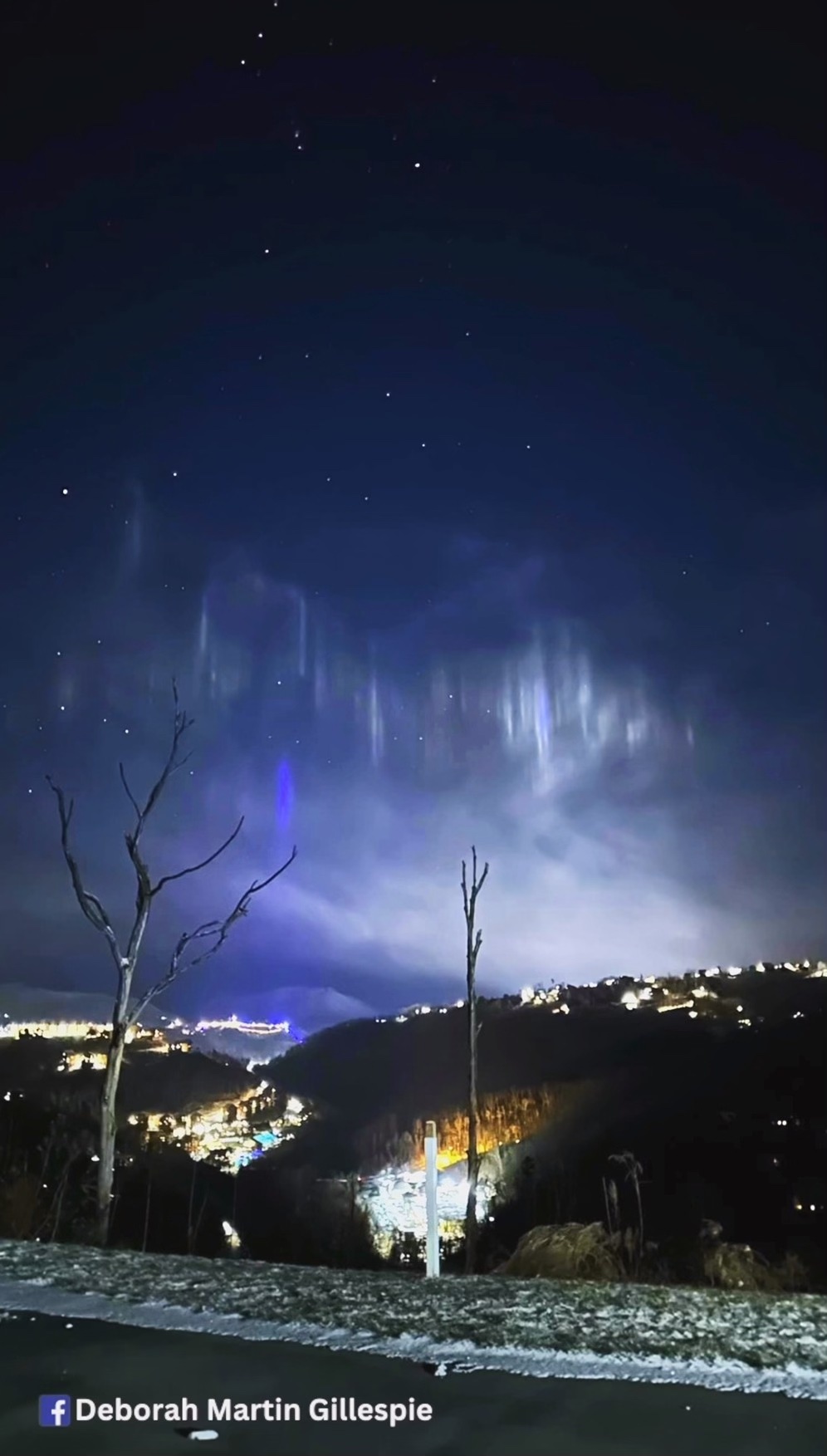
A rare and breathtaking phenomenon that I’ve featured previously on a “Wild Weather Wednesday” post made another spectacular showing last week just outside of my hometown of Knoxville, TN. In the small town of Gatlinburg, TN located in The Great Smoky Mountains, light pillars could be seen hanging against the night mountain landscape. Debra Martin Gillespie captured photos of the lights, and said that she just could not stop taking photos. Light pillars are created as ice crystals slowly fall or are suspended in the atmosphere, and during that process catch and reflect bright lights that shine onto them. In this case the lights from the city below were reflected upwards, with the bright blue light coming from a popular local theme park “Anakeesta”. Many of the other lights that you can see came from downtown Gatlinburg, and cabin resorts nestled inside the mountains. Some believed it to be the Northern Lights since they will be the brightest that they have been in 2024, then they have been in the past two decades. This is because the current solar cycle will reach its maximum activity, providing the ideal conditions for the creation of the most spectacular and visible northern lights from larger regions of the Earth. I recently celebrated my 21st birthday in a cabin in Gatlinburg with family and friends, and absolutely hate that I missed this once-in-a-lifetime light show.
Wild Weather this Day in History
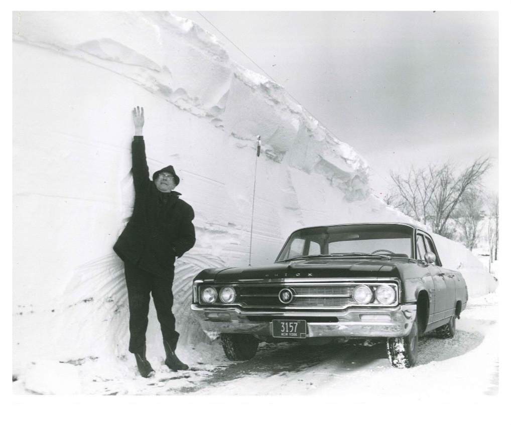
With all of the recent snowfall events in and around the US, it only made sense that this week’s “Wild Weather this day in History” would focus on just that. In the winter of 1966, a massive blizzard would hit New York and leave it absolutely paralyzed. Winds gusting up to 60 mph and temperatures dropping into the teens made for frigid conditions. Along with the gusty and heavy blowing winds, blizzard conditions were certainly in full effect. It crippled the train service, numerous highways, and many of the airports throughout western and central New York. This left transportation at a complete hault, and people stranded in the area for several days. The Syracuse-Oswego area was the hardest hit, and an incredible 102.4 inches (that is 8 1/2 feet of snow) was recorded by a local meteorology professor by the name of Bob Sykes! Many of the local school systems shut down for nearly a week following the blizzard. Massive economic losses would also follow the blizzard costing an estimated $35 million dollars. Within days, at least 142 people had been killed — 31 of those people frozen to death and 46 of them died in fires while trying to heat their homes. It is a blizzard that left its mark, and is still talked about to this day.
I hope everyone has an amazing rest of the week and enjoys the warmer and sunnier days!
Sources: https://youtu.be/1TWuzmF4ZQA?si=mNVIOGWSqdMgKRYr https://www.syracuse.com/vintage/2016/01/vintage_archives_blizzard_1966.html