
Today’s Forecast
Good morning and happy Valentine’s Day! Some areas will see patchy fog this morning, but a beautiful Wednesday is in store! With sunny skies and warm temps, highs will get into the lower 60s with lows later tonight in the lower 40s. Tomorrow will continue to be sunny and warm with highs in the lower 60s and lows in the upper 30s. Heading into this weekend things start to look cooler and wetter. Friday will be partly sunny and then a slight chance of rain shows up later that night. Highs will be in the lower 50s and lows will be in the upper 20s, which could lead to the potential for snow. Going into Saturday, once any precipitation moves out of the area, it’ll be mostly sunny with highs in the upper 30s.
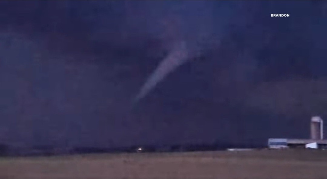
Recent Wild Weather
This week in wild weather a rare winter storm made is way through southern Wisconsin on Thursday. This massive storm left a path of destruction that included dead and missing cows, roofs blown off of homes, destroyed storage sheds and barns, downed power poles and trees, trashed vehicles and shattered windows. Luckily, there were no deaths to report or even serious injuries (which is quite remarkable. February tornados are nearly unheard of, especially in the Northern States. This left most residents and local business owners in shock. Wisconsin has been experiencing a much warmer winter than usual, registering even 25 degrees higher than average. Some believe that the summer-like temperatures are what caused this unusual weather event. This was the state’s first recorded tornado in the month of February, according to Taylor Patterson, a meteorologist at the National Weather Service in Milwaukee. Records date back to 1948.
Wild Weather this Day in History
This weeks look back in weather history for February 14th… takes us to the “The Saint Valentine’s Day Blizzard.” A winter snow storm that buried New England with 8 foot snow drifts in 1940. Lots of different writers and story-tellers over the years have stated that instead of getting hit with cupid’s arrow for Valentine’s Day, New England was hit with 60 mph wind gusts and 14 inches of snow. The storm hit parts of Massachusetts, Connecticut, and Rhode Island. The storm began at about 3 p.m. on Valentine’s Day and began causing havoc during the evening commute. It made it impossible for anyone to get out and celebrate the holiday with cars stranded on the roadways and traffic at a standstill. The storm continued for the next nine hours without letting up. Many people living and traveling through the area were caught off guard because the Weather Bureau had been predicting “rain and light snow” for that day, claiming that the worst of the storm would stay off shore. Residents of New England would have a different story to tell, and that included the fact that 31 lives were claimed due to this storm and its unexpected arrival.

I hope everyone has an amazing rest of the week and enjoys the sunshine and warmth before it cools down this weekend.
Sources: https://apnews.com/article/wisconsin-first-february-tornado-storm-7362a8772cd1e953240a1966b2611ec4 https://www.kare11.com/amp/article/weather/wisconsin-hit-with-its-first-ever-february-tornado/89-1a6679e5-87e5-437d-97fc-5084b662e70b https://www.farmersalmanac.com/the-saint-valentines-day-blizzard-18213