Today’s Forecast
Good morning and happy Wednesday! As most of the severe weather came through last night and early this morning, I hope everyone remained safe and has minimal damage! The severe threat for the day is mostly gone, but gusty winds and rain will continue through most of the day. A wind advisory is still in effect until 3pm (CST). Once storms have passed through it will be cloudy and cold, with temps dropping throughout the day. Luckily, tomorrow will be sunny with light winds. Temps will be cooler with highs in the upper 40s and lows in the mid 30s. Going into Friday, there is a chance for some more showers to return, so make sure to enjoy the sunshine tomorrow!
Recent Wild Weather
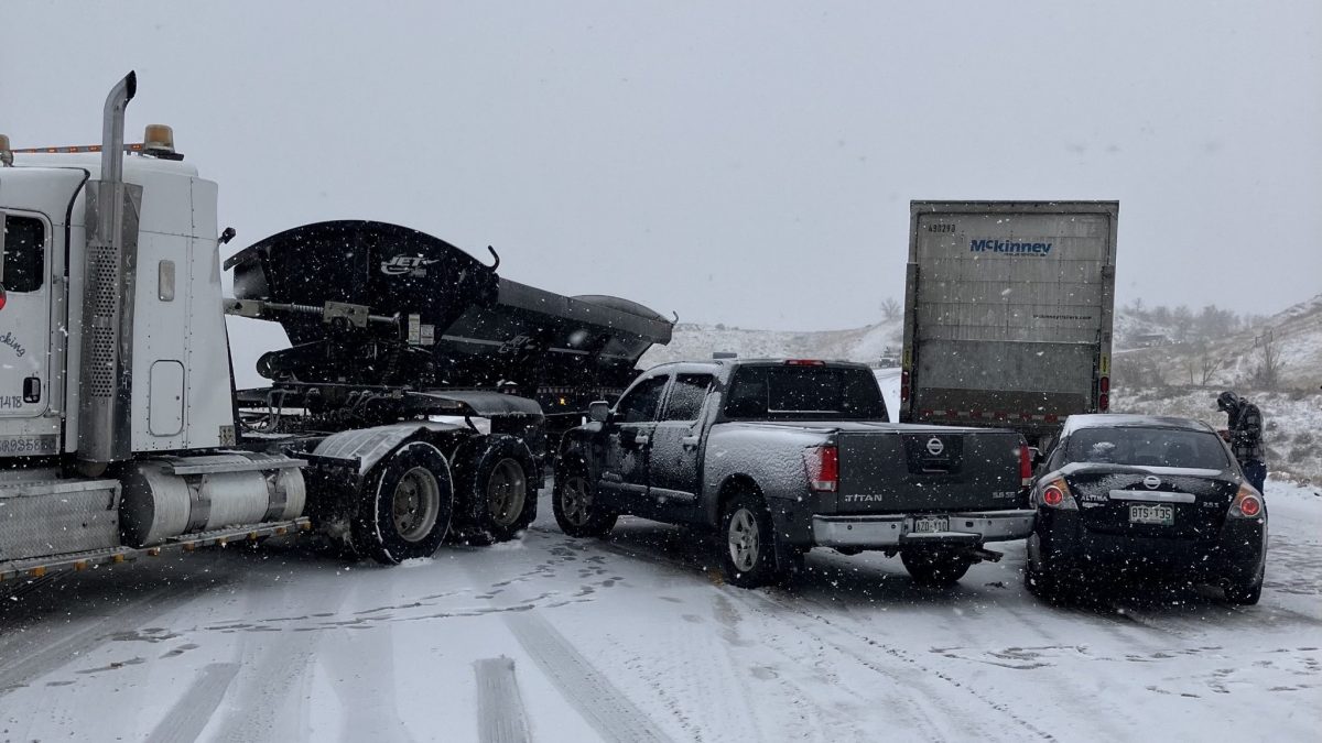
This week in wild weather a fierce snow squall hit the Denver area. The craziest part of all of it was that less than 24 hours prior the daily temp sat at a warm 64 degrees. The storm began at light flakes falling, but would eventually turn into complete white out conditions. This left driver’s with zero visibility and icy road conditions. There were several accidents reported including a multiple vehicle pile-up. This particular snow squall was caused by a powerful cold front that swept through Denver bringing with it very heavy wind gusts and dropping more than 2 inches of snow per hour. With Denver being the wildest city for weather it isn’t all that shocking. However, it still comes with many challenges as local residents are caught off guard by this fast-moving and sometimes unpredictable snow event. A Snow Squall Warning was in effect until 10:30 a.m. Tuesday and ceased on Tuesday at 10:45 a.m. Most snow squalls only last 30 minutes to an hour, but they pack a punch in a small amount of time. Most of Denver will see a total of a foot of snow and possibly two feet in some mountain regions. The National Weather Service has issued a Winter Storm Warning and Avalanche Warning for portions of the mountains, especially areas above 9,000 feet.
Wild Weather this Day in History
While many experienced severe storms last night through early this morning, let’s take a look back at a very powerful low pressure system that ripped through southeastern Kansas on February 28th, 2007. This low pressure system, that tracked into the plains, produced 3 different tornadoes that later merged into 1 large tornado. With mostly EF0s and EF1s reported, this large tornado was rated to be an EF4, making it the first EF4 tornado of the newly implemented Enhanced Fujita Scale (which became operational on February 1st, 2007). These storms erupted around 5pm, producing severe hail, and intensified into a supercell around 6:30pm, producing many of the tornadoes. These storms continued until 9:30, when reports of penny sized hail were still coming in.
I hope everyone has a great rest of the week and can continue to stay safe as rain and wind continues to rip through!
Sources: https://www.9news.com/article/weather/weather-colorado/winter-weather-snow-colorado-denver-forecast/73-3aff0492-0ffb-4c67-b9be-fb8752a08c90 https://www.weather.gov/ict/event_20070228

