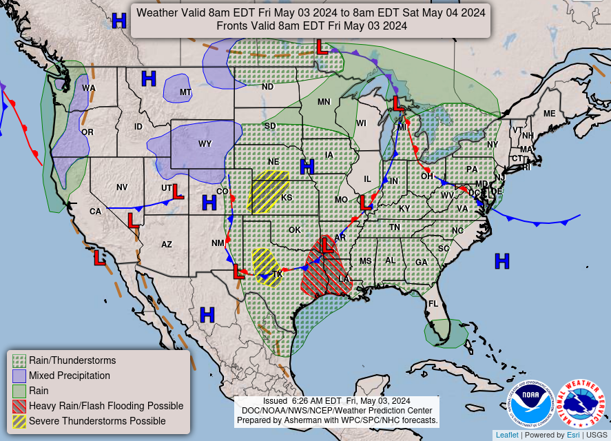
WKU Storm Chase 2016 – Day 2

Today's route map

Today’s route map

Our morning forecast discussion identified an enhanced kink in probable dryline formation that formed an axis between the western Panhandle regions into the central Texas Panhandle. Model data suggested caps would break around 1-2 pm in Colorado and storms would slide down the dryline into the Panhandles, where a more favorable environment for tornadic supercells existed. We decided to target the western Oklahoma Panhandle to start our day, and left our hotel in Yukon, OK at 9:45 CST.

While on the road, 18Z model data indicated a consensus on the placement and timing of initiation, which strengthened our confidence. However, it also brought signs of a less conducive environment in the Panhandles. Low level moisture and shear variables began looking meek, but we persevered! The SPC issued a Severe Thunderstorm Watch at 2:35 CST for the entire Panhandle region.

We intercepted a supercell at 3:50pm CST in Kenton, OK that had just crossed the border from Colorado (Figure 1). Rotation was evident in the supercell on radar, and it was already associated with a Severe Thunderstorm Warning. We followed the storm further south and east and stopped to view the storm just east of Felt, OK. While photographing the storm, several students pointed out what looked to be a large tube that reached from cloud to ground, but was not in the textbook location for a tornado. None of us, including professors, were sure until it was reported by the NWS as an ongoing tornado (Figure 2). Sure enough, soon after we learned it was a tornado, the funnel roped away and dissolved.

OLYMPUS DIGITAL CAMERA

Figure 1: Intercepting our first supercell in Kenton, OK

OLYMPUS DIGITAL CAMERA

Figure 2: Tornado in Felt, OK

We attempted to chase the tornadic supercell further, but road conditions deteriorated quickly and were becoming unsafe. We opted to chase a sister storm to the west instead. This storm’s mesocyclone was less organized than he first, but as we chased, we witnessed a large funnel attempt to touch down west of Dalhart, TX. However, we never saw the funnel actually contact the ground, although it was a tornado-warned storm.

The Dalhart cell began to split, but instead of forming two opposite-spinning storms, the split produced two cyclonic right-moving storms. We opted to follow the western storm and got an excellent look at its structure in Hartley, TX (Figure 3). We decided to get a closer look, but as we approached, we were assaulted with penny to nickel sized hail in Channing, TX and had to leave the area. We stayed ahead of that storm until we reached Amarillo and took some excellent structure photos as the sun set (Figure 4). After, as is tradition, we enjoyed some fantastic steak at the Big Texan Steak Ranch in Amarillo, and packed into the hotel for the night.

OLYMPUS DIGITAL CAMERA

Figure 3: Impressive structure of the Hartley, TX cell

Figure 4: Leaving the supercell in Amarillo

Figure 4: Leaving the supercell in Amarillo

Tomorrow looks as if we will be heading into Deep South Texas to chase, so stay updated!

-Isaac Bowers

Posted in U.S. Weather | Tagged , , , , , | 1 Comment

WKU Storm Chase 2016 – Day 1

Greetings, and welcome to the official blog of the 7th Annual WKU Weather Analysis and Forecasting Field Methods Course (a.k.a. Storm Chase)! Daily updates on the group’s activities and targets will be posted here.

Last week, our team of students assembled for the first time and, after filing the proper documentation, began a forecast discussion to decide our departure date and target location. Modeling indicated a trough moving through the Southern Plains on Monday, and positioned the trough neutrally over the Four Corners by Monday evening. Moisture advection looked excellent throughout central Oklahoma, and forecast soundings in the area showed favorable conditions there, as well as closer to the associated warm front in north-central Kansas. Since Monday appeared chaseable, we decided to depart Sunday to prepare for a chase day on Monday

We departed Bowling Green at 9:30 AM CST Sunday morning and made our way south and west towards Oklahoma City. After a short lunch stop near the Shiloh Battlefield and a short dinner stop near Fort Smith, AR, we arrived at our hotel for the evening in Yukon, OK, just west of Oklahoma City at around 9:00 PM CST. After running through a quick data analysis and a relaxing soak in the hotel hot-tub, we went to bed with our alarms set for a 9:00 AM CST forecast discussion to select targets for Monday.

Keep updated on this site and on Twitter by following @wkustormchase!

-Isaac Bowers

Leg 1 of our journey 5/15/16, Bowling Green, KY - Yukon, OK

Leg 1 of our journey (in blue), 5/15/16, Bowling Green, KY – Yukon, OK

Posted in U.S. Weather | Tagged , , , , , | 7 Comments

Chilly Sunshine

Overnight we had clear skies with cold temperatures. The sunny weather looks to continue as we head through the weekend. Chilly weather will stick around as well.

Today: December 4: High: 53

Sunshine will be around as a high will move over to Ohio. Temperatures will remain chilly as they reach the low 50s.

Forecast valid Saturday 00Z

Tonight: Low: 29

We will remain clear due to the high. Temperatures will get cold once again as they reach the upper 20s to maybe even low 30s.

Forecast valid Saturday 12Z

Tomorrow: High: 56 Low: 32

As we begin the weekend sunshine will be aplenty as the high still dominates our weather. Temperatures will warm slightly as we reach the mid 50s.

Looking Ahead:

Sunday: High: 55, Low: 37. Clouds will start to move in making for mostly sunny skies. Rain shower or two may move through as we head through the overnight. Temperatures will stay similar as they reach the mid 50s.

Monday: High: 52, Low: 34. A few rain showers will move through during the day. Temperatures will get slightly cooler with them reaching the low 50s.

Tuesday: High: 54, Low: 36. Rain showers will move out and we will return to sunshine. Temperatures will warm slightly as they reach the mid 50s.

Wednesday: High: 56, Low: 40. Sunshine will continue across the area. Temperatures will reach the mid 50s.

Thursday: High: 57, Low: 41. Rain shower or two will move through the area once again. Temperatures will continue to stay in the mid 50s.

Posted in Kentucky Weather | Comments Off on Chilly Sunshine

Cold Then Chilly

Overnight we did have some clouds around. Sunshine will stick around through the rest of the week and into the weekend. Temperatures are going to get cold then warm up slightly and be on the chilly side.

Today: December 3: High: 46

Sunshine will take over today as a high dominates the area. Today will get cold with temperatures reaching the mid 40s.

Forecast valid Friday 00Z

Tonight: Low: 29

Overnight tonight will remain clear as the high will situate over Bowling Green by morning. Temperatures will get cold once again reaching the upper 20s.

Forecast valid Friday 12Z

Tomorrow: High: 49 Low: 30

Sunshine will continue as the high will still affect us as it moves to the northeast. Temperatures will warm slightly reaching the upper 40s to maybe even low 50s.

Looking ahead:

Saturday: High: 57, Low: 33. Sunshine continues across the area. Temperatures will warm some reaching the upper 50s.

Sunday: High: 55, Low: 38. Clouds will start to move back in making for mostly sunny skies. Temperatures will reach the mid 50s.

Monday: High: 54, Low: 35. Rain showers will move through during the morning. Temperatures will stay in the mid 50s.

Tuesday: High: 52, Low: 36. Sunshine makes a return with a few clouds around. Temperatures will cool slightly reaching the low 50s.

Wednesday: High: 53, Low: 38. Sunshine will be around once again with some clouds making for mostly sunny. Temperatures will be around the same area reaching the low 50s.

Posted in Kentucky Weather | Comments Off on Cold Then Chilly

Rain Continuing

Overnight featured more rain and this morning the rain has continued. The rain looks to continue for part of the week. Temperatures will slightly cool off as we move through the week.

Today: November 30: High: 59

The drizzles will continue then light rain showers will move in for the afternoon. Temperatures will reach the upper 50s maybe even the low 60s.

Forecast valid Tuesday 00Z

Tonight: Low: 51

Periods of rain will continue as we move through the night. Temperatures will stay warmer than they have been the last few nights staying in the low 50s.

Forecast valid Tuesday 12Z

Tomorrow: High: 57 Low: 42

The rain will continue but will decrease as we move through the day. Temperatures will cool off slightly as we will stay in the upper 50s and low 40s.

Looking Ahead:

Wednesday: High: 50, Low: 33. Showers will still be around but there will not be many of them as the coverage will decrease as the day moves on. Temperatures will cool off slightly once again reaching the low 50s.

Thursday: High: 49, Low: 32. Sunshine will make a return to the area. Temperatures will still continue to cool off as they reach the upper 40s.

Friday: High: 52, Low: 34. A few clouds will be around making for mostly sunny skies. Temperatures will warm slightly as they reach the low 50s.

Saturday: High: 55, Low: 37. More clouds will move in the area making for partly cloudy skies. Temperatures will warm slightly once again reaching the mid 50s.

Sunday: High: 57, Low: 39. Clouds will start to go away making for mostly sunny skies. Temperatures will reach the upper 50s.

Posted in Kentucky Weather | Comments Off on Rain Continuing

A Soggy Weekend Ahead

General Discussion: A cold front looks to move into the area tonight into tomorrow, then looks to stall out over our area through Tuesday, then looks to finally move well east of the region. Seasonably cooler and drier air then looks to move into the region behind this front as cold surface high pressure builds into the region for mid to late next week. All of this looks to result in occasional rain chances from tonight straight through Tuesday, as the cold front moves in, and as waves of low pressure ride up and along it once it stalls out.

Today has been overcast and mild so far. The main area of rain is currently well out to our north and west, but will gradually move closer to the region, and ultimately into the region tonight.


Tonight: Low: 57

Tonight looks to be overcast with a 40 percent chance of showers.


Tomorrow: High:63 Low: 54

Tomorrow looks to be a tad bit cooler than today, with overcast skies and a near 100 percent chance of rain.


Looking Ahead:

Tonight
A 40 percent chance of rain, mainly after 8pm. Cloudy, with a low around 57. South wind around 6 mph.
Saturday
Rain. High near 63. South wind 5 to 8 mph. Chance of precipitation is 90%. New precipitation amounts between a quarter and half of an inch possible.
Saturday Night
Rain. Low around 54. South wind around 5 mph becoming calm in the evening. Chance of precipitation is 90%. New precipitation amounts between a quarter and half of an inch possible.
Sunday
Rain. High near 59. Calm wind becoming east around 6 mph in the morning. Chance of precipitation is 80%. New precipitation amounts between a half and three quarters of an inch possible.
Sunday Night
Rain. Low around 50. Chance of precipitation is 80%. New precipitation amounts between a quarter and half of an inch possible.
Monday
Rain likely. Cloudy, with a high near 60. Chance of precipitation is 70%.
Monday Night
Rain likely. Cloudy, with a low around 50. Chance of precipitation is 70%.
Tuesday
A 40 percent chance of rain. Mostly cloudy, with a high near 56.
Tuesday Night
A 20 percent chance of rain. Mostly cloudy, with a low around 39.
Wednesday
Mostly sunny, with a high near 50.
Wednesday Night
Mostly cloudy, with a low around 34.
Thursday
Mostly sunny, with a high near 50.
Posted in Kentucky Weather | Comments Off on A Soggy Weekend Ahead

Changes Coming!

General Discussion:  Surface high pressure is currently off to our east, resulting in southerly flow. A cold front looks to slowly move toward the area tomorrow into Friday, then looks to hang up and stall out over the region through early next week, before finally moving out. This all looks to result in mild temperatures tomorrow and Friday, with occasional rounds of rain starting late tomorrow night straight through early next week as multiple areas of weak low pressure ride along the stalled boundary through the area.

Today so far has been a quite mild and nice day for the day before Thanksgiving.

Tonight: Low 45

Tonight looks to be much warmer than the past several nights, with a low of around 45 under partly cloudy skies.

Tomorrow:High 66 Low: 52

Tomorrow looks to be mostly cloudy, but quite mild and breezy ahead of that front.

Looking Ahead:

Tonight
Partly cloudy, with a low around 45. South wind 6 to 9 mph.
Thanksgiving Day
Partly sunny, with a high near 66. South wind 6 to 13 mph, with gusts as high as 21 mph.
Thursday Night
Mostly cloudy, with a low around 52. South wind 7 to 9 mph.
Friday
A 50 percent chance of showers after 7am. Mostly cloudy, with a high near 64. South wind 8 to 11 mph, with gusts as high as 20 mph. New precipitation amounts of less than a tenth of an inch possible.
Friday Night
Showers likely, mainly after 7pm. Cloudy, with a low around 52. Chance of precipitation is 70%. New precipitation amounts between a quarter and half of an inch possible.
Saturday
Showers likely. Cloudy, with a high near 59. Chance of precipitation is 70%.
Saturday Night
Showers. Low around 50. Chance of precipitation is 80%.
Sunday
Showers. High near 58. Chance of precipitation is 80%.
Sunday Night
Showers likely, mainly before 7pm. Cloudy, with a low around 48. Chance of precipitation is 70%.
Monday
A 50 percent chance of showers. Cloudy, with a high near 58.
Monday Night
A 50 percent chance of showers. Cloudy, with a low around 47.
Tuesday
A 40 percent chance of showers. Mostly cloudy, with a high near 57.
Posted in Kentucky Weather | Comments Off on Changes Coming!

Active Thanksgiving Week Ahead!

General Discussion: An area of surface high pressure currently over the southern United States looks to move off to the eastern United States over the next couple of days. A strong surface low looks to then take shape by midweek over the Plains region, and looks to track northeast from there all the way into Canada by Thanksgiving Day, and looks to push its cold front through the region on Friday night. The end result of all of this will be a gradual warm up throughout the week, followed by a soggy Thanksgiving night and Black Friday.

Today has been a rather clear, chilly, and breezy day. After starting out the day in the lower 20’s, temperatures have rebounded to around 50 as of early this afternoon at most locales in the area. High pressure has been firmly in control of our weather today.


Tonight: Low: 30

Tonight looks to be a bit warmer than the past couple of nights have been, as that area of surface high pressure slides off to our east providing us with southerly flow.

Tomorrow: High:56 Low: 37

Tomorrow looks to be even warmer than today, as that gradual warming trend gets underway. Mainly sunny skies look to rule the forecast for tomorrow in the area.

Looking Ahead:

Tonight
Mostly clear, with a low around 30. Southwest wind around 6 mph becoming calm in the evening.
Tuesday
Sunny, with a high near 56. Calm wind becoming south around 6 mph in the afternoon.
Tuesday Night
Partly cloudy, with a low around 37. Light southeast wind.
Wednesday
Sunny, with a high near 61. South wind 5 to 13 mph.
Wednesday Night
Partly cloudy, with a low around 46.
Thanksgiving Day
Partly sunny, with a high near 65.
Thursday Night
A 20 percent chance of showers. Mostly cloudy, with a low around 54.
Friday
Showers likely. Cloudy, with a high near 64. Chance of precipitation is 60%.
Friday Night
Showers likely. Cloudy, with a low around 46. Chance of precipitation is 70%.
Saturday
A 40 percent chance of showers. Mostly cloudy, with a high near 51.
Saturday Night
A 30 percent chance of showers. Mostly cloudy, with a low around 39.
Sunday
A 30 percent chance of showers. Mostly cloudy, with a high near 48.
Posted in Kentucky Weather | Comments Off on Active Thanksgiving Week Ahead!

The Best Time to Wear a Striped Sweater…

Tonight:

We’re staying pretty chilly and clear. The high pressure system moving in will keep us clear allowing the daytime heat to escape overnight. It will also get pretty breezy in the evening hours bringing in more cold air from the NW to drop our lows into the low 20’s.
9
NAM 850mb Wind Speeds (COD)

These winds will allow the wind chills to drop into the teens. So, be sure to bring in the pets or make sure they have some extra warmth.

Tomorrow:

Once again, the high pressure will keep the clouds away to make for a beautifully sunny day. This will allow for it to warm up a tad bit. Highs should be in the low 50’s.
27
NAM 2m Temperatures (COD)

We might get a little breezy tomorrow which will  make the real-feel a little less comfortable, so make sure to wear a warm coat if you are going to be outside.

Looking Ahead:

Tonight: Clear, with a low around 22. Northwest wind around 5 mph becoming calm in the evening.
Monday: Sunny, with a high near 50. Light south wind becoming southwest 6 to 11 mph in the morning.
Monday Night: Mostly clear, with a low around 30. Southwest wind 5 to 7 mph becoming calm in the evening.
Tuesday: Sunny, with a high near 56. Calm wind becoming south around 5 mph in the afternoon.
Tuesday Night: Partly cloudy, with a low around 35. Southeast wind around 5 mph.
Wednesday: Mostly sunny, with a high near 61.
Wednesday Night: Partly cloudy, with a low around 46.
Thanksgiving Day: Partly sunny, with a high near 66.
Thursday Night: A 20 percent chance of showers after 7pm. Mostly cloudy, with a low around 54.
Friday: Showers likely, mainly after 7am. Cloudy, with a high near 65. Chance of precipitation is 60%.
Friday Night: Showers likely. Cloudy, with a low around 47. Chance of precipitation is 70%.
Saturday: Showers likely. Cloudy, with a high near 53. Chance of precipitation is 70%.
Saturday Night: A 40 percent chance of showers. Mostly cloudy, with a low around 37.
Sunday: A 30 percent chance of showers. Partly sunny, with a high near 49.
Posted in Kentucky Weather | Comments Off on The Best Time to Wear a Striped Sweater…

Cold Days Ahead

Tonight:

A cold front has just made its way through the area over the past few hours and we will are already feeling the effects. According to the NWS, the peak wind gusts over the past 18 hours for the area were between 31mph and 38mph. This front has brought in much colder temperatures and winds that are making it less bearable.
Current US Wind Chill Map
Wind Chill (TWC)

Overnight hours will see lows into the 20’s. The 00Z run of the HRRR shows the freezing temperatures up through 8am Sunday morning.

14
 HRRR 2m Surface Temperatures (COD)

Other than the cold, we should stay clear through the overnight hours.

Tomorrow:

The highs for tomorrow will stay in the low 40’s with winds calming down. It will stay clear and sunny making for a cool, beautiful fall day. The 18Z run of the NAM gives temps in the 30’s for noon Sunday.
24
NAM 2m Surface Temperatures (COD)

Tomorrow night looks to be clear and cold with lows in the 20’s. Winds should continue to be light.

Looking Ahead:

Tonight: Mostly cloudy, with a low around 25. Northwest wind 7 to 13 mph.
Sunday: Sunny, with a high near 39. Northwest wind 5 to 8 mph.
Sunday Night: Clear, with a low around 23. Light and variable wind.
Monday: Sunny, with a high near 51. Southwest wind 5 to 11 mph.
Monday Night: Mostly clear, with a low around 30. Southwest wind around 6 mph becoming calm in the evening.
Tuesday: Sunny, with a high near 57.
Tuesday Night: Partly cloudy, with a low around 36.
Wednesday: Mostly sunny, with a high near 60.
Wednesday Night: Partly cloudy, with a low around 44.
Thanksgiving Day: Partly sunny, with a high near 66.
Thursday Night: A 20 percent chance of showers. Mostly cloudy, with a low around 52.
Friday: Showers likely. Cloudy, with a high near 63. Chance of precipitation is 60%.
Friday Night: Showers likely. Mostly cloudy, with a low around 41. Chance of precipitation is 60%.
Saturday: A 50 percent chance of showers. Mostly cloudy, with a high near 49.
Posted in Kentucky Weather | Comments Off on Cold Days Ahead