More Rain & Another Winter Weather Tease

As Wednesday’s major winter storm was wrapping up across the area, light snow fell and officially a trace of snow fell in Bowling Green; just a winter weather tease so to speak.  Behind the system also came cold air.  Highs on Thursday only reached 36 degrees at the Bowling Green-Warren County airport under an overcast sky.  Speaking of overcast skies we really haven’t seen much of the sun since last weekend and we won’t see the sun again until Sunday.  That’s nearly a full week without sunny skies.  We’ll be seeing more than just cloudy skies by this afternoon/evening however.  Drizzle or light rain should start sometime around 1 pm and then continue into the evening and overnight.  Rainfall will be fairly light but steady and anywhere from a quarter to a half of an inch of rainfall is expected by morning.

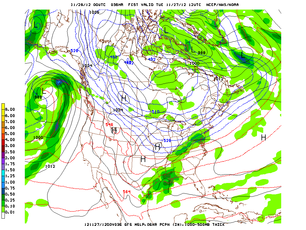
The Hyrdometeorological Prediction Center’s total precipitation forecast shows around a half an inch across south-central Kentucky. Some of this will be rainfall while some of it will fall as sleet and snow.

Temperatures today will reach the low 40s but they will continually cool during the evening and overnight.  With cooling temperatures and continued precipitation, a chance of a wintry mix and eventually snow exists after midnight.  Sometime between midnight and 3 am is when sleet and snow should begin to mix with rain and eventually a change to all snow is expected sometime early Saturday morning.

High-Resolution NAM model showing the rain/snow line bisecting south-central Kentucky around midnight tonight. This is not a forecast but rather just one computer model.

At this time no significant accumulation is expected and for this reason it will be just another winter weather tease for south-central Kentucky.  Nevertheless, up to an inch of accumulation is possible by Saturday morning.  This is not to say we will see an inch as some locations especially further south likely will see no accumulation but areas further north and west (Butler & Ohio Co etc…) stand a decent chance at some minor accumulations.  Snow chances and totals will increase as you go north and along the Ohio River some locations could receive 2-4 inches of snow.  In fact a Winter Weather Advisory is posted along and to the northwest of the Western Kentucky Parkway.  Snow showers/flurries should continue throughout much of the day Saturday and at the very least it will be another cloudy cold day.  Cool WNW winds at 8-12 mph will keep highs in the low to mid 30s.  Clouds should finally begin to clear out Saturday night as a surface high pressure moves in; these two factors combined with light winds will make for a very cold start to Sunday with lows upper teens.  The sun will make a return to the area by Sunday with the high pressure overhead but it will still be chilly with highs only near 40.  The sunshine will be short lived however as another system is poised to impact the area Monday afternoon into New Year’s Day.  At this time the system should bring predominately liquid precipitation but there is a possibility it could bring yet another winter weather tease.

Daily Forecast:

Today: Cloudy skies with a 80% chance of light rain after 1 pm. High around 40.  Southeast to south winds at 3-8 mph. Around 0.1-0.25 inches of rainfall.

Tonight: 90% chance of precipitation which will start as rain and mix with and change to snow by morning.  Low near 30. Around 0.1-0.25 inches of rainfall.  Up to an inch of snowfall possible.  WNW winds from 3-8 mph.

Saturday: 50% chance of snow showers/flurries.  Otherwise cloudy and cold with a high near 34.  WNW winds at 8-12 mph.

Saturday Night: Mostly cloudy skies will become mostly clear.  Cold with a low around 19.  Northwest winds from 4-9 mph becoming light by morning.

Sunday: Mostly Sunny with a high around 39. Winds will be light and from the SW to south.

Monday: Morning low near 29 with a high around 41.  Cloudy with a 40% chance of afternoon showers.

Posted in Uncategorized | Comments Off on More Rain & Another Winter Weather Tease

Heavy Rain Tonight… Snow Tomorrow!

Christmas has turned out to be cold and cloudy here in south-central Kentucky, but at least the cold weather makes it feel more like Christmas right? The clouds are ahead of a major winter storm now starting in the southern plains.  Snow is falling in Oklahoma, even as far south as Dallas, TX and icing is occurring in Arkansas.  Meanwhile Tornadoes have already been reported in east Texas and there are numerous Tornado warnings in LA/MS.  So how will this storm system impact us here in south-central Kentucky?  It looks like the heavy snow/blizzard conditions will remain just off to our west.  Blizzard warnings have been posted for much of western KY with a winter weather advisory now extending from just north of Louisville down to Central City and Hopkinsville.

Current watches and warnings across central Kentucky as of 3:40 pm.

In these areas rain will transition to a wintry mix and will eventually switch to all snow sometime Wednesday morning.  Some light snow is likely even for much of south-central Kentucky including Bowling Green by mid-day Wednesday.  First however rain will move in and the winds will increase.  NE winds will continually increase this afternoon into the evening.  Overnight winds will be from 18-28 mph with gusts up to 35 mph.  Winds will be strongest between 10 pm and 6 am.  Rain should start across our area sometime around or just after 6 pm this evening and will continue into the early morning hours of Wednesday.  Rainfall will be heavy at times and 1.00-1.50 inches of rainfall is likely in the area, some areas may receive up to 2 inches of rain.

The Hydrometeorological Prediction Center’s precipitation forecast. Note around an inch plus in south-central KY.

Rain will probably move out between 6-9 am tomorrow as the “dry slot” of the storm system moves in.  Meanwhile temperatures will be dropping from the mid 40s early to the low 30s throughout the day as cold air is ushered in by strong 10-20 mph NW winds.  Some precipitation should wrap around the back side of the low pressure system and into south-central KY including BG just around noon on Wednesday and continuing into the evening hours.  This will likely be rain which will mix in with and switch to snow after 1 pm.  At this time this shower/snow shower activity appears to be light and scattered and thus little accumulation of snow is expected.  Some areas may pick up around a half inch of snow.

18Z High Resolution NAM reflectivity indicates light rain changing to light snow in central Kentucky by 1 pm.

Behind the storm system cold air will continue to move in.  Skies should be mostly sunny by Thursday though it will be cold with highs only in the upper 30s.

Tonight: Rain, heavy at times.  Windy; winds from the NE from 18-28 mph with gusts to 35 mph.  Temperatures warming to near 45 by morning.  Rainfall between 0.75-1.25 inches.

Wednesday: Rain in the morning coming to and end by 9 am.  70% chance of rain/snow showers after noon.  Winds switching from the NW at 10-20 mph.  Temperatures cooling from near 45 in morning to the low 30s by 6 pm.  Rainfall less than a quarter of an inch and snowfall around a half an inch is possible.

Wednesday Night: Cloudy skies with a few snow flurries possible early otherwise cold with lows near 26.  Winds from the NW at 6-12 mph.

Thursday: Partly cloudy and cool with highs near 38.

Posted in Uncategorized | Comments Off on Heavy Rain Tonight… Snow Tomorrow!

Cloudy Cool Christmas… Rain or Snow Christmas Night?

It’s been a nice first weekend of winter here in south-central Kentucky.  As a matter of fact yesterday’s high of 55 in Bowling Green put us about 10 degrees above average for this time of year.  Changes in our weather pattern look to bring the warmer than average trend to and end by the end of the week however.

Below Average Temperatures are Forecast by the Climate Prediction Center for this Weekend into Next Week for much of the Nation including Kentucky.

Cold Canadian air will take aim at the Ohio Valley behind a storm system moving though this Wednesday.  Temperatures will initially begin cooling off this afternoon as a cold front will pass through.  Behind the front cooler air will settle in from the north which will make for a cool Christmas Day. It seems as though clouds will stick around for most of today with some clearing overnight behind the front.  The clouds will quickly create overcast skies again on Christmas Day with the next storm system which will be approaching from the southwest.  There will be no snow, so if you’ve been dreaming of a white Christmas, just keep dreaming, next Christmas is only 366 days away!  Back of the next storm system, the last blog post mentioned the possibilities of our first real winter storm of the season the day after Christmas.  I also said that the models didn’t have a good handle on the track of the storm system and that the track of the low would mean all rain, all snow, or a mix here in south-central Kentucky.  Well the models have come into some better agreement, enough to say that it seems very unlikely that we will receive snow here.  Models have come into better agreement that most of the snow will fall just to the north of the Ohio River from SE Missouri to Indiana.

Probability of 2 inches of Snow or more from the Hydrometeorological Prediction Center shows that any significant snowfall will remain just north of the Ohio River.

As we near the time of the system and because the models have come to at least some degree of certainty it seems highly unlikely that the models would shift so far south as to give south-central KY/Bowing Green a good chance at significant snow.  However, some snow may wrap around the back side of the low pressure system and thus there is a chance for light snow Wednesday afternoon.  So if you are in want of snow you’ll need to travel north and west to find some snow. For those traveling north to the Little Caesars Pizza Bowl in Detroit to cheer on the WKU football team be aware that heavy snow is likely in Detroit Wednesday morning. So if no snow here, what kind of weather will come our way?  Well you guessed it, it looks like a rainy Wednesday is ahead.  Rain should actually start sometime Christmas evening, around or just after 6 pm.  Rain will continue overnight and some rainfall could in fact be fairly heavy.  It appears as though much of the area may receive at least an inch of rainfall by the time the rain is ending midday Wednesday; much of the mid-south could receive closer to an inch and half.

The Hydrometeorological Prediction Center’s Precipitation Forecast for the next 3 days. Notice the Forecast of 1.00 to 1.75 inches of Rain in South-Central Kentucky.

It does look like that at least some light snow may fall Wednesday afternoon/evening but little to no accumulation is anticipated at this time.  As for the end of the week skies should clear briefly Thursday before another storm system impacts the area Friday night/Saturday.  This system will too bare watching as precipitation may be of the wintery type.  Temperatures will be cool with highs in the 30s and 40s.

Daily Forecast:

Monday: Mostly cloudy with 40% chance of light rain/drizzle especially before 10 am.  High near 52.  Winds between 3-8 mph switching from the SW to NW.

Monday Night: Clouds clearing to become partly cloudy with a low near 34.  Light northwest to northeast winds.

Christmas Day: Increasing clouds in the morning to make for a cloudy day.  Cool with a daytime high around 45.  40% chance of rain late.  Northeast winds from 6-12 mph.

Christmas Night: Rain some of which could be heavy at times.  Temperatures warming overnight to near 50.  Winds from 10-20 mph switching from the east to the southeast and then to the southwest.  Rainfall between 0.75-1.00 inches.

Wednesday: 60% chance of rain before 10 am with a 40% chance of a showers changing to snow showers by the afternoon. Temperatures will fall throughout the day with temps near 50 at 6 am but only in the upper-30s by 6 pm.  West to west-northwest wind from 10-20 mph.

Thursday: Partly to mostly sunny with morning low near 28 and high of only 38.

Posted in Uncategorized | Comments Off on Cloudy Cool Christmas… Rain or Snow Christmas Night?

Nice Saturday, Wet Sunday Evening & Snow Possible Mid-Week

What a wild weather day!  From 60 and heavy rain to 35 and light snow; the biggest story of the day however… the wind!  Bowling Green had sustained winds up to 35 mph and the peak wind gust was 53 mph!  Other locations in the state had gusts up to 60 mph.  What really made yesterday’s winds impressive was there longevity.  Since the start of the 20th (12 am) 32 hourly reports at Bowling Green had gusts equal to or higher than 25 mph including 18 hours straight from the 11:53 am report (20th) to the 4:53 am report (21st).  The winds will die down continually overnight and may even be calm by morning.  Light winds combined with a clear night will allow temperatures to drop a good deal.  Temperatures will fall into the low 20s.  Warmer days are ahead however, this despite the official start of winter today.  The upper-level trough that has moved into the Ohio Valley behind yesterday’s storm system will push out and high pressure will build in at the surface.  The clockwise flow around the high pressure will bring a warm return flow into Kentucky which will allow temperatures to rise.  This high pressure will be in control of our weather through Saturday.

NAM forecast for 00Z on the 24th (6 pm Sunday). Notice rainfall beginning in southern KY. Also note the return flow (red arrows) bringing in warmer and more moist air. A high pressure in Canada is set to settle into the northern Plains (blue arrow).

By Sunday warm air will be brought in by the return flow and a shortwave disturbance will move closer to the area along with a weak surface low.  This should be enough to spark a few showers Sunday evening especially into Sunday night.  Anywhere from a tenth to a quarter of an inch of rainfall is possible by Monday morning.

It’s behind this weak system that the weather gets interesting.  Behind the surface low which will move through on Monday, winds will switch from the northwest as a cold Canadian high pressure system will try to move in making for a cooler Tuesday (Christmas Eve).  Meanwhile another disturbance will move out of the Rocky Mountains and develop a surface low near the Gulf Coast.  A Canadian high pressure in the northern Plains and a surface low developing near the TX/LA coast creates a perfect set-up for a mid-south snowfall.  Yes, we stand a shot at our first winter storm here in south-central Kentucky Christmas night and Thursday morning (26th).  The problem is where will the surface low track?  Models have continually flip-flopped on the exact track of the low from run to run.  The surface low track is vital to whether we receive rain or snow or a mix.  If the surface low tracks to our south and east over parts of Alabama and GA/E TN we would receive all snowfall here in south-central KY.  The next to last (18Z) run of the GFS model gives us this solution.  However, if the surface low tracks from Mississippi and then very close to us it would bring primarily rain for us here with only a chance of some light snow behind the system.  The morning (12Z) run of the GFS model gave us this solution.  Finally the latest (00Z) run of the the GFS model showed a solution in between the two which could bring rain, changing to a mix and then snow.

Three runs of the GFS model, the 12Z (morning) run, 18Z run (next to last), and 00Z (latest) run all valid for 12Z (6 am) on Dec 26th.

What can you take away from this?  The possibility is there for our first winter storm here in south-central Kentucky next week, but it’s just that a possibility.  Computer models continue to disagree on the exact track of the low pressure and it’s the track of the low which will determine if we get rain or snow.  Significant snow accumulations by KY standards are possible and likely somewhere in KY but how much and exactly where are still unknown.  Two things seem fairly sure though, a system will impact the mid-south the middle of next week and colder air will be moving in.  Until then though, we’ll be watching as we get closer to the time of this system.  Enjoy a nice Saturday!

Daily Forecast:

Tonight: Clear and cold; low near 21.  Less windy with winds WNW between 5-15 mph decreasing between calm and 5 mph by the morning.

Saturday: Sunny skies and a little warmer with a high near 44.  WSW winds from 3-8 mph.

Saturday Night: Low near 28.  Mostly clear night with SW winds from 3-8 mph.

Sunday: Warmer with a high around 50.  Clouds increasing early to make for a mostly cloudy day.  30% chance of a few showers after noon.  SSW winds from 7-14 mph.

Sunday Night: Cloudy with a 60% chance of rain.  Rainfall between a 0.10-0.25. Winds switching from the SW to the WNW from 4-9 mph. Low near 44.

Monday: 40% chance of rain in the morning otherwise mostly cloudy with a high around 50.

Posted in Uncategorized | Comments Off on Nice Saturday, Wet Sunday Evening & Snow Possible Mid-Week

From Sunny & Warm to Rainy, Windy & Cold

After a brief lull in forecasts here on the blog last week during WKU final’s week, we are back and will continue providing you up-to-date weather information here on the WKU meteorology blog throughout WKU’s winter break.

The sun has now returned to south-central KY after several cloudy and rainy days.  Even thunderstorms impacted the area with small hail reported near Morgantown (see pic) with other isolated reports of small hail in Logan and Warren Counties.  Most of the hail reports in the state yesterday occurred near near the Louisville area (check out the Louisville NWS recap).

Hail from just south of Morgantown on 12/17/12. Image courtesy of Landon Hampton (@BeechTreeWx) on twitter.

The storms have of course since pushed east and the low clouds from this morning have now pushed east as well giving way to mostly sunny skies.  Clear skies will continue throughout today as high pressure builds in at the surface at least for a couple of days before our next system moves in.  We are currently in a very active pattern with several disturbances or shortwaves moving across the US.  A disturbance and associated low pressure system in Iowa along with the high pressure over the Gulf of Mexico is allowing a warm SSW wind to set up over the mid-South.  This will allow highs to continue to be above average for this time of year with highs in the mid-50s today to low 60s tomorrow.  Our next weather maker is currently associated with an upper-level trough near the California coast.  This system will progress east in the coming days and could bring stormy and rainy weather to Kentucky by late Wednesday night and primarily Thursday morning.  Rain will likely move in after 2 am Thursday.  As you can see in the image below (at 9am Thurs) a surface low will be located near Chicago with a cold front extending to the south.  This will bring rain which could be heavy at times.  A few rumbles of thunder are possible though instability will be very weak due to the time of day.  Meanwhile heavy snow with near blizzard like conditions will be occuring from Iowa to Wisconsin.  Back here at home rainfall is expected to be greater than a quarter of an inch and could be as high as a half an inch.  Temperatures

NAM Mean Sea-Level Pressure, 850 temperatures & 6 hour precipitation at 15Z (9 am CST).

will then cool quickly behind the front which will pass through during the morning; temperatures will get colder throughout most of the day.  Temperatures should start out in the mid-50s on Thursday however temperatures are expected to drop to around 40 by 6 pm Thursday.  The colder temperatures will be ushered in by strong northwest winds Thursday afternoon.  Winds will be blowing between 20 and 30 mph with gusts up to 35 mph+ so hold onto your hats.  Those winds will make if feel much cooler than actually will be Thursday afternoon.  Friday should be cool as well with an upper-level trough over the Ohio Valley and northwest winds at the surface.

Daily Forecast:

Today: High near 56.  Clouds this morning will clear making for a mostly sunny day.  Winds will be from the south-southwest at 6-12 mph.

Tonight: Low near 38.  Mostly clear skies with light SSW winds up to 5 mph.

Wednesday: High near 64.  Warm with mostly sunny skies.  SSW wind becoming more southerly from 5-10 mph.

Wednesday Night: Low around 55.  Increasing clouds with 70% chance of rain after 2 am; thunder possible.  Winds from the south at 8-16 mph.

Thursday: 90% chance of rain especially before noon.  A rumble of thunder will be possible early.  Temperatures will warm to near 57 early with temperatures then falling throughout the day.  Noon near 50; near 40 by 6 pm.  Windy with winds from the northwest from 20-30 mph with gusts 35 mph+.  Total rainfall from 0.3 to 0.6 inches of rain.

Friday: Much cooler with a morning low in the mid 20s and a high near 41.  Sunny skies with continued blustery northwest winds.

Posted in Uncategorized | Comments Off on From Sunny & Warm to Rainy, Windy & Cold

Wet Weekend Ahead!!

Rain today, rain tomorrow will be the general theme of this weekend.  This is due to several disturbances passing through our area between now and Monday when a strong cold front will finally pass through.  Until that time we’ll have a cold front approaching from the northwest will which begin to stall out near the Ohio River Valley.  Because the front will begin to stall to our north we’ll see continued rain chances along with warm temperatures.

A cold front near the Ohio River Valley will be the focus of scattered areas of rainfall the next couple of days. Surface forecast from the HPC for Saturday.

Today and Saturday by no means look to be wash outs.  For today, the majority of the rain will be focused north of south-central Kentucky near the Ohio River which is closer to the front but at least a few scattered showers are likely in our area.  On Saturday rain seems more likely in our area as a band of rainfall should set-up in south-central Kentucky along the front which will slowly drift closer to our area and even pass through during the evening hours.  Rain chances will be highest into the afternoon but this rainfall shouldn’t be terribly heavy with generally less than a quarter of an inch of rainfall possible.

Total rainfall forecast from the HPC through Wednesday morning.  Rainfall totals in Kentucky/Tennessee are expected to be between 1.50-2.00 inches of rainfall.

By the time we move into Sunday another cold front will be approaching from the west ahead of a deep trough in the upper-levels which will be moving east.  As this system approaches the front which had stalled near our area will begin to lift back the north as a warm front.  This should enhance rainfall chances with the front near our area especially Sunday morning as the front pushes back through our area.  Sunday should be a warm day as we once again challenge record highs in Bowling Green.  Highs should be near 70 and could reach the record high of 71 set in 1952.  The warm weather will break into early next week however as the aforementioned strong cold front pushes through bringing much colder temperatures to our area.  Furthermore as the cold front moves through Sunday night/Monday morning rain will be likely.  Rainfall is expected to fall steadily for several hours and thus the area could pick up as much as an inch of rainfall by midday Monday.  Some of the models disagree with the timing of when the rainfall will move out Monday and thus this will be monitored to see how forecast models can come into agreement.  Meanwhile temperatures will fall throughout the day on Monday with temperatures expected to be in the 30s by the afternoon.

Daily Forecast:

Today: High: 66  Cloudy with a 70% of a few scattered showers through the day with around a tenth of an inch of rainfall possible.  Winds from the south-southwest from 10-15 mph.

Saturday: Low: 58  High: 67  Cloudy skies with and an 80% chance of showers especially in the afternoon.  Rainfall should be less than a quarter of an inch.  Winds from the southwest switching to the northeast late at 5-10 mph.

Sunday: Low: 54  High: 71  Cloudy skies with an 80% chance of rainfall especially before noon.  Rainfall around a quarter of an inch.  Winds out the south-southwest from 10-15 mph.  More rainfall moving in overnight Sunday night; overnight/Monday morning rainfall totals could approach one inch.

Posted in Uncategorized | Comments Off on Wet Weekend Ahead!!

Highs in the 70s…. It is December Right???

Yes, you read your calendar correctly, though it may not feel like it outside, it is indeed December.  Highs of 68 (Rec: 71) on Saturday and and high of 72 (Rec: 76) on Sunday challenged daily records for Bowling Green.  On average we should be in the low 50s for highs this time of year and thus we are 20-25 degrees above average.  The warmth looks to continue as temperatures will climb even with Bowling Green situated on the warm side of a surface high pressure system off the southeast coast.  It looks as though we will once again fall short of the record high of 78 set in 1982 as highs are only expected to be around 75.  Meanwhile skies will be mostly sunny and thus making for a phenomenal day for December.  The only drawback to the weather is that it will be blustery with winds between 12 and 18 mph out of the south/south-southwest.  Temperatures will reach the maximum for the week today however as a cold front is set to bring in cooler temperatures and likely rainfall by Tuesday afternoon.  Their could even be enough instability for a rumble of thunder.  The cold front will not be a very powerful front as it is far from the surface low pressure centered well into Canada; this will allow the front to be somewhat slow moving.  Due to this rain could fall for several hours Tuesday afternoon and thus rainfall totals could be as high as a half an inch in some places with even higher totals further south and east of Bowling Green.  The best chances of rain will be between noon to just after 6 pm when the front pushes through.

The Hydrometeorological Prediction Center’s 1-2 Day QPF (Total Rainfall) Forecast.  Notice forecast rainfall totals around a half an inch in south-central Kentucky.

Behind the front on Wednesday, skies look to clear out for a sunny day as another high pressure system will work its way in from the northwest.  While temperatures will be cooler, highs near 60 will still mean that we’ll be about 10 degrees warmer than average.  Thursday looks to be the coolest day with morning lows reaching the upper 20s and highs only in the mid to upper 50s due to cool winds coming in around the high pressure.  Looking longer term into the end of the week temperatures will remain above average and rain looks to enter the forecast again for the weekend as front stalls out in the Ohio Valley.

Daily Forecast:

Today: Low: 57  High: 75  A few clouds especially in the morning but otherwise mostly sunny and warm.  Blustery with S/SSW winds at 12-18 mph.

Tuesday: Low: 59  High: 68  Cloudy skies with rain moving in mainly after noon.  Rainfall totals between 0.3-0.6 in.  Chance of rain 90%.  S/SSW winds between 8-14 mph becoming NW/N in the evening between  5-10 mph.

Wednesday: Low: 39  High: 60  Sunny skies with light north winds 3-8 mph.

Thursday: Low: 28  High: 58  Mostly sunny with winds from 5-12 mph switching from the east to the SSE/S.

Posted in Uncategorized | Comments Off on Highs in the 70s…. It is December Right???

Welcome in December with Beautiful Weather

For the past couple of days, we have been under a dominant surface high pressure system. Currently, the upper level flow is zonal and the models show this pattern persisting into Sunday. Thus, we are going to be stuck under this stationary high pressure to close out the week. As it moves eastward, our area will begin to experience a return flow, bringing in warmer, more moist, Gulf air. With this said, expect a warming trend into the weekend with beautiful weather. Get ready to welcome in December with mid-60 temperatures!

Days at a glance:

Friday: High – 60; Low – 32
Saturday: High – 65; Low – 42
Sunday: High – 67; Low – 48

Forecaster: Austin Boys

Posted in Uncategorized | Comments Off on Welcome in December with Beautiful Weather

More Cold Weather This Week

We are currently in the return flow of a surface high pressure system with a weak cold front draped diagonally across central Illinois and Missouri. The strengthening upper level support will help to push the boundary through our area early Tuesday morning. The inflow of moisture is apparent, but not very significant. There is a nose of moisture extending into western Kentucky from the Gulf of Mexico.

NAM 11/25 18Z run valid for Tuesday 11/27 03Z (9PM 11/26) showing 850mb dew points greater than 0 Deg C, heights, and winds. The nose of moisture is clearly visible as well as the frontal boundary across the Ohio River valley.

The question is whether this precipitation will be of the frozen kind, and how much.

GFS 11/26 00Z run valid for Tuesday 11/27 12Z (6AM) showing mean SLP, 1000-500mb thickness, and 6 hour precipitation in inches. The boundary between red and blue thickness lines marks the freezing line bisecting Kentucky.

The GFS run above is showing the line of critical thickness (estimated freezing line) horizontally dividing Kentucky. Being situated near the freezing line makes determining the type of precipitation very tricky. Concerning the amount, both the NAM and GFS are concluding the precipitation at 12Z Tuesday, with the GFS calling for up to .09 inches and the NAM calling for up to .24 inches. I will stick to the lower end, since the frontal lifting and moisture inflow are moderate at best. The temperature difference on either side of the front is lacking, thus further reducing its chance of strengthening, especially at night. Right now, precipitation received is looking like rain, but I will continue to monitor and provide updates to precipitation type up to the frontal passage if needed.


After the frontal passage early Tuesday morning, a surface high pressure will settle into the region for the middle of the week bringing more of a return flow into Thursday.


Days at a glance:

Monday: High of 56, Low of 34, no precipitation

Tuesday: High of 43, Low of 22, .11 inches of rain

Wednesday: High of 49, Low of 25, no precipitation

Thursday: High of 55, Low of 32, no precipitation


Forecaster: Austin Boys

Posted in Uncategorized | Comments Off on More Cold Weather This Week

Thanksgiving Forecast….

One more warm and sunny day is expected across the area for the Thanksgiving Holiday before a cold front brings a big temperature change for the Ohio Valley region. For today, high pressure currently stretching across the region will slowly shift eastward leaving the area the last full day of sunny and warm conditions.  Highs are expected to reach the mid to upper 60’s with light and variable winds from the southwest making the holiday an absolute gorgeous one.

SPC Mesoanalysis Map 500mb heights, temps, and winds valid Thursday 14Z. Ridge building over the south with the short wave trough to our north and west.

Looking ahead, a cold front will move into parts of southern Indiana late tonight while advancing southeastward near the Ohio River by tomorrow morning.  The cold front will bring  showers into the forecast as the highest coverage of precipitation looks to be just to our west.  Shower activity will become more scattered in nature as the front progresses eastward over our area.   The HPC’s  latest QPF map shows a light to moderate rainfall event over the Midwest with heaviest rainfall falling in parts of Missouri and southern Illinois.

HPC’s latest QPF map showing a light to moderate rainfall event over 24-36 hours.

As the front passes through Friday, some additional moisture swinging around the upper level trough may bring some scattered clouds in the north during the afternoon.  At this time, winds should begin to pick up out of the northwest behind the front with gusty conditions expected with winds up to 25 mph.  Colder air will filter in behind the front just in time for the weekend, as temperature will be noticeably cooler across the region.

————-

Friday: Showers likely. High: 54 Northwest winds around 10-15 mph.

Friday Night: Clearing skies and cold. Low: 28. Light Northwest winds around 5-10 mph.

Saturday: Sunny and cool. High: 41. Northwest wind around 5 mph.

Saturday night: Clear and cold. Low: 24.


Forecaster: Chris Johnson

Posted in Uncategorized | Comments Off on Thanksgiving Forecast….