
Last night frost was widely scattered but was reported at some locations, especially low lying areas. Here is a graphic of last nights temperatures that reflect this idea.
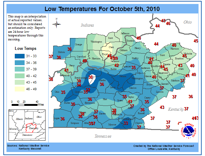
Graphic taken from NWS Louisville
Tonight will be a similar story as last night with low temperatures approaching 35 as surface high pressure takes hold. Expect a few more areas to receive frost tonight as radiational cooling is maximized under high pressure with light winds. Otherwise, todays high temperatures will be on the increase with a high of 69. As ridging takes place temperatures will rebound this week, and conditions will remain abnormally dry.