An upper level tough exists over the region and will allow for some convection to our west through the morning hours, allowing for rain chances before noon. However most of the heavy precipitation has pushed its way on out of the area. Highs today will reach near 80, which is not normal for late October. Tonight temps will stay unseasonably warm as well as we remain in the warm sector of system to our north. A cold front will approach early Tuesday morning with a few scattered showers out ahead of the front. However, Tuesday is when things get real interesting.
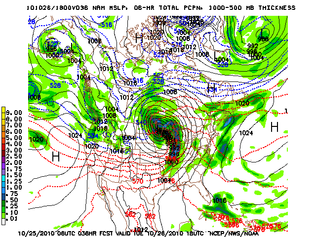
Tuesday and Wednesday are setting up to be historic. Maybe not for this area in particular but definitely for the northern Plains and the Great Lakes region. A low is forming off the Rocky Mountains and is forecast to move northeast into Minnesota. As it does so, will deepen to around 964 millibars, which is not typical in the U.S. at all. A strong pressure gradient will exist through most of the eastern U.S., including our area. Winds expected to be high today through Tuesday afternoon. Stronger winds on Tuesday around 15 to 22 mph with gusts in the mid 30’s or higher. Dynamics with this storm will be enough to suggest a strong line of storms rolling through the area Tuesday mid morning through Tuesday night. A few embedded tornadoes can’t be ruled out from the strong line of storms to roll through Tuesday. Rainfall amounts Tuesday through Wednesday are expected to be between 1 to 2 inches. An update will come shortly as we gain more knowledge of what is to come. Here is the look at NAM model output for Tuesday.