
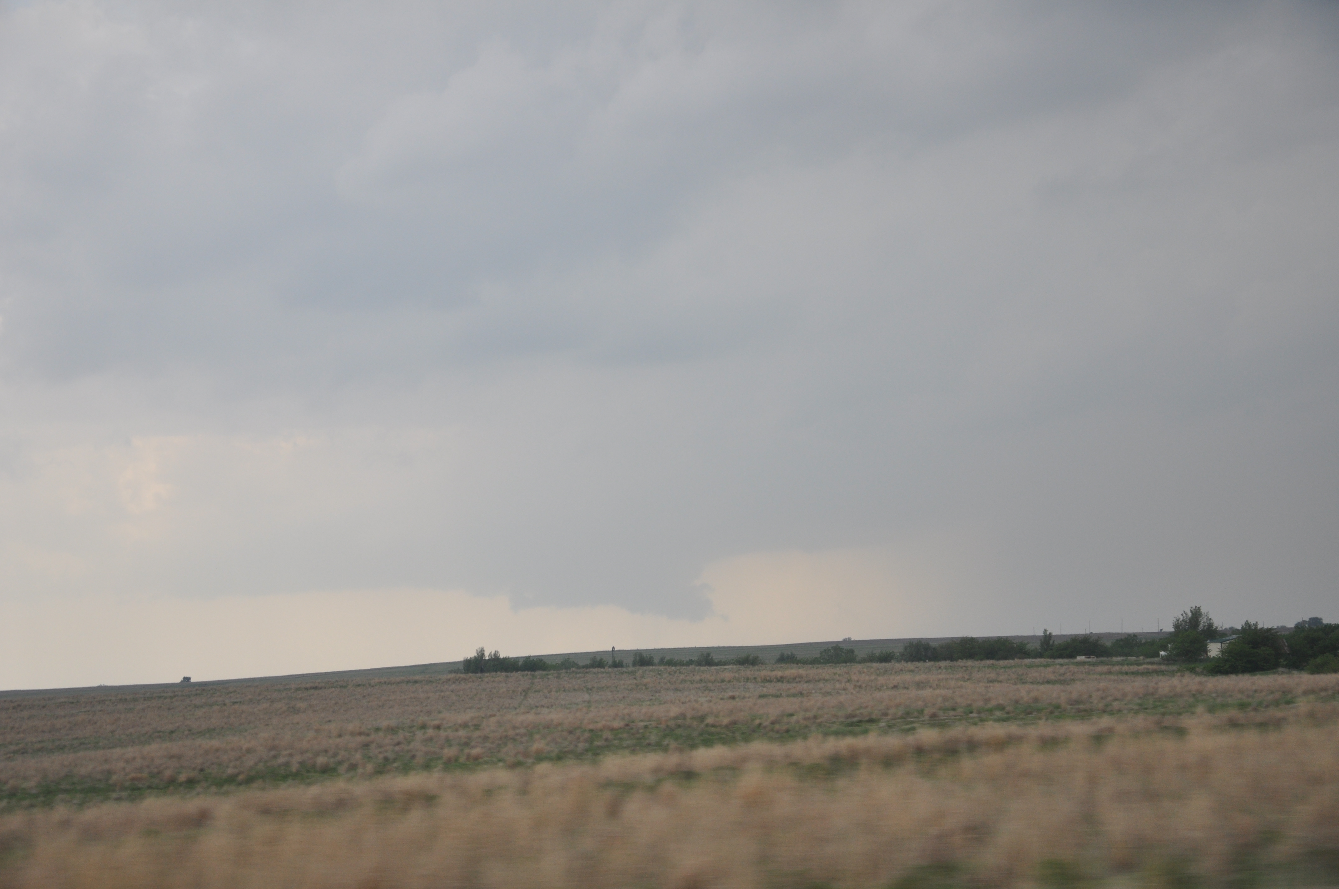
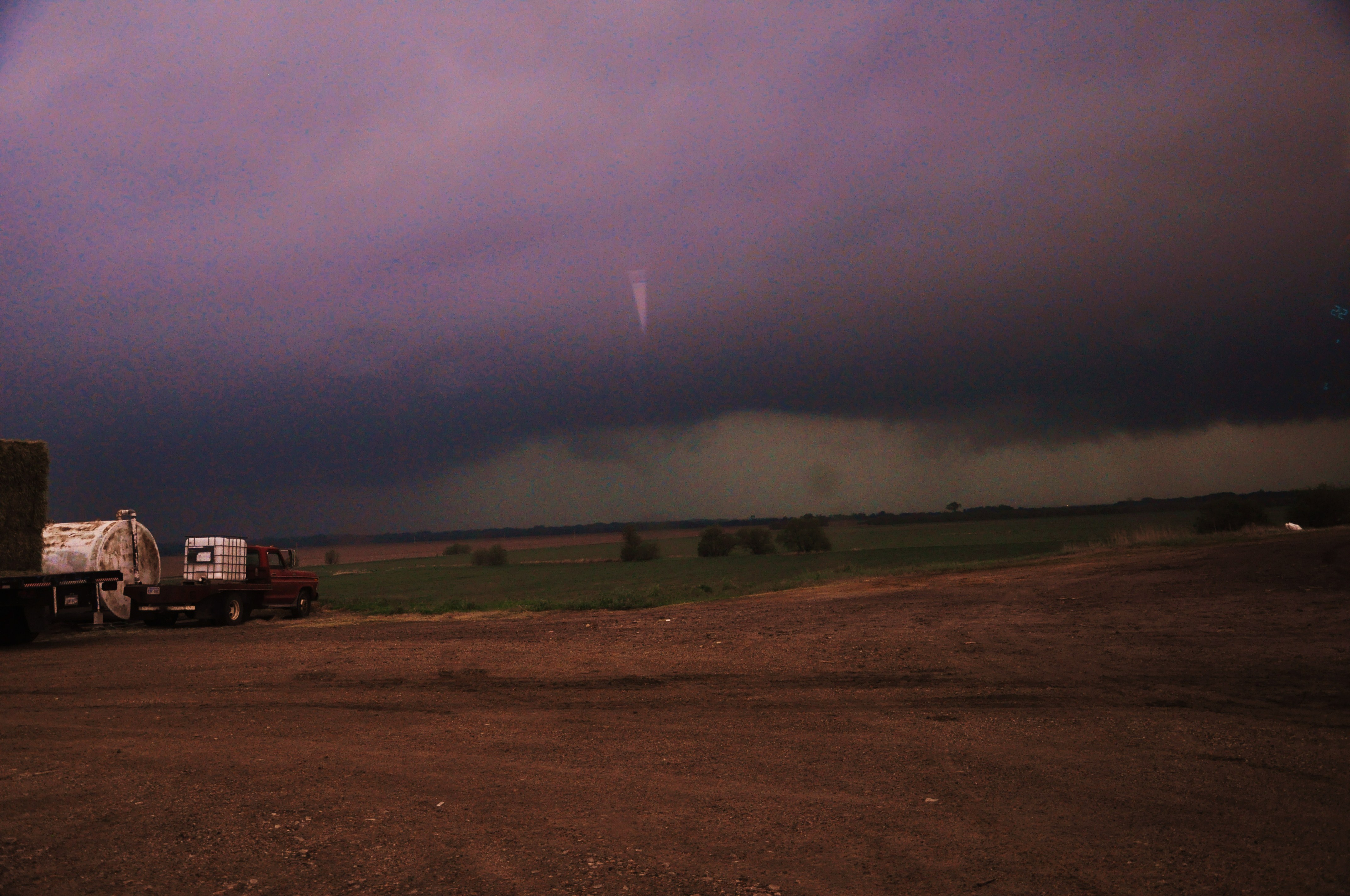
The class nailed the forecast target area where cells fired up early afternoon and dropped two tornadoes. However, they were high precipitation super cells so unless we got dangerously close we would not be able to see the reported tornadoes as they were rain wrapped. It was a very successful day though, because the students got their forecast right which is what this is all about! Here are some pictures from yesterdays storm. First photo displays the structure of the supercell we were on, second one is of the wall cloud that dropped and was rotating but quickly retreated back up, and third photo is the shelf cloud as we let it approach the van. Hope you enjoy the photos and we plan to recap every chase day. A blog update should be posted later this morning concerning the plan for the day.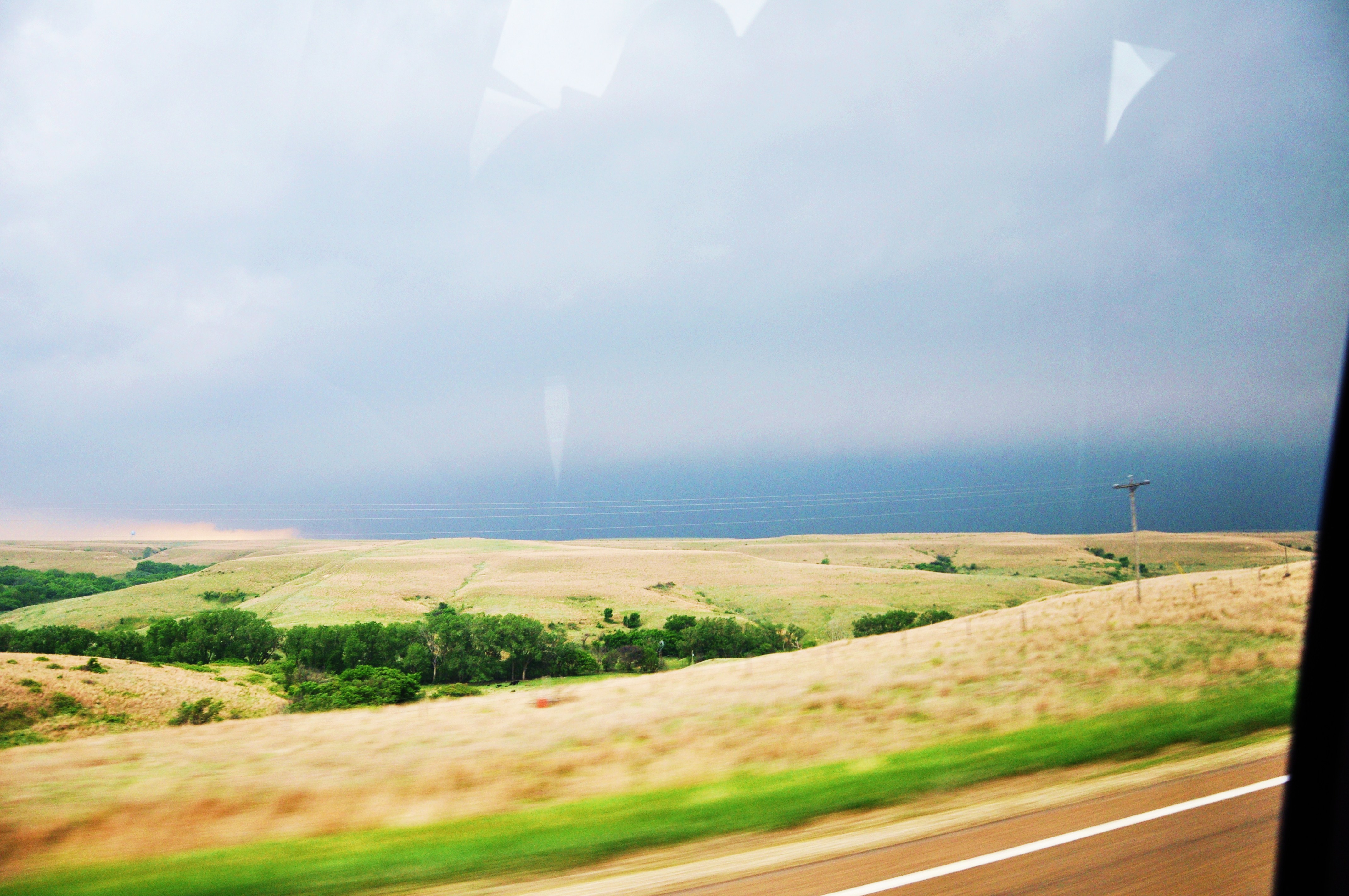
Blogroll
Login
Pages
-
Recent Posts
Recent Comments
- Desiree Harris on About me – Dr. Greg Goodrich
- J.D on Cold January Day
- Fantazi Kıyafetleri on Weekend Severe Weather Synopsis
- Gregory Goodrich on Meteorology at WKU
- Ann on Meteorology at WKU
Archives
- April 2024
- March 2024
- February 2024
- January 2024
- December 2023
- November 2023
- October 2023
- September 2023
- August 2023
- May 2023
- April 2023
- March 2023
- February 2023
- January 2023
- December 2022
- November 2022
- October 2022
- September 2022
- August 2022
- July 2022
- June 2022
- May 2022
- April 2022
- March 2022
- February 2022
- January 2022
- December 2021
- November 2021
- October 2021
- September 2021
- August 2021
- May 2021
- April 2021
- March 2021
- February 2021
- January 2021
- December 2020
- November 2020
- October 2020
- September 2020
- August 2020
- December 2019
- November 2019
- October 2019
- September 2019
- May 2019
- April 2019
- March 2019
- February 2019
- January 2019
- December 2018
- November 2018
- October 2018
- September 2018
- May 2018
- December 2016
- November 2016
- October 2016
- September 2016
- August 2016
- May 2016
- December 2015
- November 2015
- October 2015
- September 2015
- June 2015
- May 2015
- April 2015
- March 2015
- February 2015
- December 2014
- November 2014
- October 2014
- September 2014
- August 2014
- June 2014
- May 2014
- April 2014
- March 2014
- February 2014
- November 2013
- October 2013
- September 2013
- June 2013
- May 2013
- April 2013
- March 2013
- February 2013
- January 2013
- December 2012
- November 2012
- October 2012
- September 2012
- August 2012
- June 2012
- May 2012
- April 2012
- March 2012
- February 2012
- January 2012
- December 2011
- November 2011
- October 2011
- September 2011
- June 2011
- May 2011
- April 2011
- March 2011
- February 2011
- January 2011
- December 2010
- November 2010
- October 2010
- September 2010
- August 2010
- July 2010
- June 2010
- May 2010
- April 2010
- March 2010
- February 2010
- January 2010
- December 2009
- November 2009
- October 2009
- September 2009
- May 2009
- April 2009
- March 2009
- February 2009
- January 2009
- December 2008
- November 2008
- October 2008
- September 2008
- August 2008
- July 2008
- June 2008
- May 2008
- April 2008
- March 2008
- February 2008
- January 2008
- December 2007
- November 2007
- October 2007
- September 2007
- August 2007
- July 2007
- June 2007
- May 2007
- April 2007
- March 2007
- February 2007
- January 2007
Categories
Meta