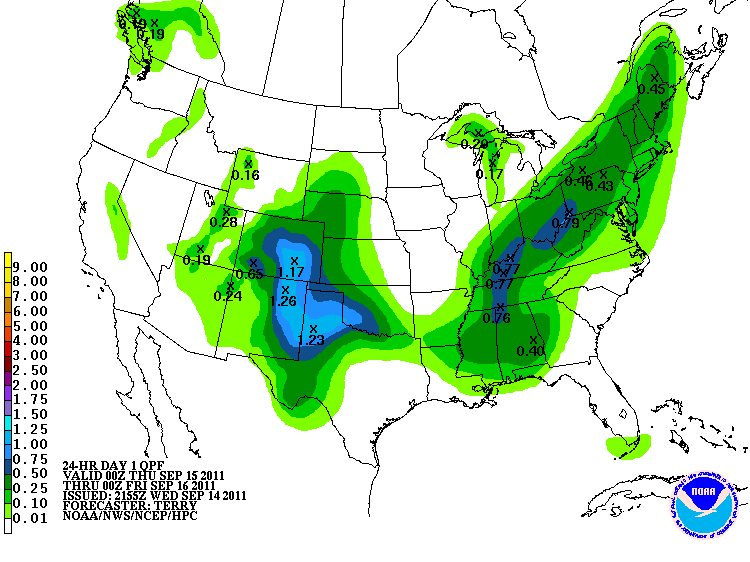
Rain, possibly with a few embedded thunderstorms, will overspread the Bowling Green area tonight ahead of an approaching cold front.
As the picture above shows, southern Kentucky is expected to receive around a half to three quarters of an inch of precipitation. Behind the frontal boundary, temperatures will fall below average. Highs in the upper 60s and lows in the upper 40s are expected tomorrow and Friday. More seasonable temperatures are expected for the weekend and into early next week, with highs climbing back into the upper 70s and lower 80s.

