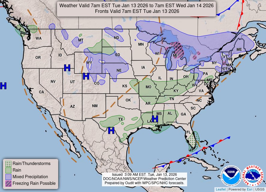
Hello all! As the temperature continues to rise to above 80 today for most of Kentucky, cooler temperatures are expected for the remainder of the week. A cold front lies along the Ohio River slowly moving south of the river ahead of the deepening upper level trough that approaches. For today the higher chances of thunderstorms lie in southern Missouri and northwestern Arkansas. Rain chances are not very high today, expect high rain chances tomorrow.

WPC National Forecast Map 10/19/16
The day 2 convection outlook gives a better chance of thunderstorms than the day 1 of outlook , with the day 2 giving Bowling Green a marginal risk of severe storms along with most of the state.
Along the boundary front lies an mass of unstable air, this air mass will slowly move across the Bowling Green are tonight through most of the day tomorrow. There are some marginally high levels of mid level and surface level CAPE (energy for severe storms to form) near Bowling Green yet they do not last long enough to give a chance of severe thunderstorms to appear near Bowling Green the higher levels of CAPE pass north of Bowling Green along the Ohio River tonight shortly after midnight and just south and east of Bowling Green near Interstate 65 after midday Thursday. The eastern side of the I-65 corridor can expect rain for rest of the afternoon Thursday and through overnight ours into early Friday morning.

Simulated Composite RADAR Forecast of the 12Z NAM for 10/191 through 10/21/16, from College of DuPage’s Numerical Models page.
As the surface low moves north east throughout tonight, the northern part of Kentucky can expect a bit of relief from showers. However as the cold front moves through the state the unstable air mass along the front coupled with the decent CAPE values can provide the marginal chances of severe storms, that the SPC predicted, where the front and CAPE values overlap. When Friday morning comes, expect the cold front to move out of Kentucky along with it the rain.

COD 12Z NAM Forecast of Surface Temperature showing passing of Cold Front near Bowling Green at roughly 1pm 10/20/16
Forecast:
Today: Mostly sunny with high temperatures reaching around 86 degrees Fahrenheit, and a south south west wind around 5 to 10 mph can be expected.
Tonight: Slightly cloudy with low temperatures around 64 degrees winds with a slight southerly wind less than 5 mph. Rain chances pick up increase after midnight around 20%.
Thursday: Cloudy with rain chances increasing to 70% after 6 am. Expected rain fall totals range from a tenth to a quarter of an inch by the end of the day Thursday. High temperatures expected near 75 degrees.
Thursday Night: Cloudy and rain chances of 50%. Low temperatures expected near 50 degrees.

