
It was yet another sunny day in Bowling Green as we warmed to a high of 79° in the afternoon. Tomorrow could be even warmer!

We could beat Wednesday’s high of 79°. Winds will come from the south, bringing us a shot of warmer air- and potentially getting us to the lower 80’s. However, the price for this warmer weather is the chance for thunderstorms and gusty winds!

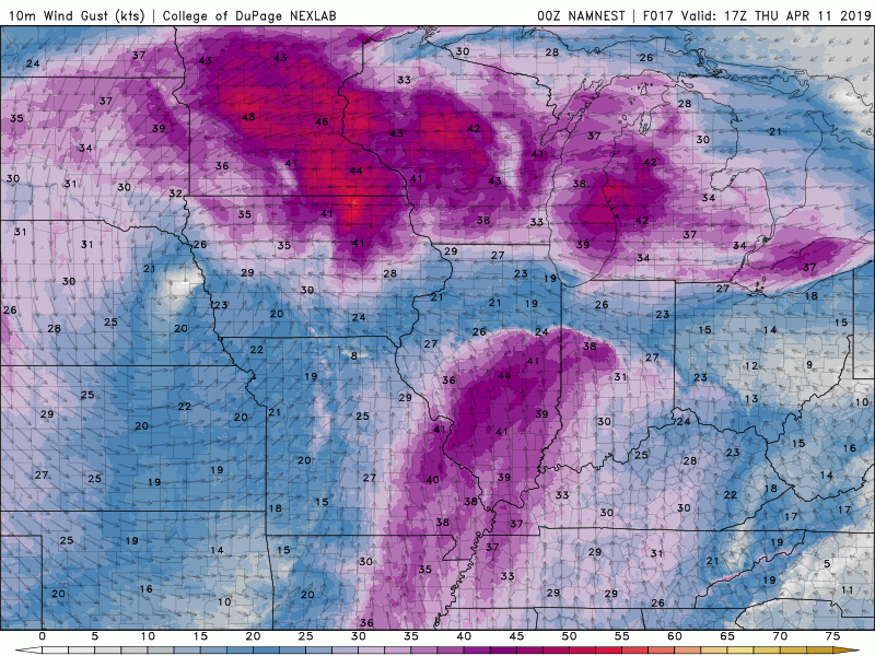
As shown by the models above, a line of thunderstorms with gusty winds should arrive in the early morning hours on Friday. This isn’t looking like a strong event, but something for those allergen sufferers to look forward to. The pollen count has been high, coming in at 11.7 today (extreme!). Besides Friday morning, it appears there will be two more chances at rain before the weekend comes to a close.
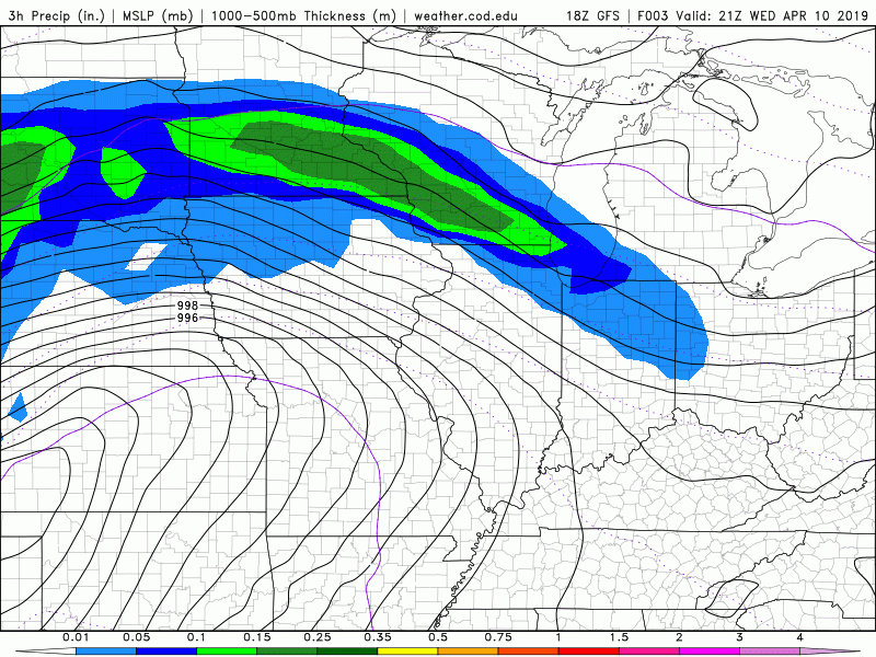
Unfortunately (or fortunately, again for those with pollen allergies), it looks like there will be a few rounds of rain this weekend. The GFS model above paints a wet picture for the next few days, especially this Sunday. With these systems moving through, we should also cool down this weekend quite a bit from what we’ve been experiencing as of late.
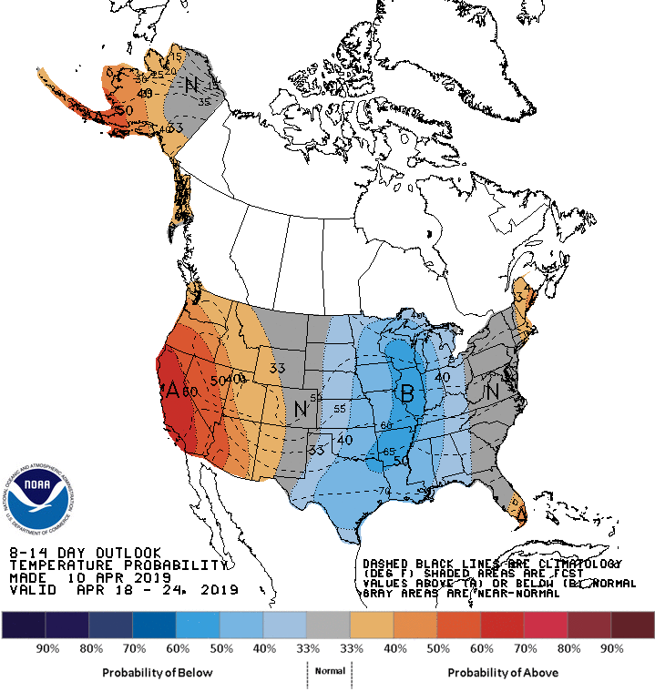
After 80’s Thursday, temperatures will crash back down to 50’s and 60’s as colder air works its way into the Mid-South. Sunday should warm up again before more rain arrives, but overall the pattern looks a bit cooler than average. This is why NOAA is forecasting a 30-50% probability of below normal temperatures for the region. With the active pattern ahead, we could be in for a back-and-forth swing in temperatures over the next two weeks!
Summary:
-Thursday warms back up to the lower 80’s
-Thunderstorms and gusty winds Thursday night into Friday morning
-Wet and cooler in the days to come