
I use many weather application, continuing radar and satellite images. Some of this application have options to give you warning for any progress that come up within time. Anyway, last night about 12pm one of them gave me a warning for light rain will accrue after 10 minutes. I saw outside to see the sky condition but no single cloud was present. I decided to stay until to see this rain although I was sleepy but nothing occurred. I don’t know from where that’s warring comes from but I know that it difficult to predict the weather and we must rely on weather forecasters more rather than fully depend on whether models because the weather modules give the output based on the input. The problem because if the input was wrong, how does the output look like? That was happen last night!
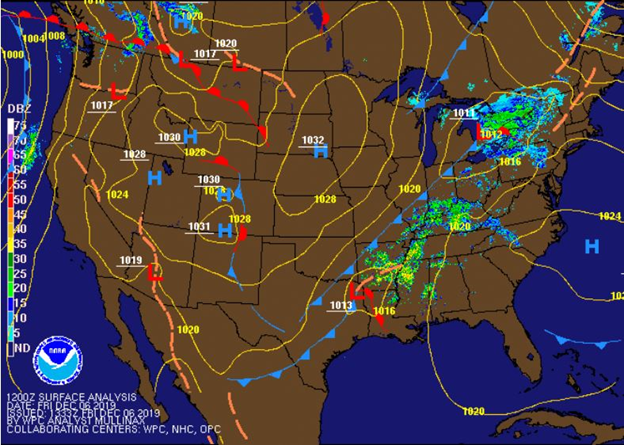
The situation right now, a cold front with moderate humidity crossing the area heading east, causing temperatures to drop and forming a cloud cover that lasts even for days (see figure 1). The high temperature will be around mid-50 and then it will drop down to mid-30 this night. We will have some rain but amount of this rain is less than a tenth of an inch possible. For Saturday and Sunday, a high surface pressure will allow to open the blue sky for Saturday. The surface high pressure will have shifted to east to the coast which allows for returning flow to send Gulf moisture back to Kentucky. Therefore, Cloud cover will increase Sunday to Sunday night and result for a slight chance of light rain.
Summary for next few days
| Day and time | Condition | High(°F) | Low (°F) |
| Tonight | Mostly cloudy | 35 | |
| Saturday | Mostly Sunny | 52 | |
| Saturday Night | Partly Cloudy | 38 | |
| Sunday | Cloudy | 56 | |
| Sunday Night | Slight Chance Rain then Chance Rain | 47 |