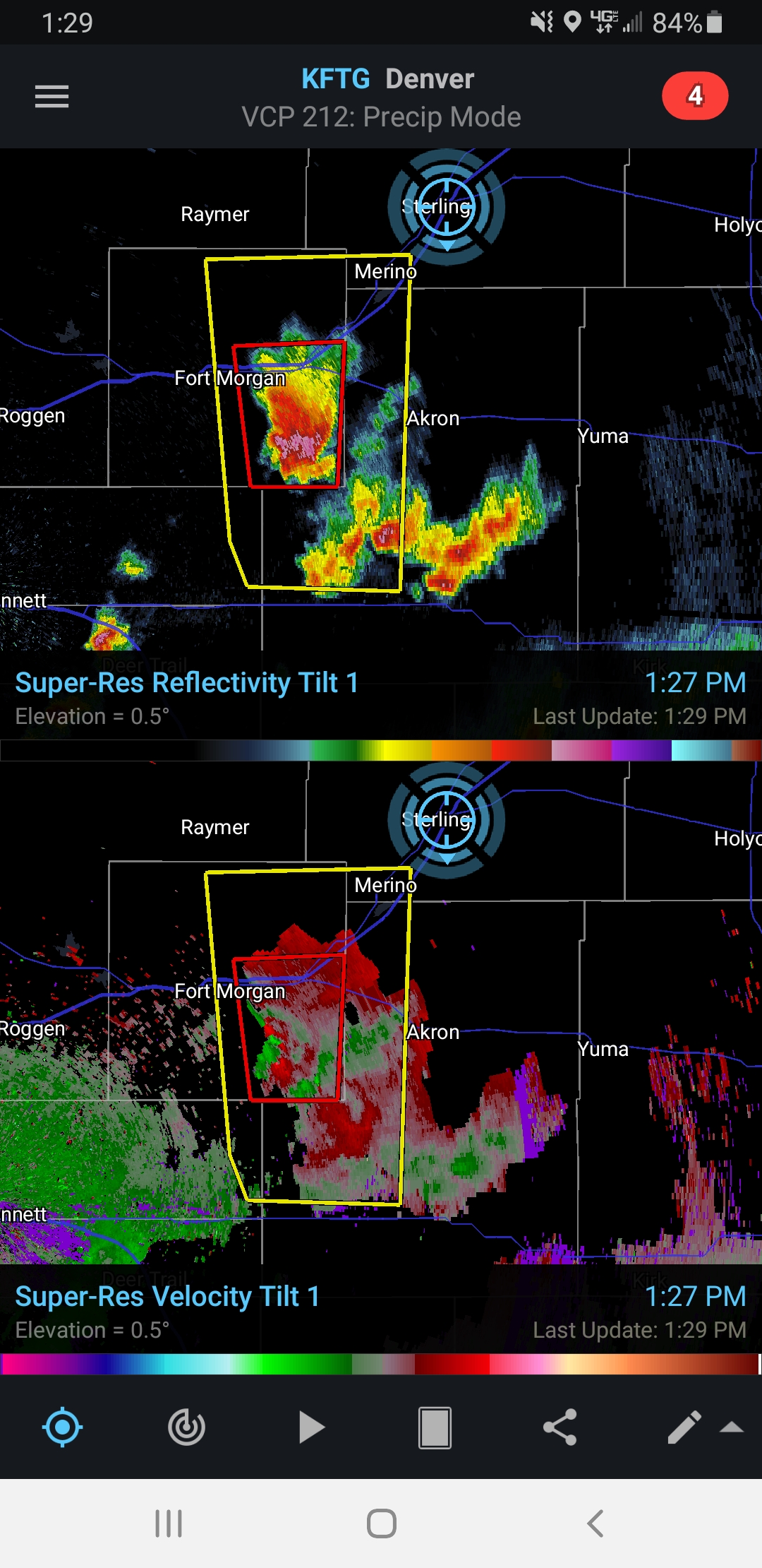
Today had a very similar set up to yesterday. It featured a NE oriented boundary draped across northeast CO. There is racing Northerly flow at 500mb showing up on the models that could potentially throw the storms over the boundary into the cold air (again like yesterday). However, if a storm can latch onto and ride the boundary, well get a great storm. Holding position at our hotel in Sterling. We stopped for lunch at the same Mexican restaurant ate at in 2019 for the Imperial, NE mothership. Right after we left, a North moving supercell became tornadic on the NW quadrant of the storm near Brush, CO.
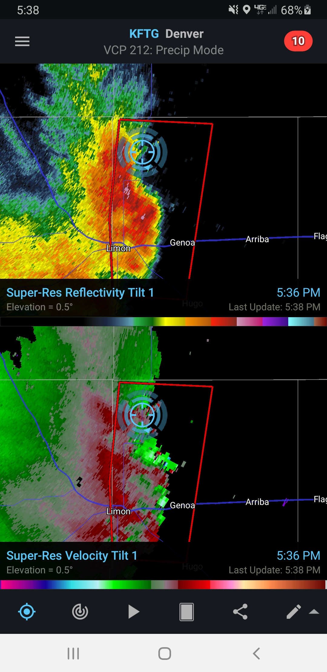
We couldn’t make it in time due to weird transient storm motions (NW and then SE side would flip back and fourth on which would rotate. It eventually crossed over into the cold sector so it no longer had a good energy source. We bailed South to Limon to get on a tornado producing storm in a more linear type mode coming due North. Made it in time to see some lowering/a wall cloud along with some dust swirls on the ground. The storm featured outflow turning to inflow and back. After we left the storm, we had dinner and spent the night in Sidney, NE.