
We woke up in Sidney, Nebraska to begin the morning and held our daily forecast discussion in the lobby of the hotel. We had some people staying in the hotel ask questions before and after the discussion as well. Our drive wasn’t long, but we knew we needed to get south for storm initiation.
Atmospheric Setup
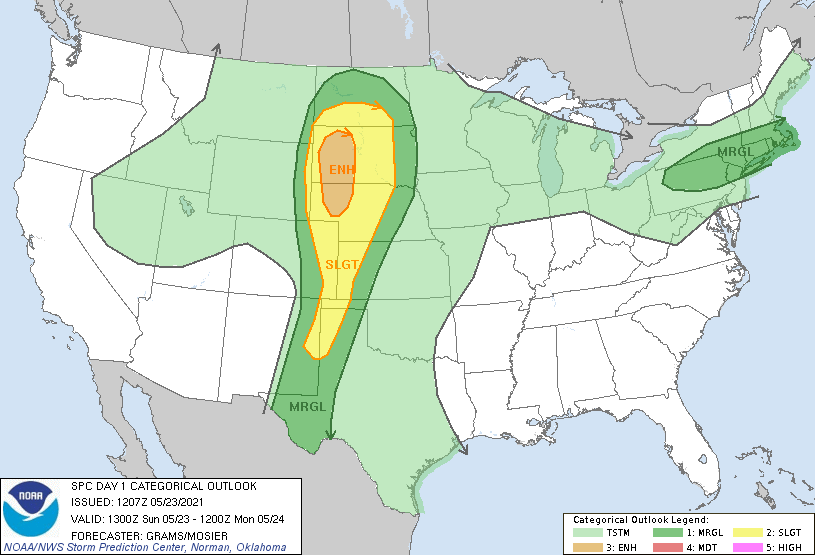
The Storm Prediction Center in Norman, Oklahoma outlined an enhanced risk (3 out of 5) over the Panhandle of Nebraska and the western half of South Dakota. A large slight risk (2 out of 5) was placed throughout the High Plains Region down through the panhandles of Oklahoma and Texas.
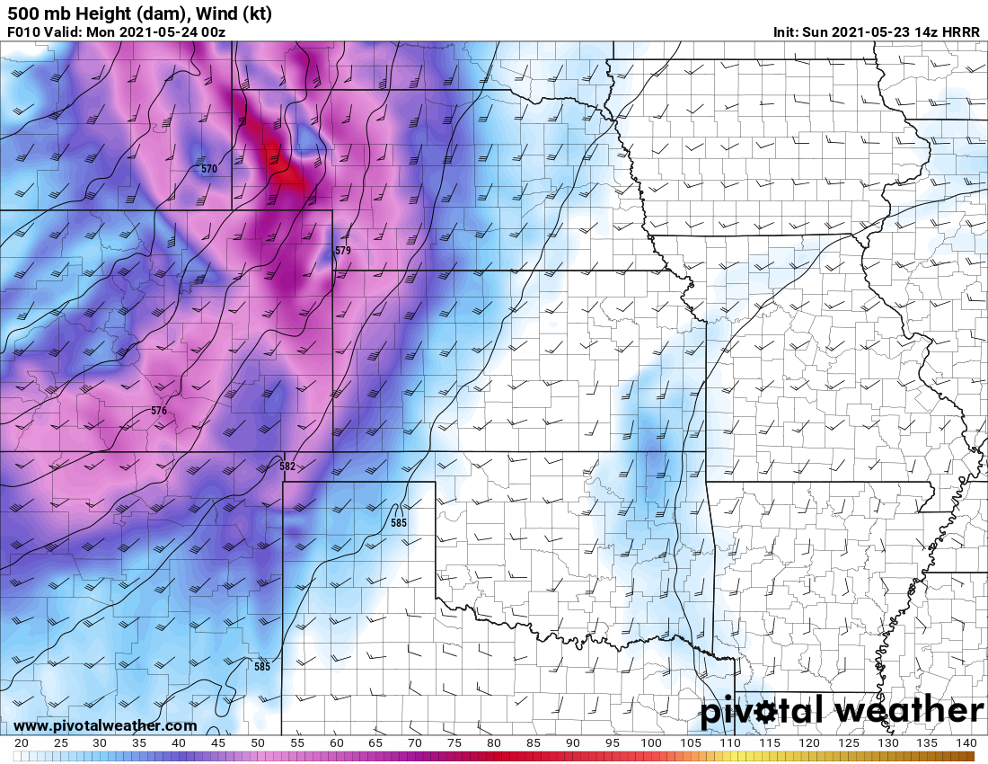
At 500 millibars (about 18,000 feet above ground level), winds were about 55-60 knots, and met criteria for severe weather. 30-40 knots is the ideal value to begin looking for severe weather. CAPE values, or instability were about 2000 joules/kilogram and were also supportive of allowing any convection to initiate. The main issue with the setup in South Dakota, was that most of the storms would be heading north into the boundary and at a very fast rate (almost too quick to successfully chase), and once they hit the boundary, we knew they would not last much longer.
At the surface
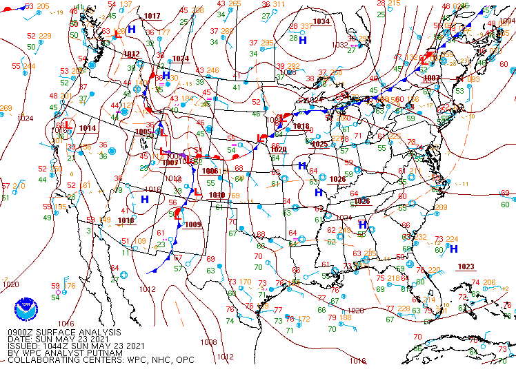
Two areas of low pressure were found over both northern and southern Colorado. A stationary boundary was draped across Nebraska and down through the Wyoming/Colorado state line. A cold front was located over the Denver Metropolitan area. As the day progressed, the cold front became stationary and moved eastward with time. Dewpoints throughout the day were in the mid to upper 50’s and some even reached the lower 60’s, which is sufficient for this location for severe weather.
Target Area
Considering the main risk of storms were located in South Dakota, we decided that the atmosphere did not look the best, and we decided to stay on the south side of the boundary, so we headed towards Limon, Colorado. Just north of Limon, a storm began wrapping around and eventually went tornado warned. Because the storms were fast movers, we had to move quick, and only had a few minutes to Rain-X the windows, gas up, and get moving again.
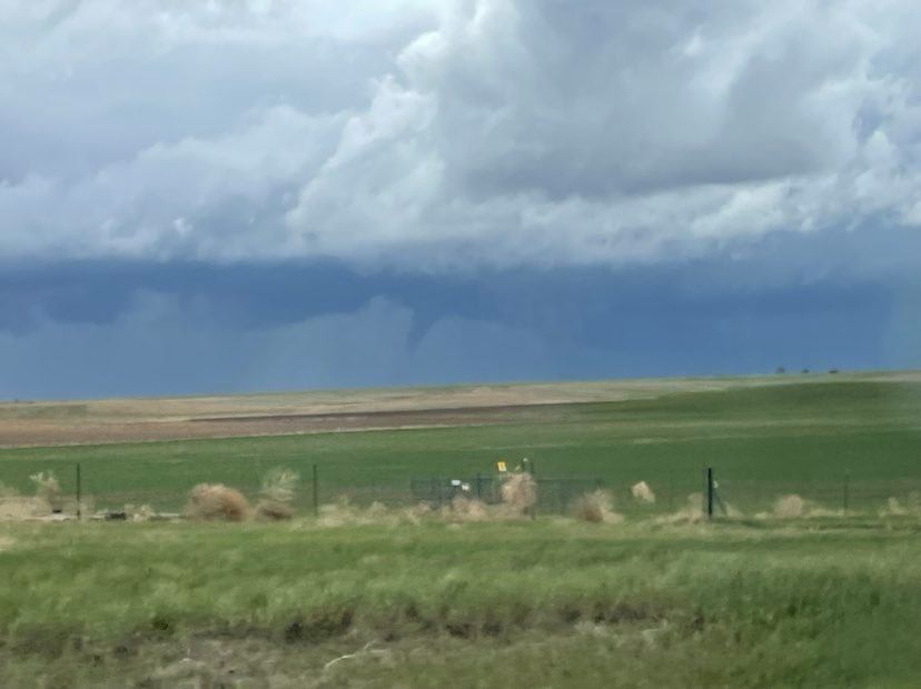
We continued to follow this storm for several miles, and even saw a brief funnel before it dissipated near Akron, Colorado. We continued to follow this storm northeast to Sterling, CO where we decided to abandon that storm to head south again for the next cluster of storms. We picked up a cell near Yuma, Colorado, and followed that storm cell to Wray, Colorado. By this time, the sun had set, and we began to head to head towards Colby, Kansas, for a good nights sleep to prepare for the next day ahead.