
Day 10 of the 2021 WKU Storm Chase was nothing short of exciting to say the least! We had a
pretty solid forecast and not very far to travel from Sterling, CO.
The Atmospheric Setup
We started by looking at the 500 mb winds to gauge our upper level support. Wind speeds of at least 30 kts were found over Nebraska and Kansas with pockets of at least 40 kts in Nebraska. As we looked through the day into our target time of 21Z – 00Z, we saw an axis of 60° dewpoints advect into southern and western Nebraska, and 70° dewpoints advect into southeastern Kansas.
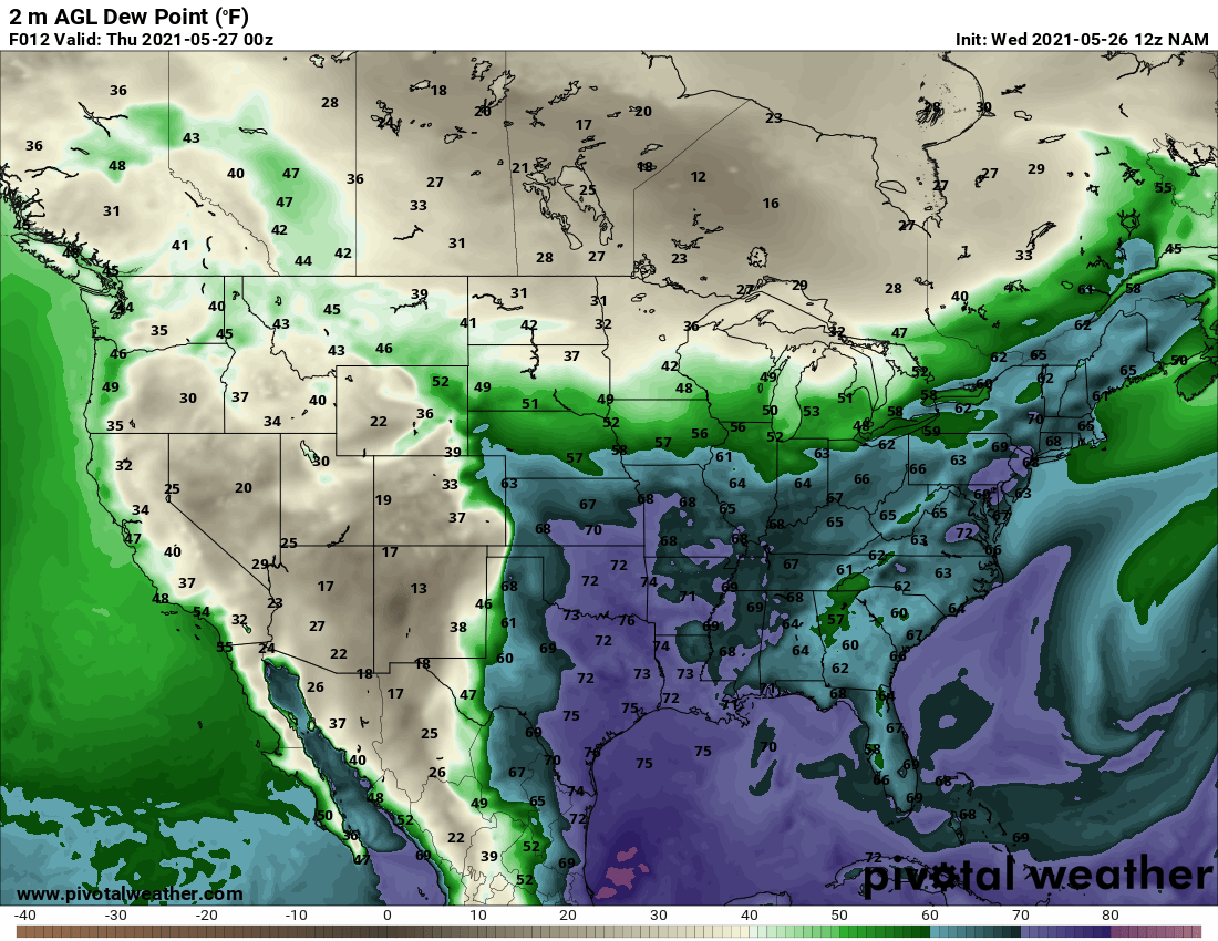
A similar pattern was found on the surface Theta-E map. This told us moisture wouldn’t be a problem! Plus, moisture can also serve as a source of lift at the surface. Speaking of which, we had a few features boundary features that would help to provide lift. The surface map showed a stationary boundary over central Kansas, a cold front drifting through Nebraska, and a dryline along the Texas-New Mexico border.
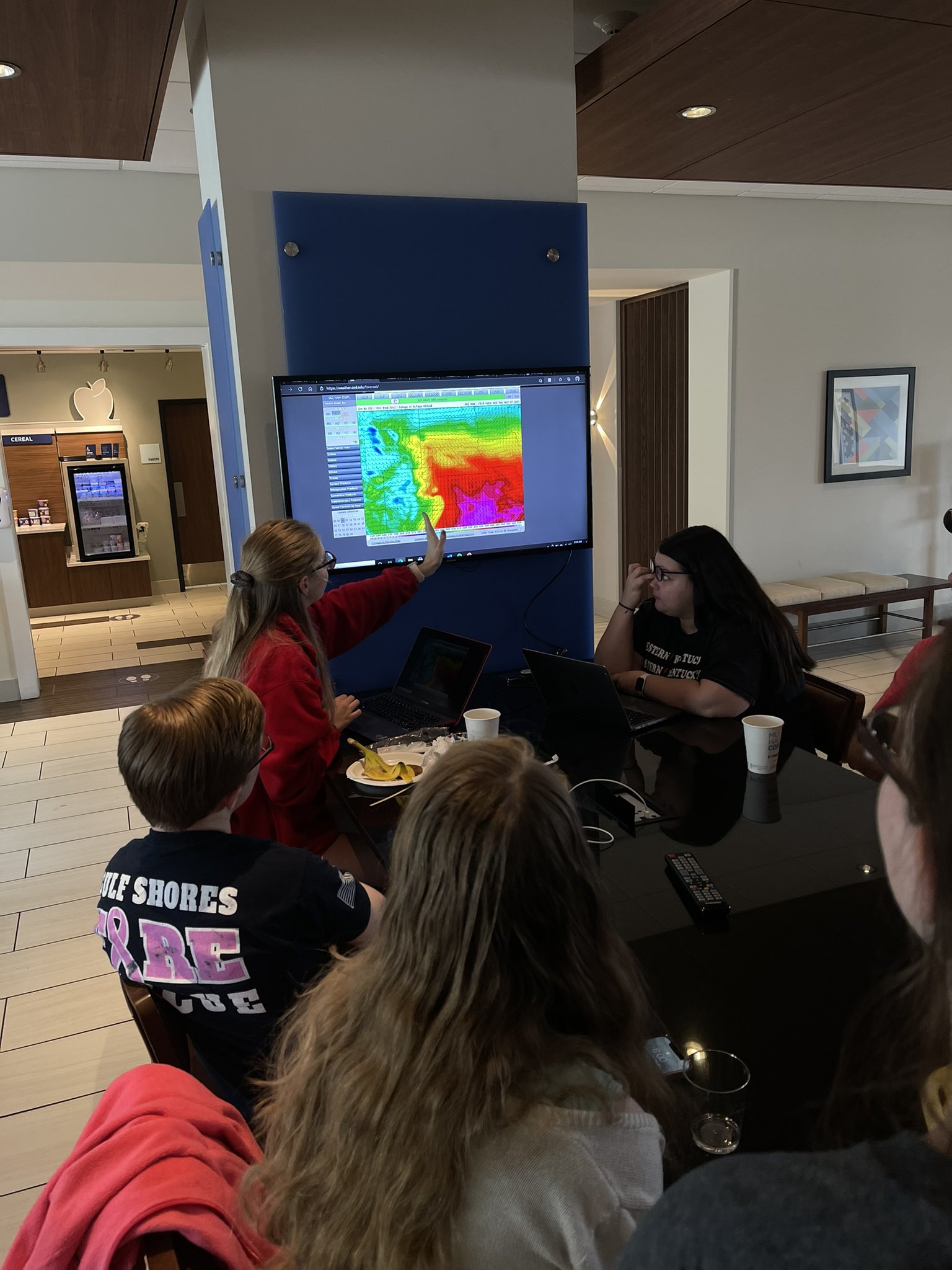
CAPE was also sufficient across the most northeast corner of Colorado (where we were) into southern and western Nebraska and across the majority of Kansas, with values upwards of 4500 J/kg in western Kansas. Comparing convection allowing models (CAM’s), there was much disagreement between timing of initiation, storm mode (cells versus a line), and where things would first initiate. This made a target location tough, but we agreed that Western Kansas had the best overall ingredients, so that’s where we headed.
The Chase
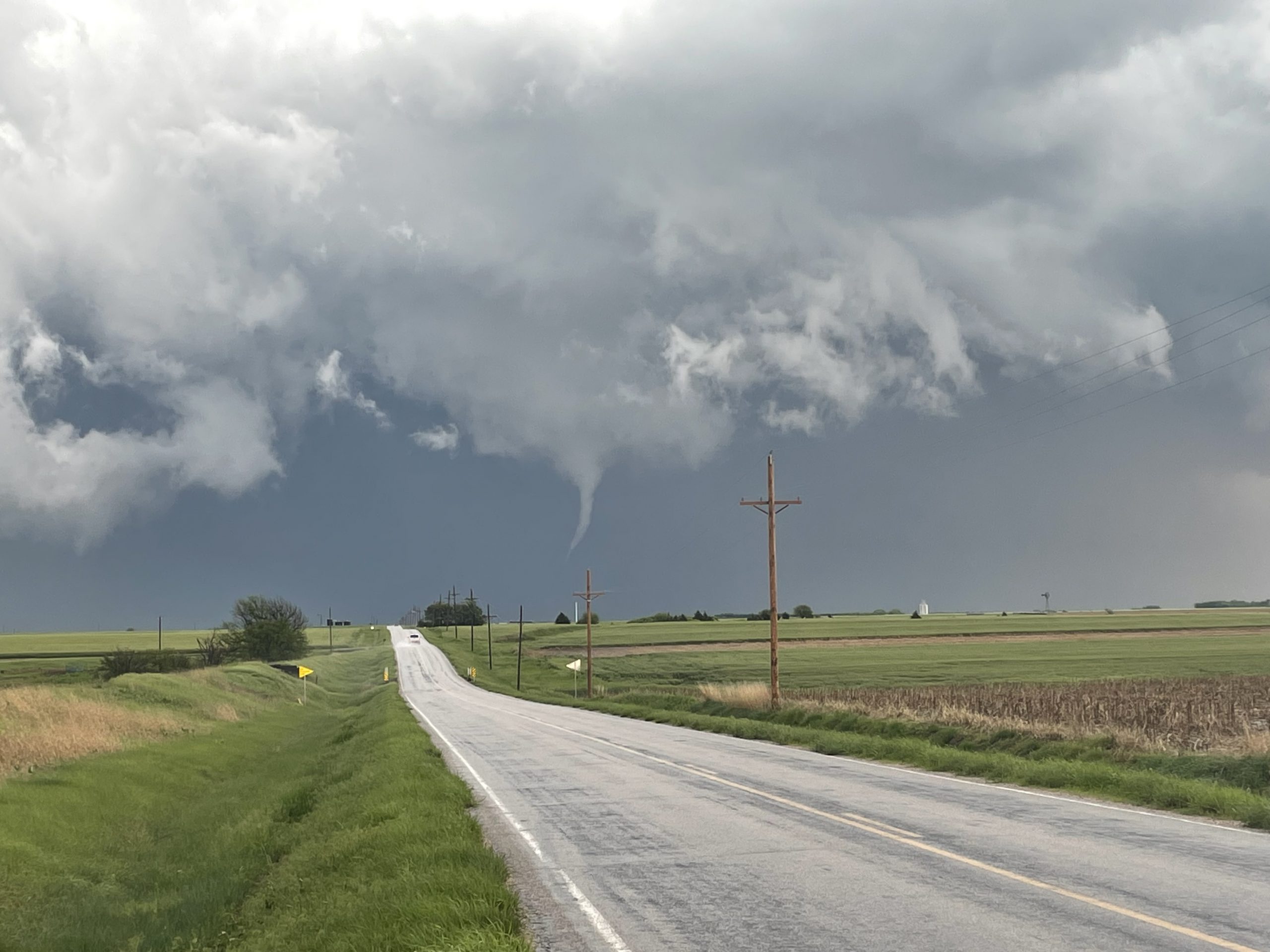
We set off from our home of Sterling, CO and headed to Goodland, KS, an about 160 mile, 2.5 hour drive. We left around 11 AM MT, and around 1 PM MT in Goodland, KS we made an extremely quick Subway stop for lunch, because storms were already initiating along a moisture boundary near Hays, KS! We raced to intercept it, all while storms were beginning to fire all around it. When we finally were in striking distance, we caught a glimpse of a skinny tornado just before it disappeared behind a new cell. Tornado #1 of the day!

Radar was showing this cell develop cuplet after cuplet, indicating that the storm was constantly rotating and redeveloping, even with other cells developing all around it. We followed it along and made some stops along the way to take some pretty picturesque photos! At one stop, radar velocity showed a tightening cuplet, and right before our eyes, we watched a skinny funnel develop, barely touch the ground, and then dissipate. (Almost) tornado #2 of the day!
After leaving to get ahead of the storm once again, we got some good visibility and were able to see some textbook supercell structure!

We spent all of our chase riding along this cell all the way to near McPherson, KS where it began to “gust out” around 8 PM CT. We decided to just stay in McPherson for the night and made it to town just before some heavy rain and hail passed just to the south of the hotel. While we didn’t experience much hail, the city of Hays, KS saw some hail around 2″ in size!
After a long chase day, we were happy to get back to the hotel. We were ready to get some rest and get ready for another big chase day the next day!