This is the final day of our storm chase trip for 2021. We started in Lubbock, TX this morning. This would be our last forecast discussion of the trip. We began the discussion at 10:30 that morning with two possible targets available. We had two possible targets again today, but had to commit to one since they were pretty far apart from each other. The first is in south eastern New Mexico, and the second target is near Midland, Texas.

The Atmospheric Setup
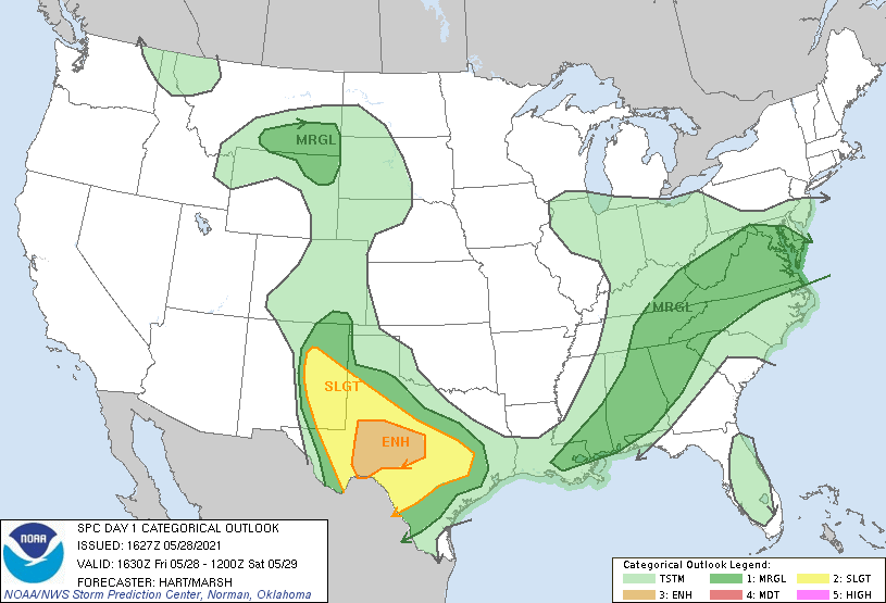
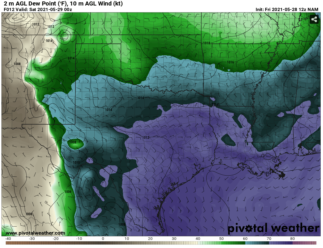
The ingredients for the atmospheric setup today was not entirely spatially coherent. It was difficult to pick a target because of this fact. The upper-level 500mb support was weak in most areas of the south central US, but it was sufficient for severe weather after 18Z, only producing winds at around 30 knots. The available CAPE and moisture in the region were not problematic, but there was a significant lack of wind shear in the lowest 1km, and the method of initiation was different for both targets. In New Mexico a dry line would be the main forcing mechanism, but storm motion suggested that storms would move with the dryline and become linear rather than move off the line. The second target near Midland, Texas had a zone of weak surface wind convergence, which suggested a good boundary for storms to track along with areas of localized vorticity. In the end we chose to chase the Midland, Texas target in hopes for more discrete super cell structure.
The Chase
We did not have a long drive today. Our target area was only 2 hours away and once we got there we had some time to play with. We ended up in a park south of Midland, and we spent some time throwing a football. We watched growing cumulus clouds for a good portion of the afternoon, and by 5:30 we were hitting the road to chase storms. A land spout was spotted south east of Monahans, Texas. This land spout was on the ground for over 5 minutes and was very well defined. This was occurring as storm cells merged into a single storm.
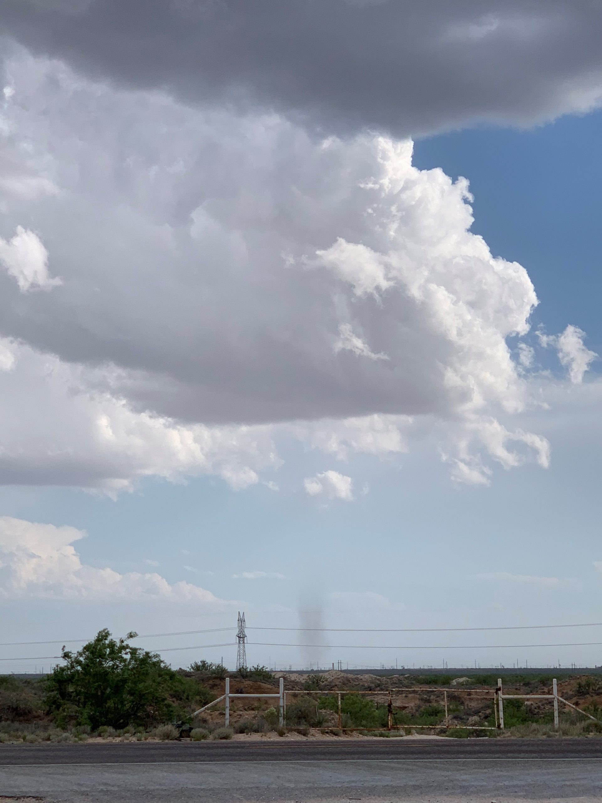
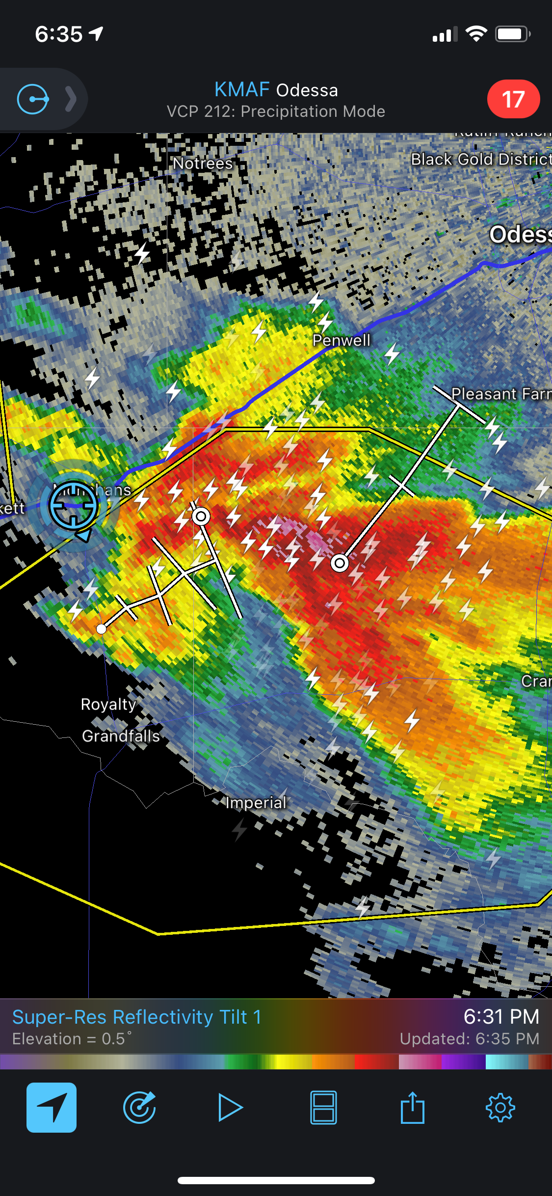
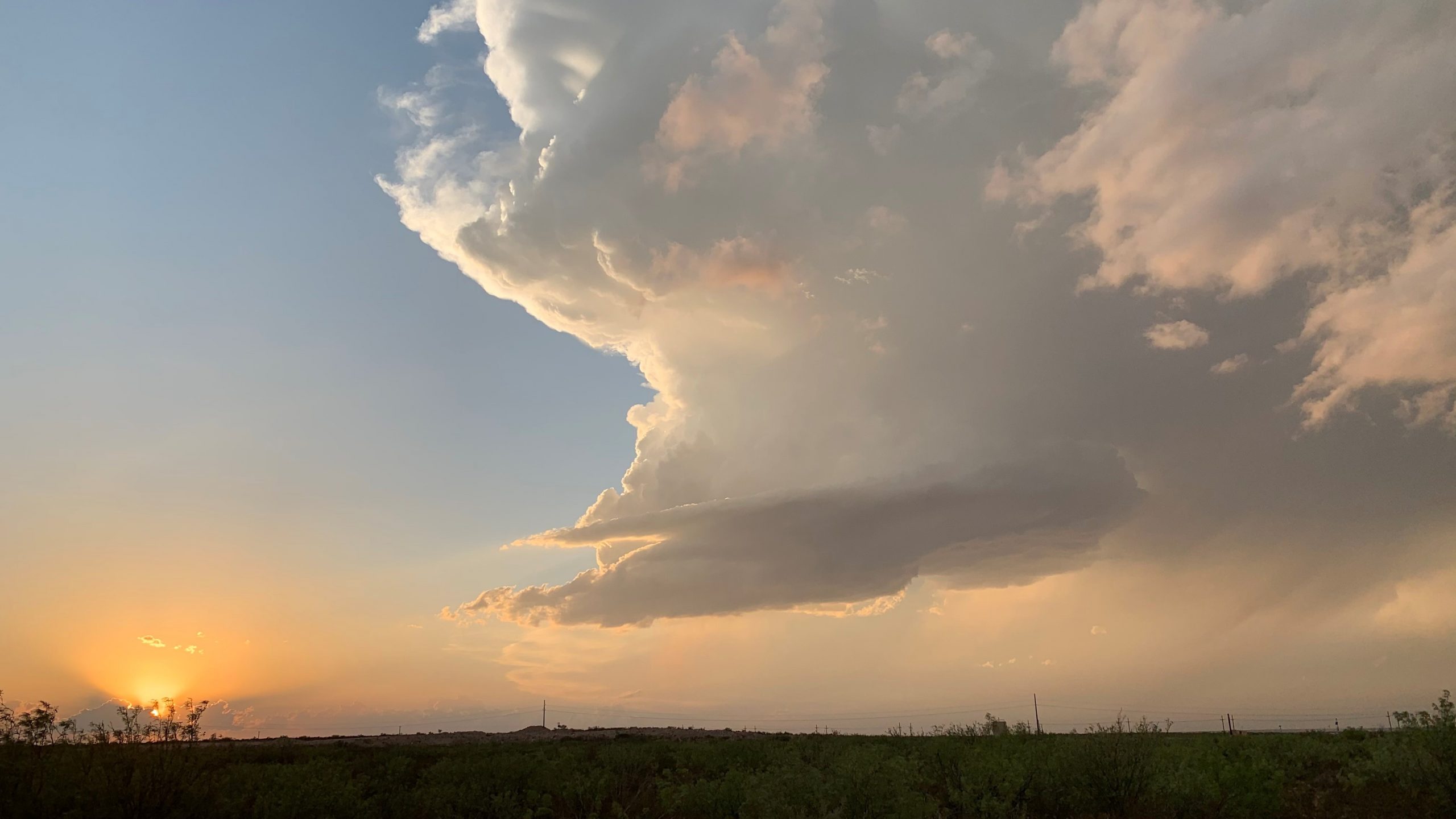
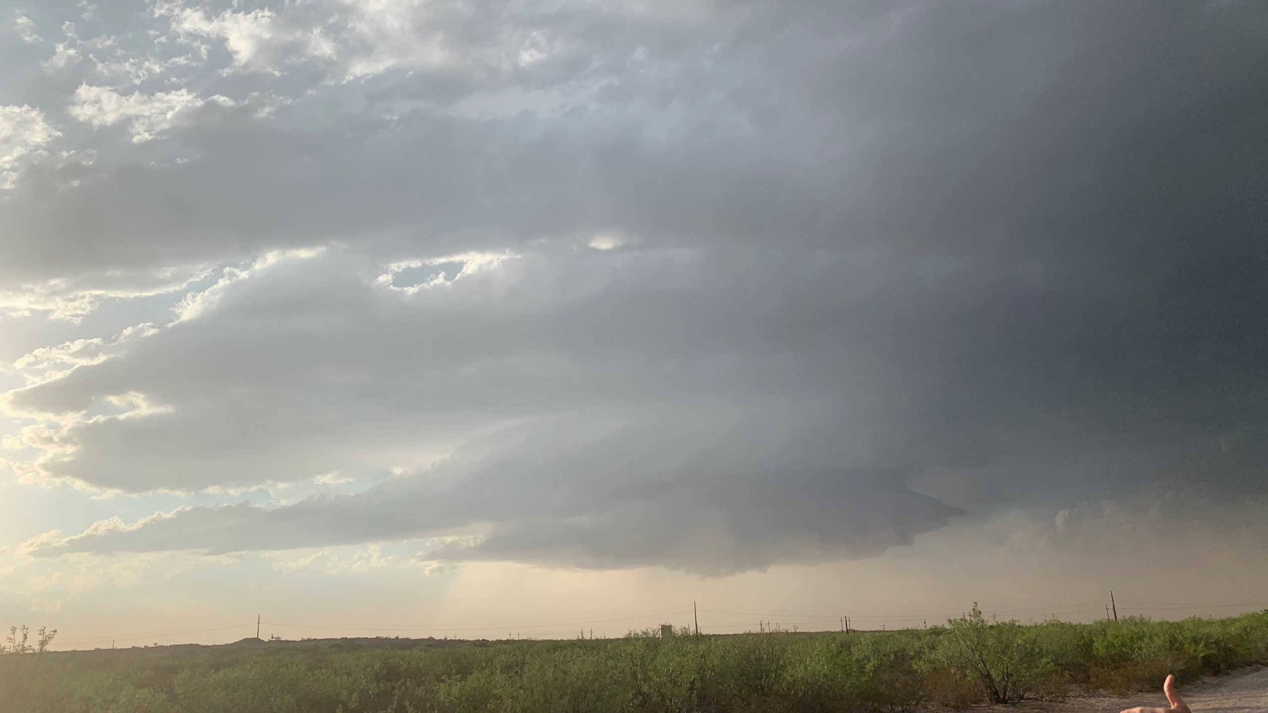
Once the land spout was over we dropped south to observe a developing super cell to the north west. We stopped at the end of a dirt road to view a spectacular supercell structure. We watched two very high based low precipitation super cells pass over us. It created an amazing view and we stayed there until there was no light left to view the storms. Once our chase day came to an end we headed back to Monahans, Texas. The trip home now begins and we will be back in Bowling Green by Sunday night.