
Today was one for the books for sure. We woke up in North Platte, Nebraska after a full and exciting day from Day 9. The enhanced risk from yesterday had centralized into a moderate risk for today located over the Iowa, Nebraska, and Missouri borders.
The Set-Up
The route from North Platte to Southern Iowa is a 6-hour drive. The long drive was cutting it close for time of initiation, which made us rethink our initial target. The set-up for today was classic with the warm front and dry line boundaries.
The typical chase would involve chasing the northeast part of the low. We decided to take the risk and chase the southwest part of the low, where the moisture and winds converge. This method is a risk due to the smaller area with all the ingredients, however, if anything were to develop, the cell will be a beautiful, isolated supercell.
The Chase
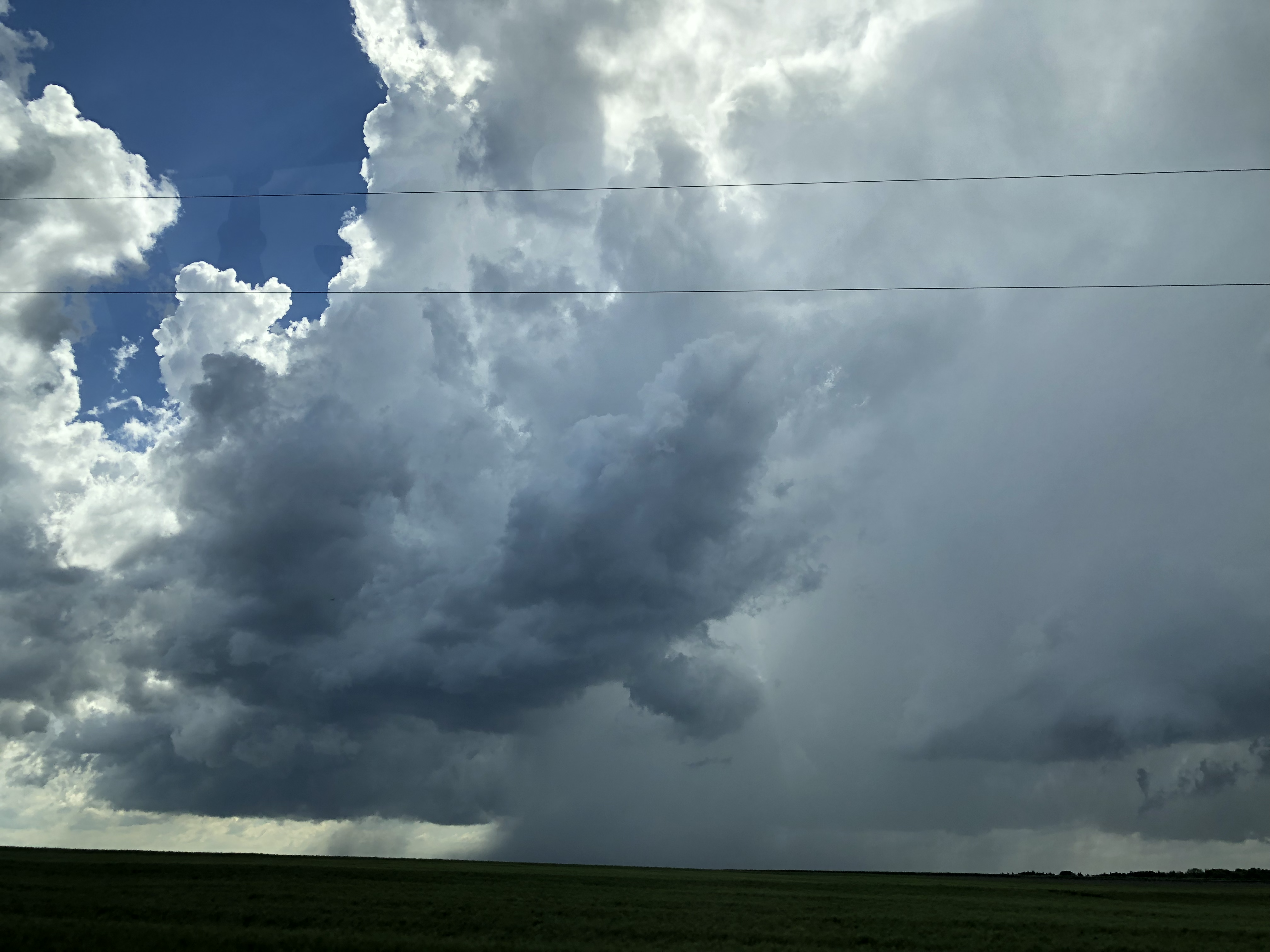
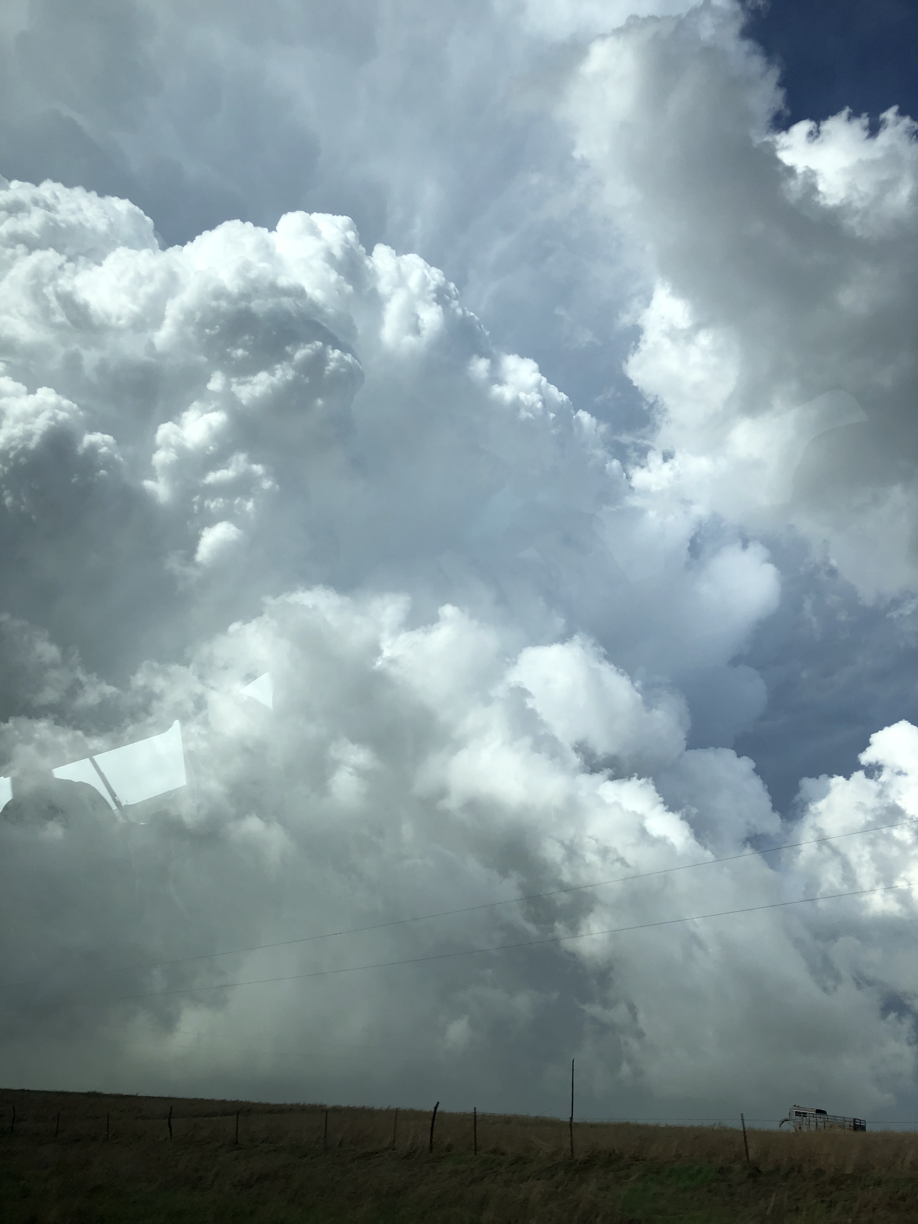
Around 5 hours of driving, we ended up in the Hays, Kansas area. We stopped in Stockton at Shirley Mae’s Deli for sub sandwiches. After burning some time, we drove around the lovely city of Stockton and ended up in the little town of Walker, Kansas. We parked the van on the side of the road and noticed cumulus clouds started to tower. After some time throwing the football, we saw that 2 landspouts were reported on this storm. We saw the landspouts forming from the towering cloud and piled back up in the van to chase it.
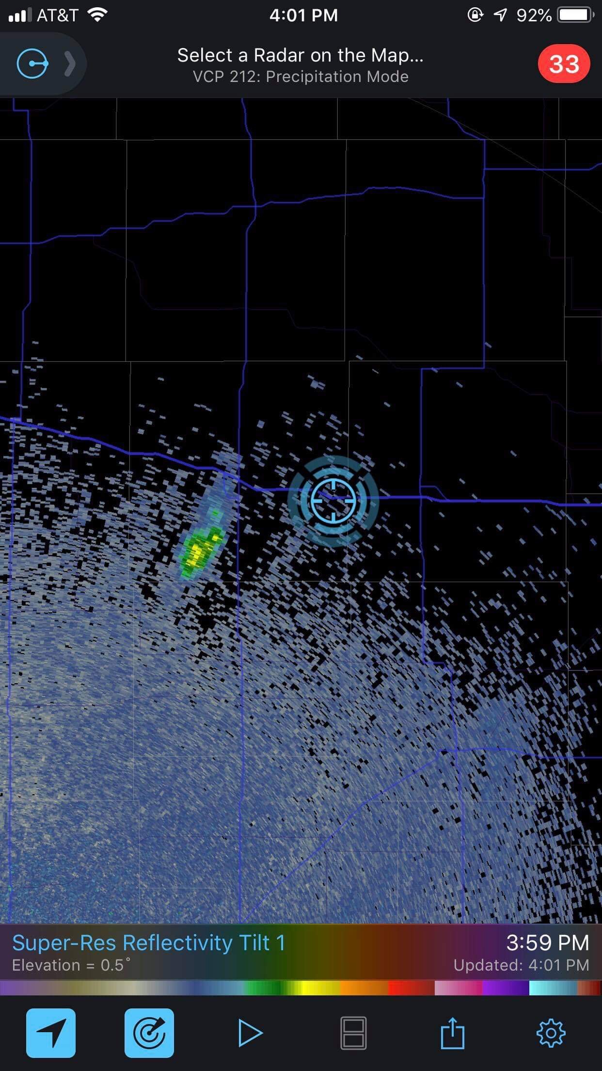
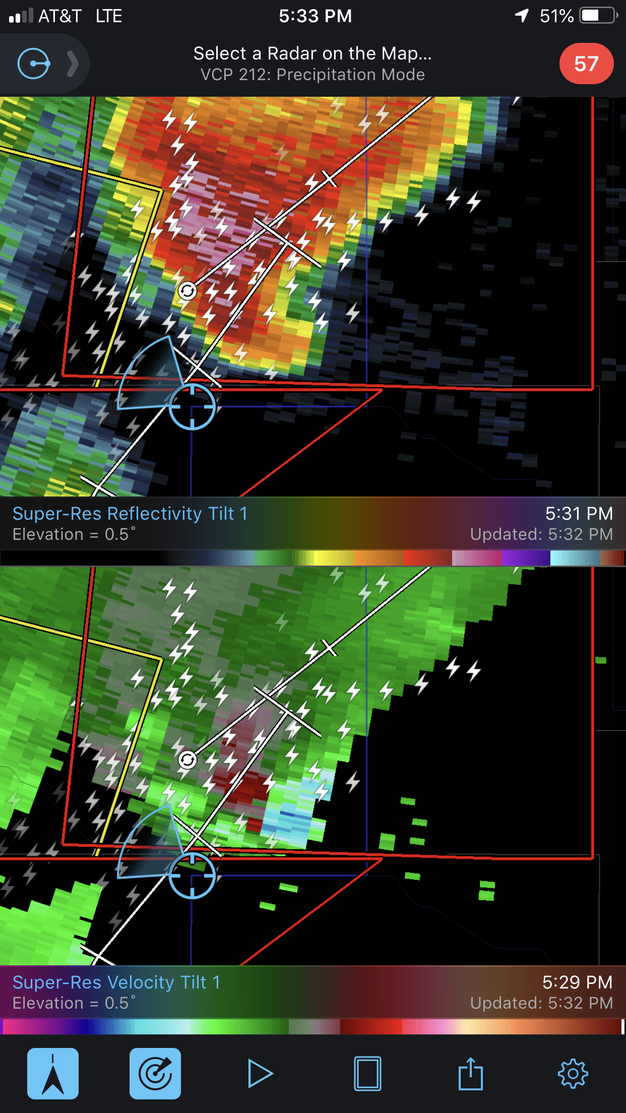
From one pixel to several in a few minutes, this storm was growing fast and strong. We drove closer to the storm and noticed the tornado sirens going off in the town of Walker. By the time we pulled over to watch the storm, the reflectivity started showing widespread rotation. This storm was now a supercell in the making.
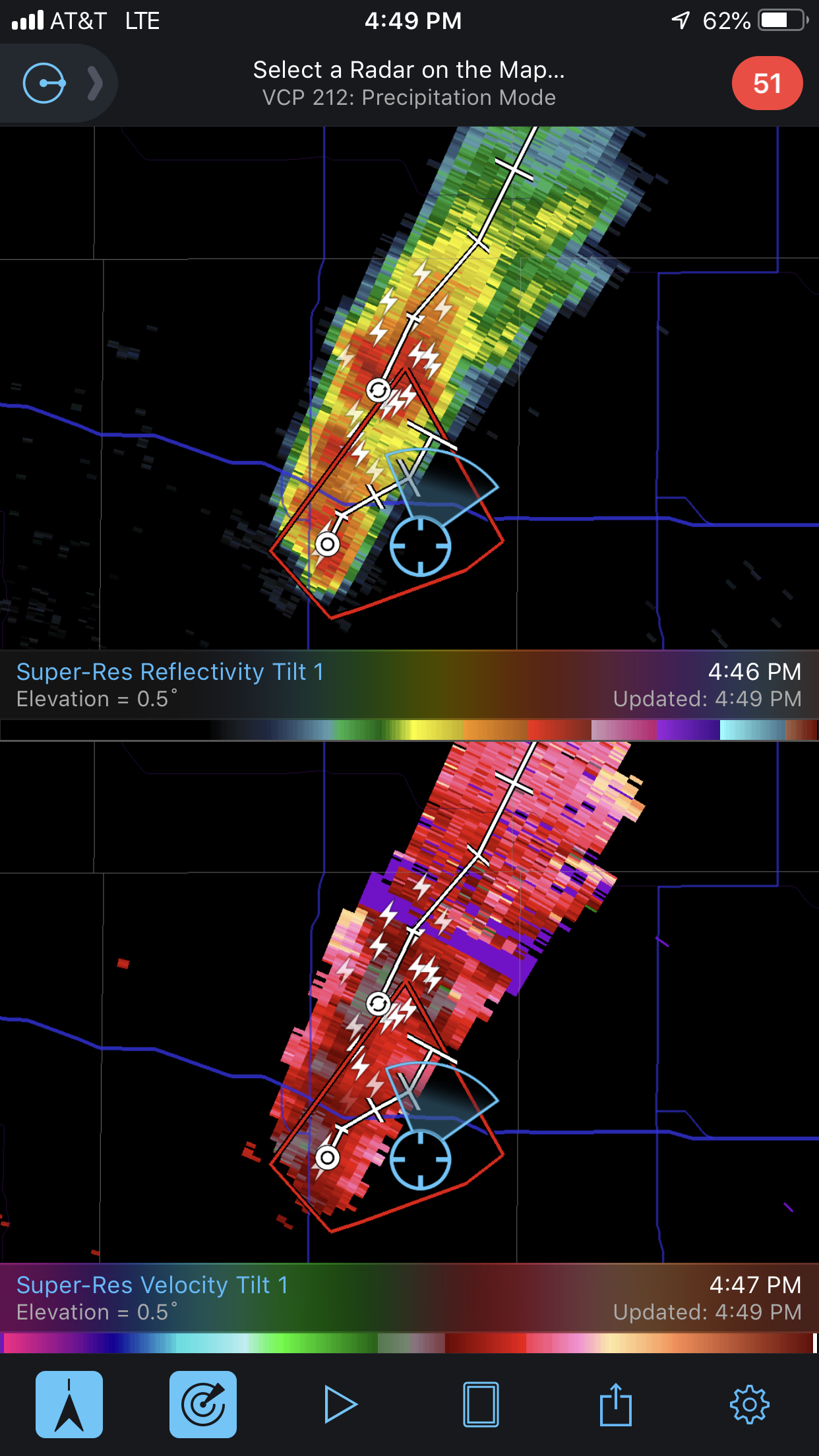
The storm started moving away from us, so we got back in the van and chased it. The reflectivity was now showing tight rotation and a “hook” feature on the south-side of the storm which is conducive of tornado circulation.
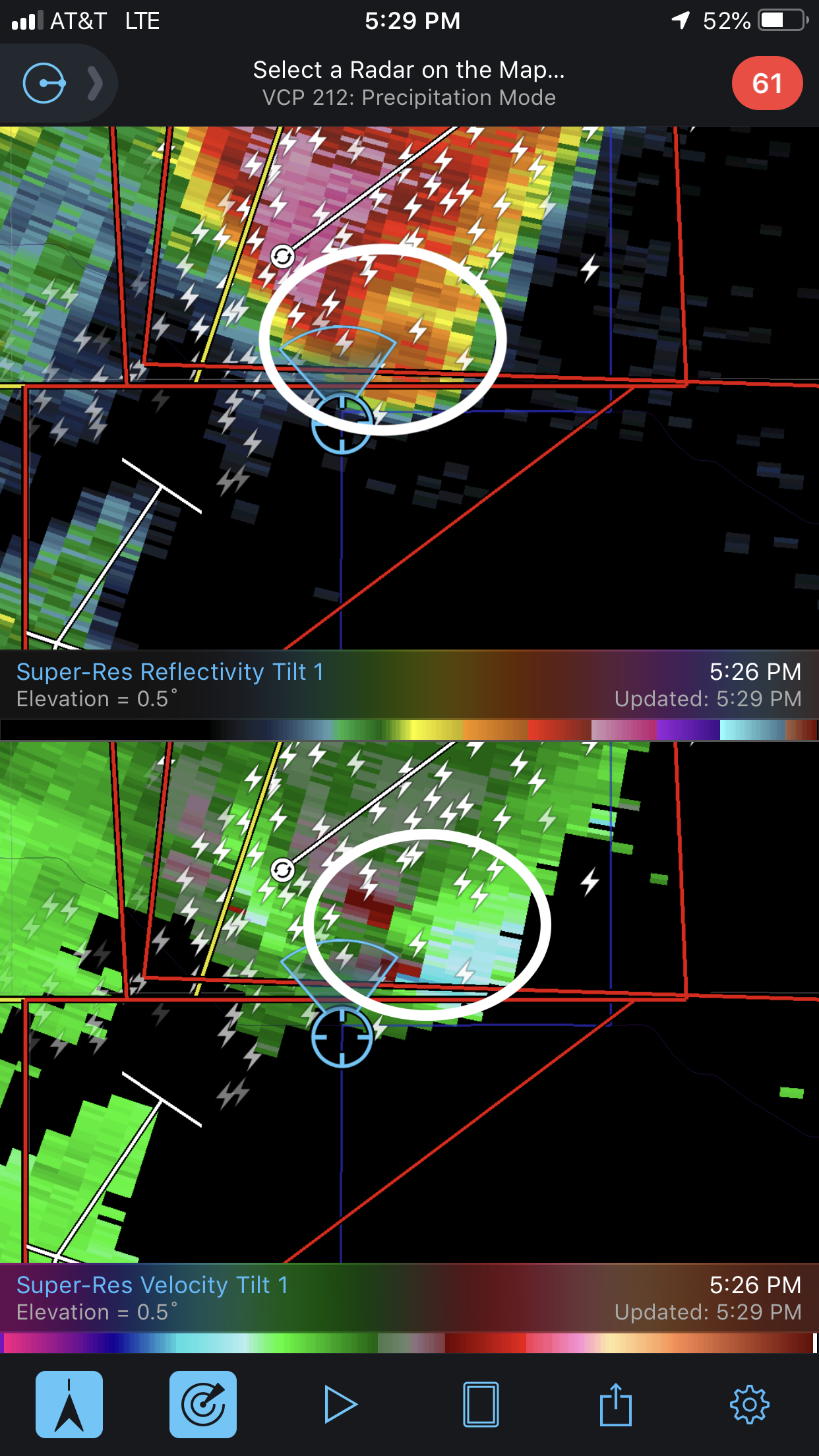
While chasing, a tornado was reported on the ground. While we were so close to it, we could not see it. The tornado had become rain-wrapped, disguising it with the rest of the storm.
We turned East on a road and notice the power lines down ahead. Multiple power lines were snapped in half from the tornado that had passed minutes prior.
We turned around due to the road closure. The hook feature on radar was now to our backs. We started driving away from the storm with hopes of getting on a new road to catch up to the storm.
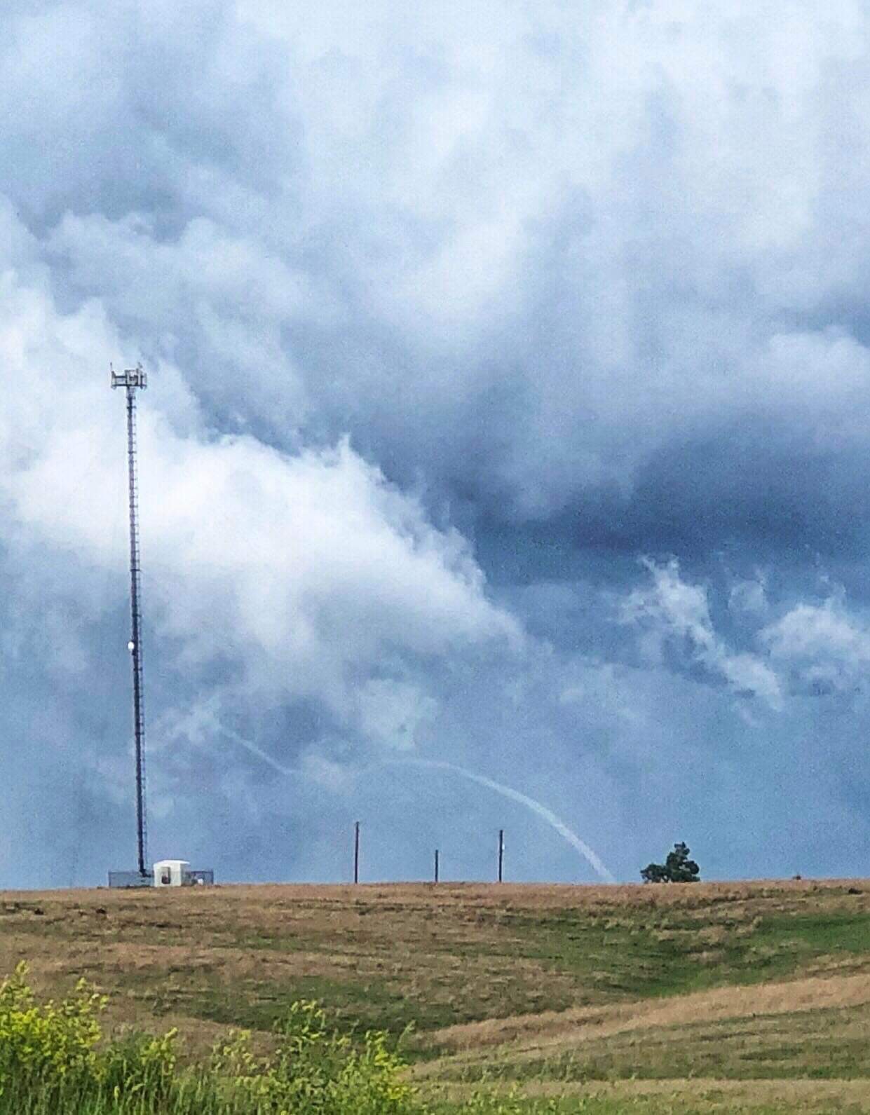
One of the students on the storm chase team, Luke Rogers, kept an eye out in the back and saw a beautiful tornado emerge from the rain. He exclaimed about the stove pipe tornado behind us and we stopped the van and all piled out.
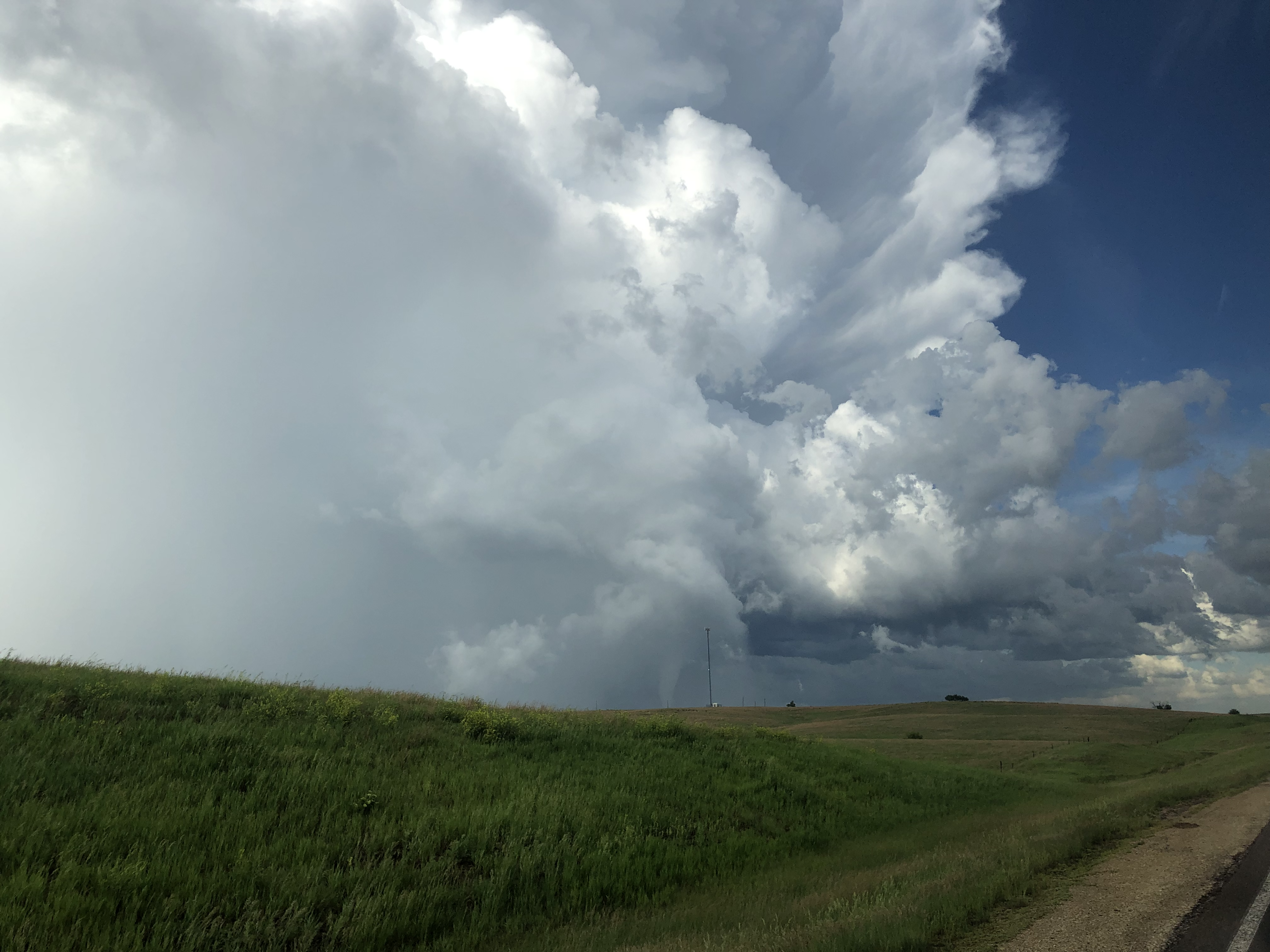
We watched the tornado for minutes and soaked it all it. This time was the moment that most of us were waiting for. It was truly a rewarding time for all of us. We saw the tornado rope out and eventually dissipate into a long elephant trunk.
We piled up back in the van to keep up with it, however, the roads made it hard to keeps eyes on it. We eventually decided to head to Salina, Kansas for the night. We had burgers at the hotel and reminisced on the success we had on this trip, especially on Day 10 of chase day.