Dry conditions look to continue….

High pressure aloft has continued to bring in very nice, but pleasant conditions across the area as high temperatures topped out in the low 80’s under mostly sunny skies. The ridge was once situated over the Ohio Valley region has now progressed further eastward into the New England Region.  Return flow has helped gradual warming across the region as temperatures have jumped a degree or two higher since Monday.

700mb heights and winds map showing the ridge just to our east over parts of Pennsylvania with a projected north-east path. Red arrows indicate return flow which explains the gradual climb in temperatures for highs since Monday.

The ridge will continue its track off the east coast as a mainly dry front sets to move through the region Thursday night. Normally with a front we would see showers and storms develop just ahead of it. Significant dry air above the lower level and precipitable water values around normal or just above will lead to relatively low chances for any development for pop up showers and storms.  We should continue to see partly cloudy conditions over the next couple of days as the weak frontal passage works through the region. Highs look to be a tad bit warmer for your Thursday with temperatures topping out in the mid 80’s across the Commonwealth. Thursday night should bring partly cloudy skies with a SLIGHT chance for an isolated shower over the area. Look for lows to be a bit cooler  as temperatures are expected to bottom out around 60 degrees.


—————-

Friday: Expect slightly cooler conditions with a high of 79 degrees. Partly cloudy skies should stick around into the evening and overnight hours. Low: 56, Light winds from the north around 5 mph.

Saturday: Expect mostly sunny conditions with a comfortable high around 76 degrees. Low: 56, Light winds from the north around 3 mph.


Posted in Uncategorized | Comments Off on Dry conditions look to continue….

Cooler, more comfortable conditions expected over the next several days…

A strong frontal boundry moved through the region this past weekend bringing showers and storms for many across the state.  As the front tracked through the region, cooler and drier air filtered across the Commonwealth bringing very comfortable conditions for many. Monday morning brought an Autumn like feel about it as lows dipped down in the upper 50’s under clear skies. Temperatures rebounded nicely as highs topped out in the mid to upper 70’s as a few fair weather cumulus clous began to build by the early afternoon hours.

A strong ridge of High pressure situated just over the Ohio Valley region will continue to build and slide eastward over the next couple of days. This will allow temperatures to gradually warm by a couple degrees each day by mid-week.

700 mb map showing ridge location and intended movement over the next couple of days.

Looking ahead for your Monday evening, expect any fair weather cumulus clouds to subside by sunset as cool, clear, and calm conditions are expected. Many could see one of the cooler nights that we’ve had in a while with temperatures expected to bottom out in the low to mid 50’s statewide.  With the dominance of the high pressure aloft, Tuesday should be identical weather wise to your Monday.  Highs are expected to be a few degrees warmer with temperatures reaching the low 80’s.  Mostly sunny skies accompanied by a light northwest wind around 5 mph should make for another great weather day across the area.

Forecast Outlook:

Tuesday night: Cooler conditions expected once again with a low of 60 degrees. Expect mostly clear skies with a light southeast wind.

Wednesday: Another nice day with mostly sunny conditions.  A few fair weather cumulus clouds expected by early afternoon. High: 85 degrees, Low: 60 degrees. Winds from the south around 5 mph.

Posted in Uncategorized | Comments Off on Cooler, more comfortable conditions expected over the next several days…

Severe Storm Risk for Friday 9/7 and Weekend Forecast

Friday has continued throughout the week to becoming more promising for a chance at severe weather for Bowling Green. The Storm Prediction Center has placed Bowling Green in a slight risk for storms for Friday. 

A surface boundary left over from a decaying MCS (Mesoscale Convective System) will be the focus for the first round of severe weather expected to move through Bowling Green in the early afternoon Friday. A line of storms is expected to move through the Bowling Green area between 1-2pm CST. The main threat with this first round of weather will be damaging winds and hail.

A second wave of severe weather is expected to move through in the later afternoon/night Friday. This wave will be associated with a larger potent low pressure system that has been evolving over the past few days to the west. A shortwave trough is expected to deepen and dig in from the east pushing along a strong cold front out ahead of it.

This system will have upper level support in the way of a potent trough axis with upper levels blasting around it in the 110 kts at 250 mb to 90 kts range around the 500 mb level. The 500 mb jet streak with peak winds around 90 kts will help provide support to a low level jet providing extra lift. A potent cold front will also provide added lift to this system as it sweeps through Friday evening/Saturday morning. In the low levels, moisture will be readily available with dew points across Kentucky in the 60’s and 70’s.  Bulk wind shear values spanning from 40 kts-60 kts will provide organization to any storms that develop. The main threat with this event will be damaging winds and large hail. Bowling line segments could develop within a greater squall line in  the event that the line is influence by a strong rear inflow jet.

After the passage of this system Saturday, a dry out is expected as the cold front moves out to the east. Due to the intense nature of this front, a major cool off is expected with almost fall like temperatures in the low to mid-70’s for highs and 50’s for lows on Saturday and Sunday.

Overlook:

Friday: Severe storms expected in rounds beginning in the early afternoon and concluding Saturday morning. High , 90. Low, 75.

Saturday: Major cool down after passage of cold front. Showers and storms continuing into the morning. High, 73. Low, 52.

Next Update: 9/8/12

Posted in Uncategorized | Comments Off on Severe Storm Risk for Friday 9/7 and Weekend Forecast

Weekend Rainfall Totals from Isaac and Forecast for 9/4-9/6.

Monday has brought us clearing from the remnants of Isaac with skies becoming partly cloudy by noon today and sunshine popping out around 2 pm. Rainfall totals over the weekend for Bowling Green ranged anywhere from 1 inch to 1.3 inches with the southern part of Warren County receiving the highest totals.

Moving onto the rest of the week, the precipitation should hold off until Wednesday. Until then, we will still be experiencing very humid conditions due to the abundance of moisture available from Isaac’s passage this weekend.  A frontal boundary will be making it’s way from the west into Kentucky overnight Wednesday bringing with it another chance at precipitation. The low pressure system associated with this front has already begun to occlude and weaken so it is expected the front will be substantially weakened when it arrives in our area Wednesday night.

This will lessen our chances for widespread precipitation as lifting with the front will be weakened as it continues to occlude. The precipitation will continue into Thursday with an eventual drying out Thursday night as the front moves to the east. The next influence should move in Friday as a more potent system looks to be in place.

Forecast At a Glance:

Tuesday Night: Partly cloudy with humid conditions. Stray showers possible in early night. Low 71 degrees.

Wednesday: Starting out dry with shower chances increasing into the night with approaching front. Partly cloudy conditions during the day. High, 90 degrees. Low, 73 degrees.

Next Update: 9/6/12


Posted in Uncategorized | Comments Off on Weekend Rainfall Totals from Isaac and Forecast for 9/4-9/6.

Tropical Depression Isaac Update

At 10 AM CDT Friday, Tropical Depression Isaac was located 25 miles northeast of Fort Smith, Arkansas. It was moving north-northwest at 11 mph. It will turn northeastward into the Ohio River Valley on Saturday as expected in previous forecasts. Here are some storm rainfall totals in inches from HPC through 7 AM CDT Friday:

Arkansas:
MONTICELLO 1.6 WNW 5.09
WHITE HALL 4.1 NNW 5.08
HAMPTON 6.8 SE 4.12
BRYANT 1.3 NW 4.03
LITTLE ROCK 2.2 N 3.13
PINE BLUFF/GRIDER FIELD 2.63
EL DORADO/GOODWIN FIELD 1.71

In addition, 2.08 inches has fallen in West Plains, Missouri. There is a light band of scattered showers currently moving through central Kentucky. Scattered showers are expected tonight, with more significant rainfall occurring Saturday through Monday. 1-3 inches of rain is likely to fall in Bowling Green over the weekend, with higher amounts to the north.  Here is the latest QPF forecast:

Posted in Uncategorized | Comments Off on Tropical Depression Isaac Update

Now Again a Tropical Storm, Isaac Continues to Produce Dangerous Storm Surges and Inland Flooding

Forecast Highlights:

1. Sunny and hot today and tomorrow. Clear tonight.

2. Models continue to depict a strengthening mid-level ridge Thursday night through Friday night over the mid-Atlantic coast extending westward into eastern Kentucky.

3. Still expecting the center of the remnants of Isaac to swing around Kentucky and move northeast.

4. Heaviest rains will fall along the Mississippi River and north of the Ohio

Hurricane Isaac has weakened slightly since making landfall and is now Tropical Storm Isaac once again. Maximum sustained winds are 70 mph. Life-threatening hazards from the storm surge and inland flooding are still occurring.

Maximum sustained winds of 70 mph

According to NBC, in Plaquemines Parish, the storm surge overtopped an 18-mile stretch of levee, sending up to 12 feet of water over the 8-foot-tall barrier. National Guardsmen and residents rescued dozens of people trapped in homes.

Water pours over a levee.

Skies are sunny in Bowling Green once again today. High pressure continues to suppress any cloud development at all. The high pressure center over Michigan is still giving us northeasterly winds. This high pressure is expected to shift to the mid-Atlantic Coast by Thursday, and it is also forecast to expand Thursday night into Friday into eastern Kentucky.

It is still August, however. Even with the northeasterly winds, we’ve warmed up to 92 this afternoon. Winds will shift from the northeast to the southeast on Thursday, and skies will remain sunny. Tonight will be another clear night, with a low of 66. Tomorrow will be hot, with a high of 95. Check out this map of wind streamlines… Hurricane Isaac is clearly visible over the Bayou.

http://hint.fm/wind/

The dewpoint is currently in the upper 50s, but we will see a return of moisture from the south by Thursday night as Isaac moves north through Louisiana. The dewpoint is forecast to reach 70 sometime Friday. There is a very slight chance for rain Thursday night. However, there is a good chance for rain Friday through Monday, until the remnants of Isaac finally move off to the east on Monday. Here is a map of expected QPF from HPC:

The heaviest rains are expected west and north of Bowling Green.

Posted in Uncategorized | Comments Off on Now Again a Tropical Storm, Isaac Continues to Produce Dangerous Storm Surges and Inland Flooding

Isaac to Affect Kentucky This Weekend

Forecast Highlights:

Today: Clearing, sunny afternoon, highs in the upper 80s

Tonight: Clear, Lows in the mid 60s

Wednesday: Sunny, high 90

This Weekend: 60% chance of rain from Tropical Storm Isaac

Hello! Classes are back in session here in Bowling Green, and that means the WKU Meteorology Blog will be updated regularly once again. Appropriately, there is a major weather event to focus on during week one. Tropical Storm Isaac continues to move northwestward toward the Gulf Coast. Isaac is still a tropical storm, albeit just below hurricane status, with an intensity of 70 mph or so. Isaac is expected to make landfall as a weak Category 1 hurricane.

Current enhanced satellite imagery shows Isaac spinning in the Gulf of Mexico as well as a boundary draped across the Commonwealth, extending from roughly Bowling Green up through the Bluegrass region. This front has been responsible for overcast conditions this morning as well as a few sprinkles. The front will slide south and clearing is expected through the afternoon. Winds are and will remain out of the north with a trough over the Northeast and high pressure centered over the Great Lakes.

The afternoon sunshine will allow Bowling Green to warm up to around 88. High pressure will expand, build in, and control the weather for now. Skies will be clear tonight, with lows in the mid 60s. Wednesday will be a sunny day with highs around 90.

As we head towards the weekend, ridging is expected to slow the progression of Isaac. The models continue to depict an area of high pressure over the eastern United States, with Isaac simply moving around the western periphery of this high pressure. The latest forecast from the National Hurricane Center has the center of Isaac moving northwestward into Louisiana, north through Arkansas, and eventually turning northeast and bringing rains to the Ohio Valley. The current QPF forecast from the Hydrologic Prediction Center shows a tight gradient over Kentucky, with the heaviest rainfall from Isaac falling in areas west and north of Kentucky (in those areas where drought has hit hardest!). However, storm totals will depend heavily on the actual track of the storm. In general, there is a good chance for rain this weekend.

Isaac is expected to make landfall as a Category 1 hurricane.

EBW

Posted in Uncategorized | Comments Off on Isaac to Affect Kentucky This Weekend

Day 13 Recap

We started off our day by leaving Borger, TX and started to head east and toward home.

Most of us fell asleep right as we made it back into the car.  There has been a competition the past two weeks to try and catch each other sleeping, well chaser Kyle Berry was the winner.  He caught six of us sleeping in the van today.

Sleepyheads

After all waking up from our nap, I was asked to decide on where to go for lunch in Clinton, Oklahoma.  After looking at some in town restaurants, I chose Jigg’s Smokehouse.  I decided to get the BBQ Beef sandwich and boy was it a sandwich.

Deliciousness

We left the smokehouse, and started on the road again.  Some of us played Apples to Apples to pass the time and some of us decided to listen to our music.  One thing that has always been a fun thing to play is the crossword game book that chaser Evan Webb brought.  Chaser Kyle Mattingly seems to know the most of these.  Jealous!

After sitting in traffic twice on our way east, we made it to our destination of Memphis, Tennessee.  We are in the home stretch and I know all of us have learned some valuable things and many things about the weather.

We have about a 4 hour drive tomorrow back to Bowling Green tomorrow.  I hope everyone has enjoyed following the trip!

Posted in Uncategorized | Comments Off on Day 13 Recap

Day 12 Recap

Day 12 of the WKU storm chase began in Raton, New Mexico, where we spent the night recovering from last night’s exhilarating hail storm. After weighing our options in the morning, the class decided to move eastward toward the Oklahoma panhandle. This would allow us to move north or south as the day wore on, depending on how convection evolved.

We ate lunch in Boise City, Oklahoma and hung out in the local park while we waited for thunderstorms to develop. After thunderstorms started to form, we moved eastward to intercept and found ourselves in the parking lot of an establishment known as Brown’s Meat Market. An alpaca, a scavenging dog, and hacky sack provided entertainment while we waited for our storm to strengthen. We also were sustained by the awesomeness of our mustaches:

Get on our level

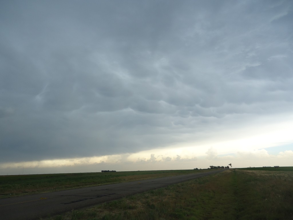
After it became clear that the storm we were watching was struggling to maintain itself, the decision was made to dive southwestward toward the westernmost storm in the line of convection. This storm displayed some persistent midlevel rotation and produced some sizable hail according to radar estimates. While not as spectacular as some of the previous supercells on the trip, it still produced some impressive lightning and mammatus clouds.

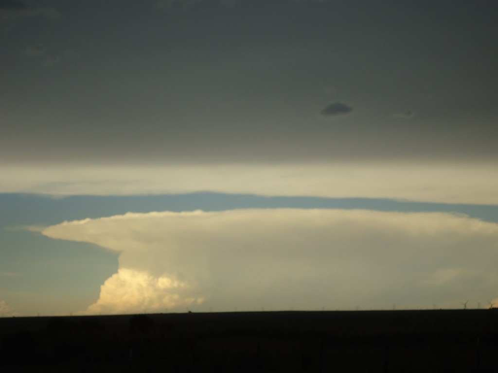
While monitoring this storm’s progress, we also were able to observe a textbook anvil and overshooting top associated with a thunderstorm near Amarillo, TX (over 70 miles to our south).

When our storm began to become disorganized, our class decided to bail and set out for our hotel in Borger, Texas. This was more than likely our last chase day, as prospects for tomorrow look dim and the day will probably be spent traveling back home. By any measure, this class has been a success and an unforgettable experience for everyone involved!

Posted in Uncategorized | Comments Off on Day 12 Recap

Day 11 Recap

  Due to the main severe risk being too far east to chase, we left Amarillo, Texas, this morning and headed west toward Raton, New Mexico, in the hopes of chasing upslope thunderstorms. On our way out of Amarillo, we visited the famous Cadillac Ranch, where ten Cadillacs are planted at an angle in the ground.

Cadillac Ranch

We stopped for lunch in Dalhart, Texas, for lunch at Taco Juan’s, where their burritos are said to be “Juan in a Million.”  Continuing west, we stopped in Clayton, New Mexico, to view and tour the Capulin Volcano National Park.  This volcano is no longer active, and its last eruption was near 60,000 years ago. Dr. Durkee drove the van up the volcano, and we then got out of the van and hiked over the rim of the cinder cone volcano.  This task proved to be more daunting than originally observed, and many of us became exhausted quickly.  However, we all made it to the bottom with no injuries or sickness!

Capulin Volcano National Park entrance

Student Chandler Santos as we scale the volcano

View from the top of the Capulin Volcano in New Mexico

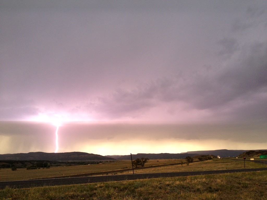
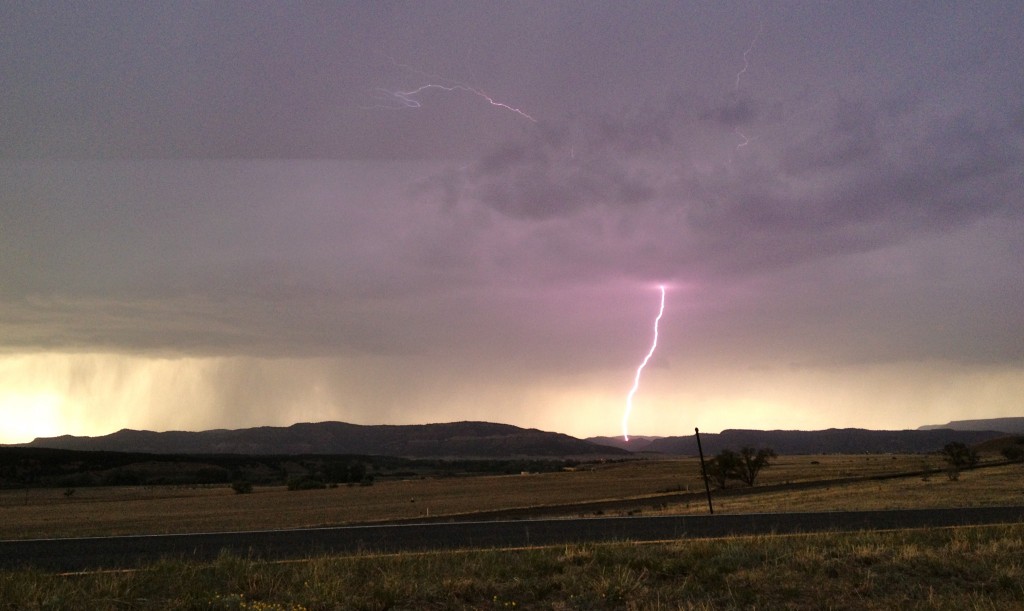
We arrived at our hotel around 4:00 (Mountain Time) this evening in Raton, New Mexico.  After a exhausting day at Capulin Volcano National Park, many of us changed clothes and freshened up.  Around 7:00 (Mountain Time) we headed toward Trinidad, Colorado, to view a storm with impressive lightning. We then headed south toward Maxwell, New Mexico, in order to intercept more promising storms. Radar indicated weak rotation associated with these southern storms.  A hail report stated that quarter inch hail covered Interstate 25 up to one inch deep.  While traveling north toward Raton, we were caught in a hail shaft, but most of the hail was dime size.  We retreated south to avoid damage to the van. When we returned north toward Raton, we were caught again by larger hail, this time quarter to ping pong size.  We again headed south toward Maxwell, New Mexico, and took cover under an overpass to observe the hail and again avoid damage to the van.

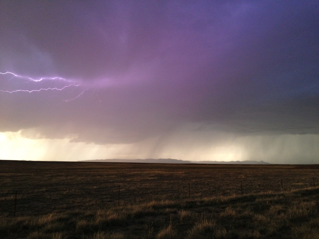
Lightning south of Raton, New Mexico

Panorama of storm south of Raton, New Mexico

Lightning south of Raton, New Mexico

Lightning near Maxwell, New Mexico

Hail in Maxwell, New Mexico

After viewing storms, we enjoyed Mexican food at Sands Restaurant in Raton, near our hotel.  Tomorrow we are meeting at 10:00 (Mountain Time) to discuss tomorrow’s chase options.

Written by Tami Gray

Posted in Uncategorized | Comments Off on Day 11 Recap