More Comfortable Days Ahead!

This Evening: Low- 65

We have warmed nicely into the upper 80’s today under clear to partly cloudy skies. More in the way of partly cloudy conditions look to move in as the night moves on, as a weak cold front gets closer to the area.

Tomorrow: High-85 Low-59

A weak cold front looks to push through the area from the northwest late tomorrow morning into early tomorrow afternoon. Due to limited moisture ahead of the front, only isolated to scattered showers and storms look likely with its passage in the area. No strong to severe weather is anticipated with this activity.

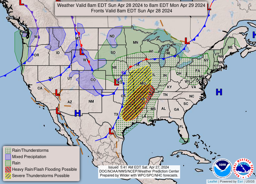
Sunday: High-76 Low-53

Surface high pressure looks to move into the region behind Saturday’s weak cold front for our Sunday. This looks to result in very comfortable temperatures and dewpoints accompanied with sunny skies. Our Sunday will definitely be the pick day of the weekend!
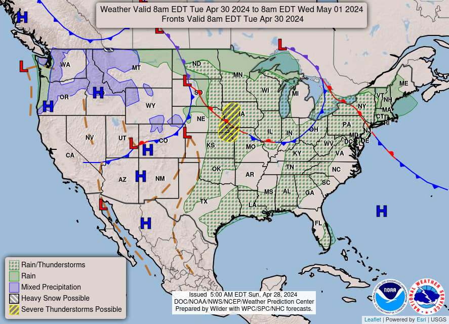
Weekly Outlook:

Tonight
Mostly clear, with a low around 64. South wind around 5 mph becoming calm in the evening.
Saturday
Scattered showers and thunderstorms, mainly after 1pm. Partly sunny, with a high near 85. South wind 5 to 9 mph becoming northwest in the afternoon. Chance of precipitation is 30%.
Saturday Night
Isolated showers and thunderstorms before 4am. Mostly cloudy, with a low around 60. North wind 5 to 8 mph. Chance of precipitation is 20%.
Sunday
Mostly sunny, with a high near 76. Northeast wind 5 to 8 mph.
Sunday Night
Partly cloudy, with a low around 53.
Monday
Mostly sunny, with a high near 78.
Monday Night
Mostly clear, with a low around 51.
Tuesday
Sunny, with a high near 81.
Tuesday Night
Mostly clear, with a low around 53.
Wednesday
Sunny, with a high near 81.
Wednesday Night
Partly cloudy, with a low around 57.
Thursday
Mostly sunny, with a high near 83.


This entry was posted in Kentucky Weather. Bookmark the permalink.