Field Methods– Day 13

The group started out the day in Norfolk, NE with some breakfast. The groups target was Des Moines, IA with a 100 percent chance of seeing tornadoes. The group went to the IMAX Film Called “Tornado Alley” by Sean Casey at the Science Center of Iowa. This film discusses the use of the Tornado Intercept Vehicle seen on the Discovery Channels show Storm Chasers. This vehicle was constructed to take a direct impact from a tornado. This IMAX film had some great video of storms seen during multiple seasons of storm chasing. This film also depicted the Vortex 2 project. This project is the largest tornado research project ever done. The group got to witness how difficult it is to manage a project of its size and some of the trying times the TIV went through to obtain the shot of a tornado coming toward and striking their vehicle. This film also taught the public briefly about how tornadoes are formed. The best part of the movie was getting to see time lapse video of multiple storms rolling across the plains. The class also saw shelf clouds, mammatus clouds, funnel clouds, wall clouds, and tornadoes. This was a great way for the group to wrap up a successful trip on the plains. The group left Hanibal, MO at 8 AM headed home.

Photos from the day:

IMAX ticket

Group photo by the "Tornado Alley" poster


Posted in Kentucky Weather | Comments Off on Field Methods– Day 13

Field Methods– Day 11

By: Nathaniel Shearer

With the memory of yesterday’s strong CIN preventing thunderstorms fresh on our mind, the group was getting anxious to view storms and especially tornadoes.  After a discussion on the current atmospheric setup, a low pressure system ejecting from the four corners would continue to deepen as well as begin to push a warm front due north and a dry line to the northeast.  Lifting along the dry line was sure to develop storms, but we strongly felt that these storms would not be tornadic due to other parameters loosely coming together in that region.  Another possible target involved shifting our attention to the southeast area of Nebraska stretching to northeast Kansas.  This target area provided the most promising signs of tornadoes developing, but once again CIN was against us.  CIN is a measure of Convective Inhibition (also known as a cap) which detects how much energy a parcel needs to overcome a warm layer in the mid-levels of the atmosphere.  With strong agreement that the best chance to see tornadoes would be in the Kansas/Nebraska area, concern quickly turned to the CIN in place and if it would erode from the southwest to the northeast into the target area as models had been suggesting it would.

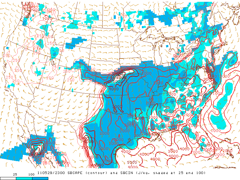
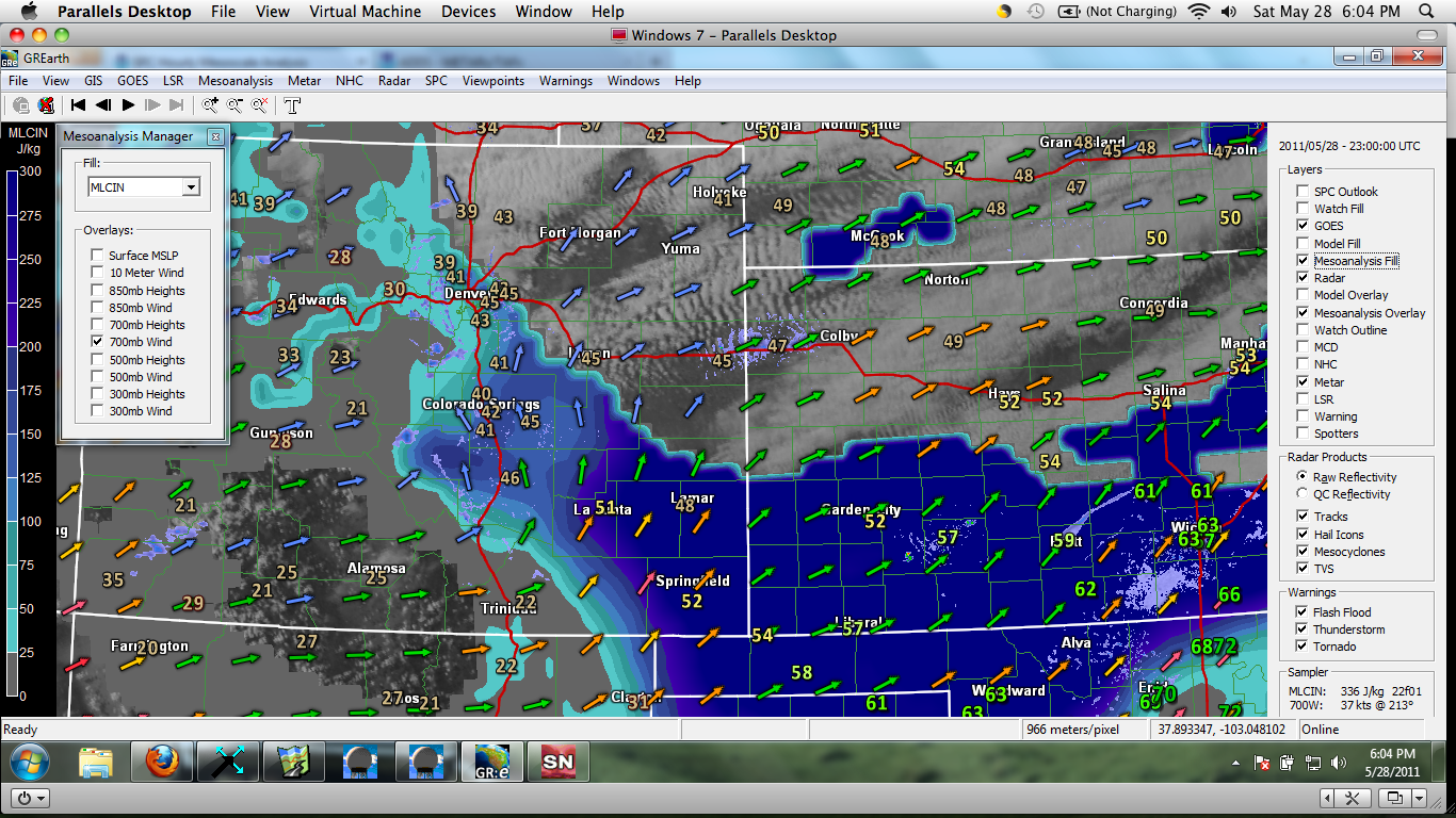
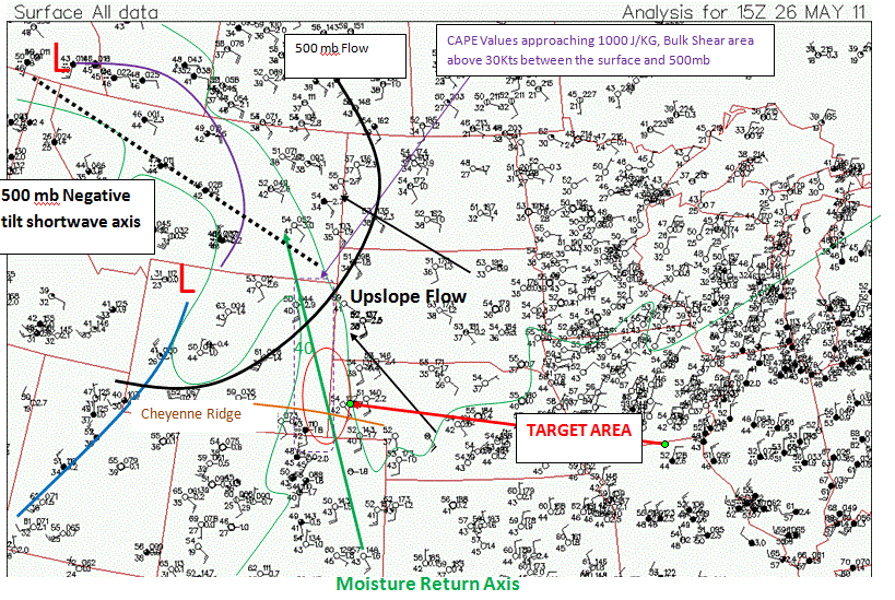
Measure of CAPE outlined in red and CIN shaded in blue. Target area predicts a hole in the CAP at 6:00pm

The Nebraska/Kansas target also housed the best instability for parcels to tap into, also known as CAPE.  Convective Available Potential Energy measure how much energy a parcel will have to rise before an air parcel becomes the same temperature as its surroundings; preventing further lift.  Composite reflectivity prediction by the High Resolution Rapid Refresh weather model depicted no storms in the state of Kansas, so it was not handling the current atmospheric setup well.  Tough calls had to be made.  We could either remain in central Kansas and see fairly guaranteed storms with little tornadic potential, or head to Nebraska/Kansas border, hope storms fire in forecasted weakening of the cap, then watch storms become potentially tornadic.  The reoccurring motto for the day was simple; go big or go home.  And with time running out on our quest for a beautiful tornado, the choice was simple.  We packed out bags and left from Colby KS to our target area of Beatrice NE.

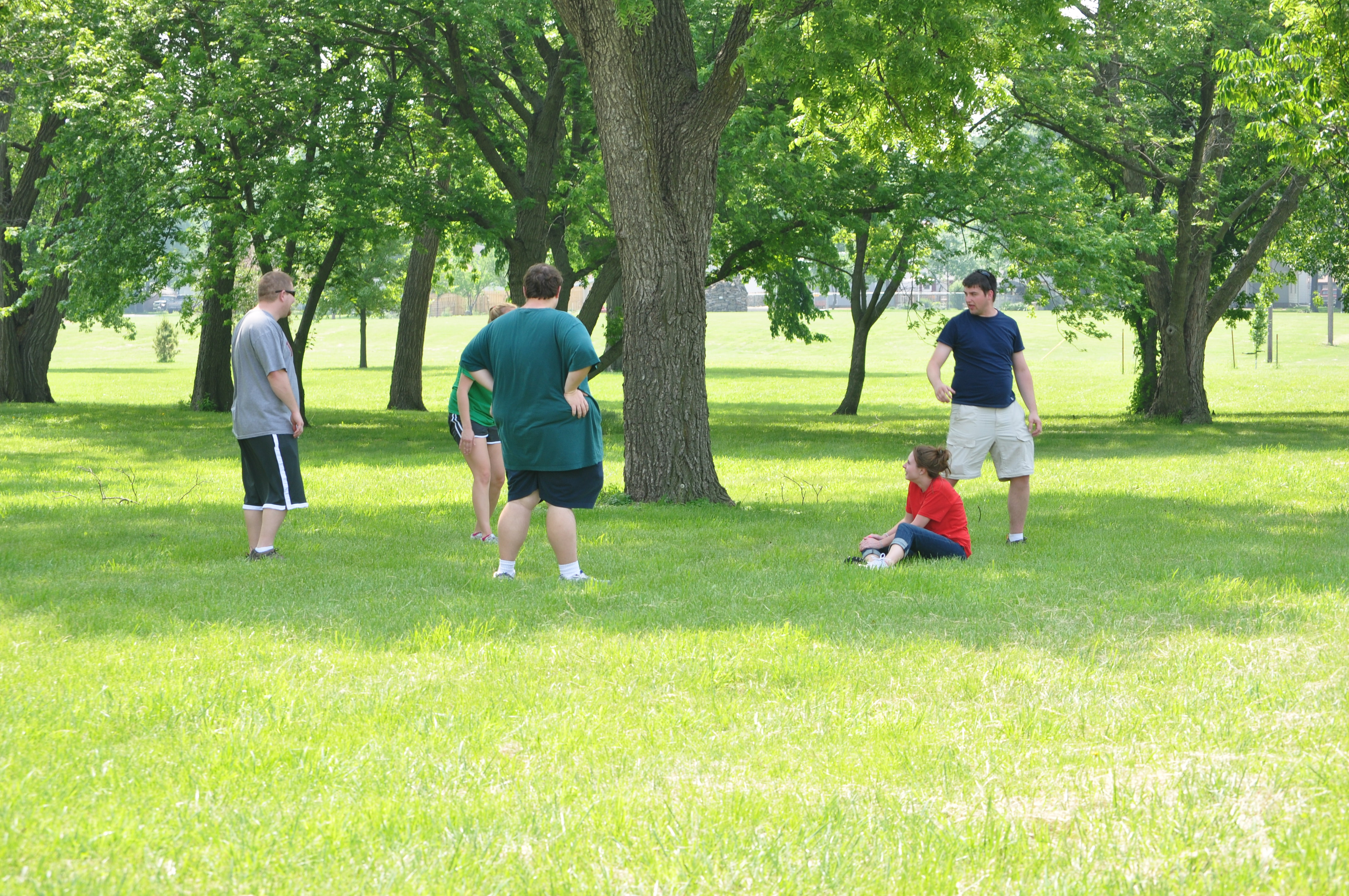
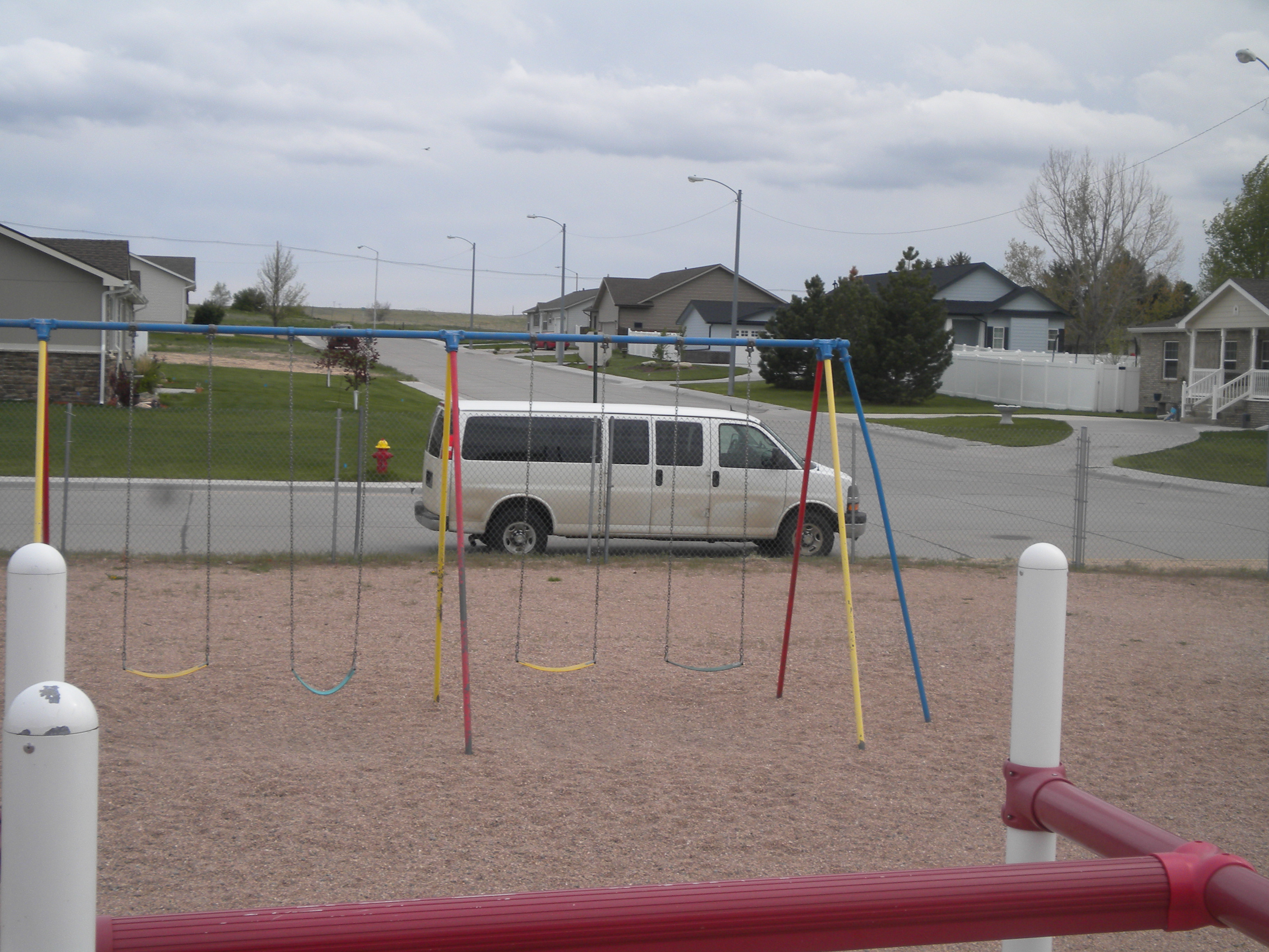
Once we arrived in Beatrice we enjoyed lunch and passed time at a local park waiting for the cap to erode.

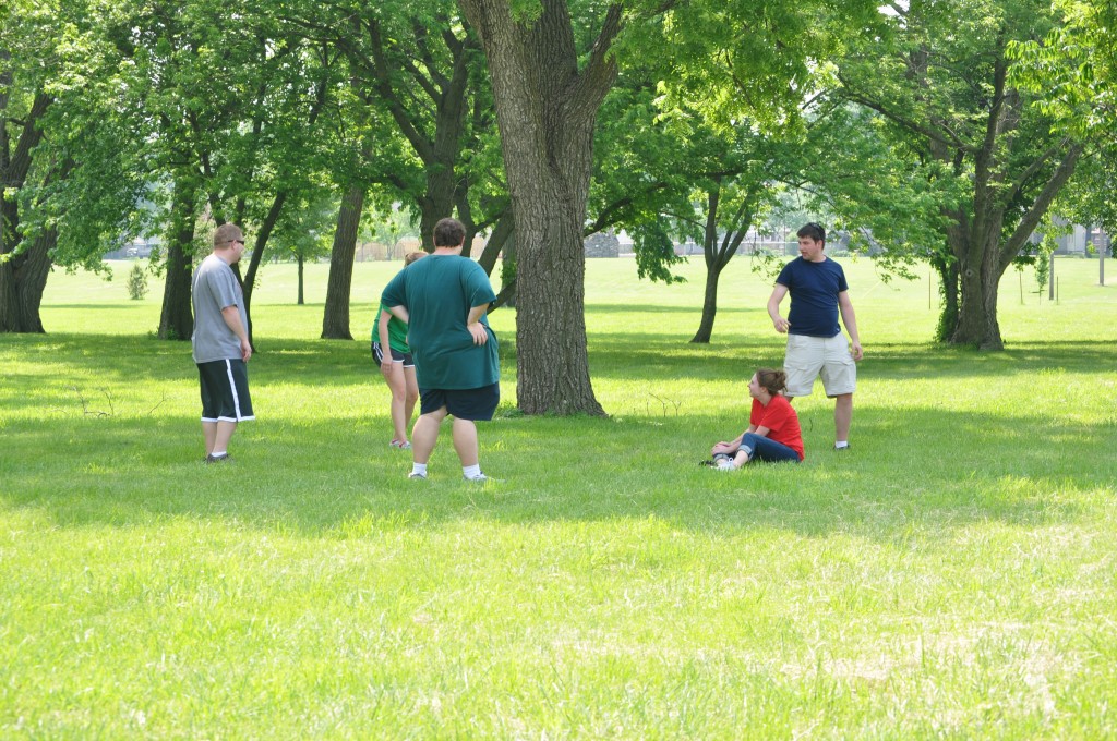
Group resting in the shade. It was greatly needed since temperatures were in the low 80's with dewpoints in the low 70's!

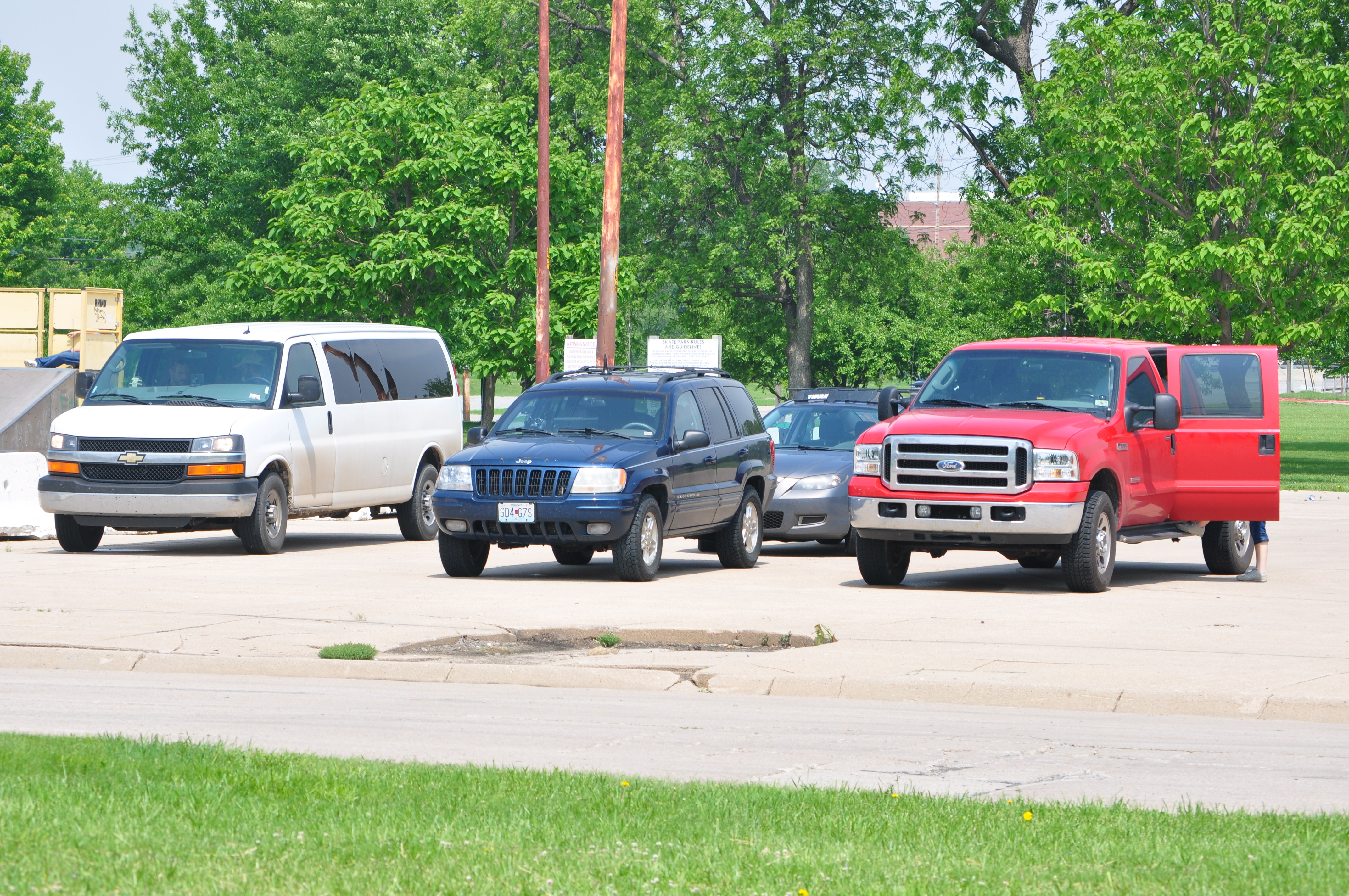
Turns out we wern't the only chasers anxious to see storms around Beatrice.

Waiting for storms to initiate can be cumbersome, so we made a few stops around town before storms finally began to fire in the region of the weakening CIN at 6:15.  With continued strengthening of the cell that developed just north of Huskerville Nebraska as well as strong shear/helicity in the region, the Storm Prediction Center accordingly released a tornado watch for our region.  It seemed everything was coming together.

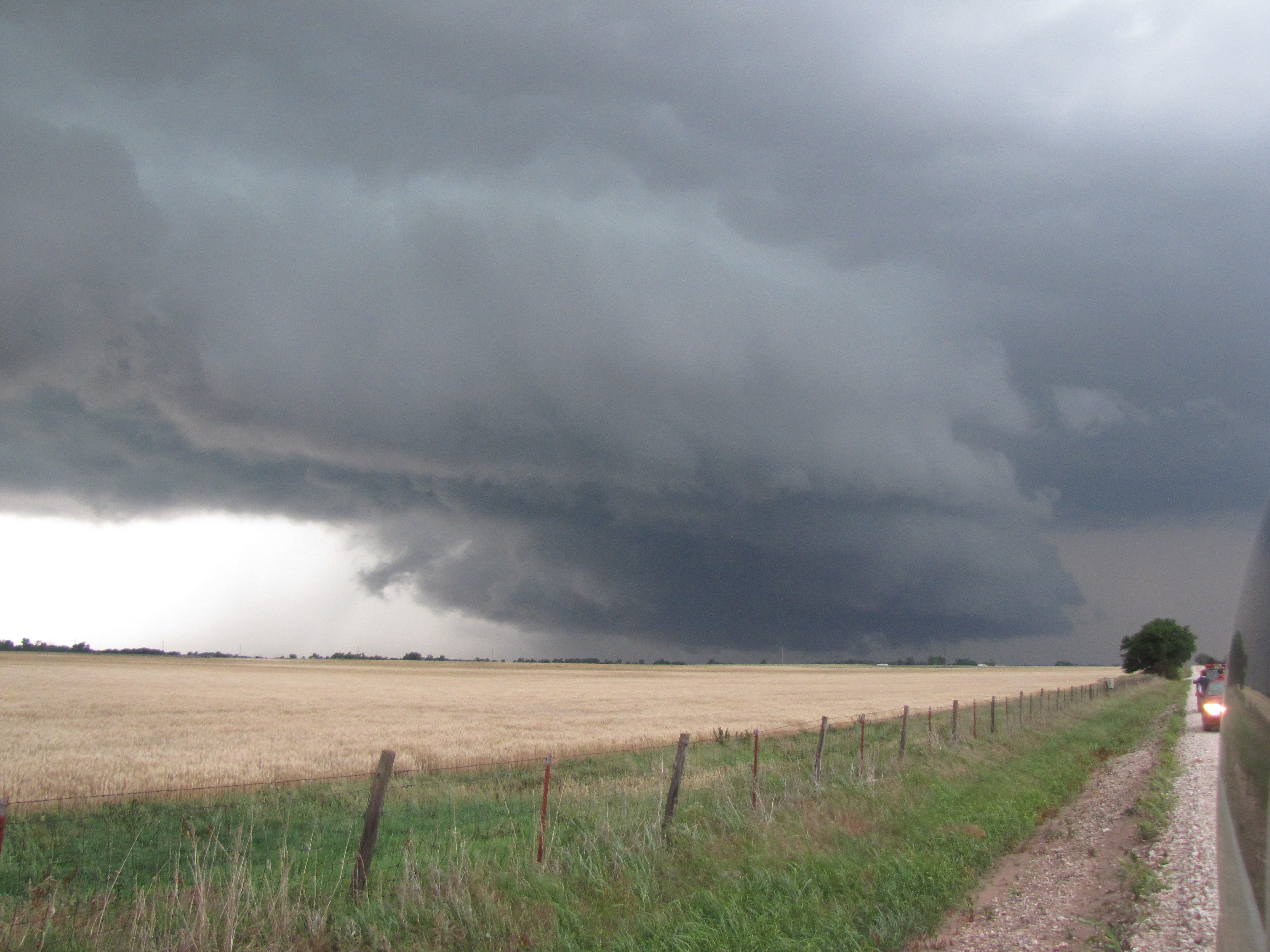
We continued to watch the cell slowly move to the northeast.  First view of it showed an increasingly impressive anvil, but an updraft tower that was quite smaller than we’d like to see.

Towering cumulonimbus
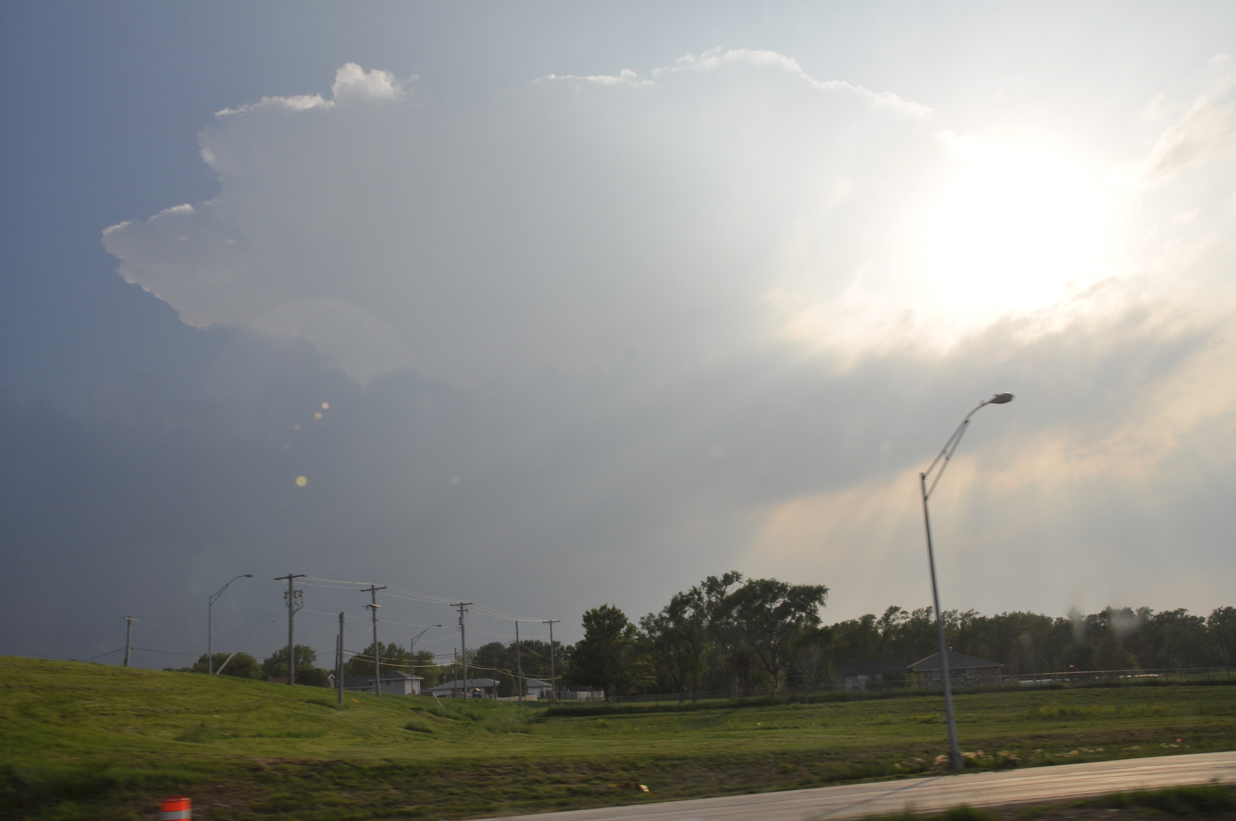
It wasn’t more than an hour before excitement turned into disappointment.  We believe that the updraft tower was too narrow to sustain itself in the highly sheared environment.  Shear refers to a changing in wind with height, and because shear was so strong around the weak updraft it was essentially twisted apart.

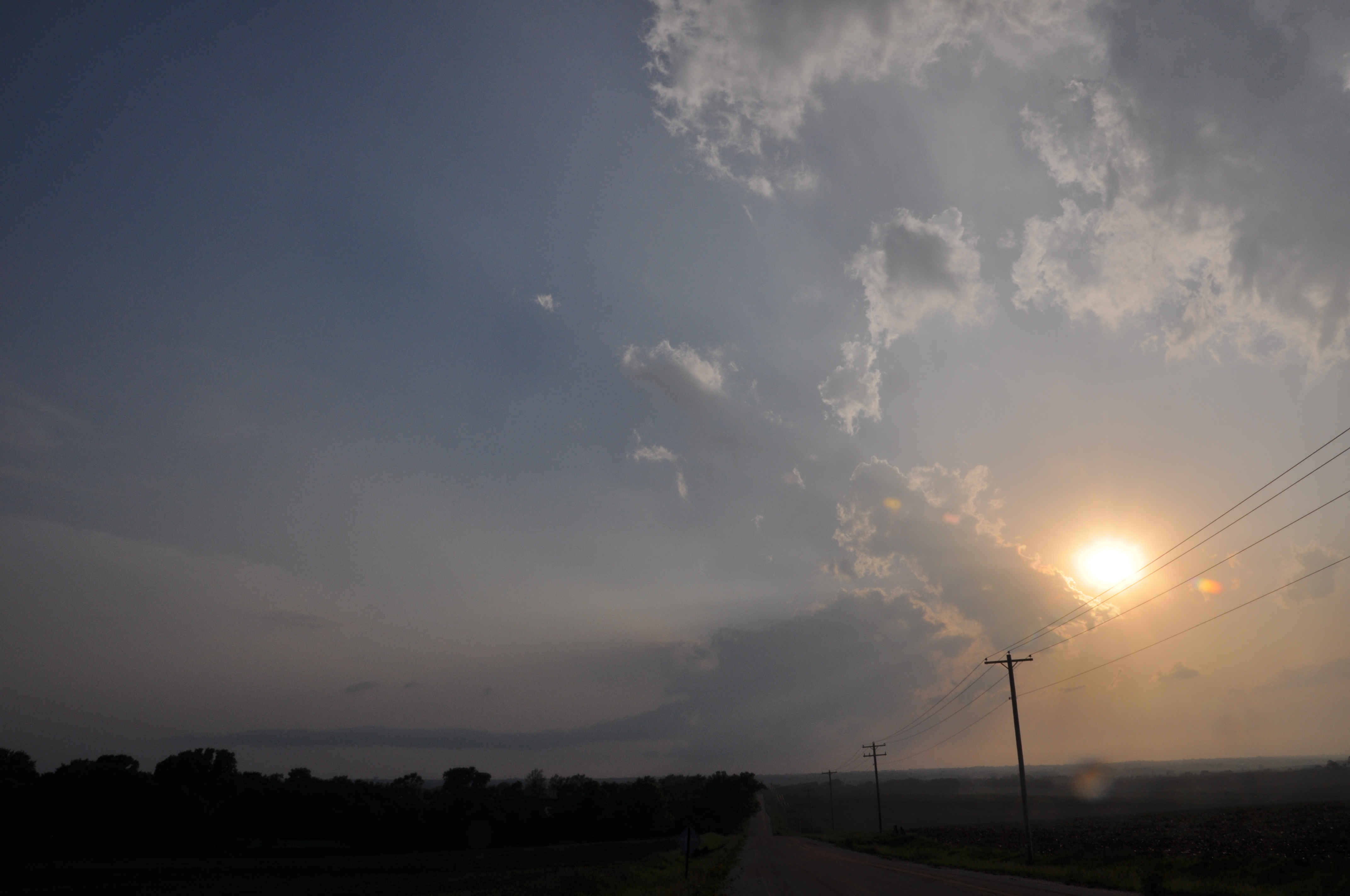
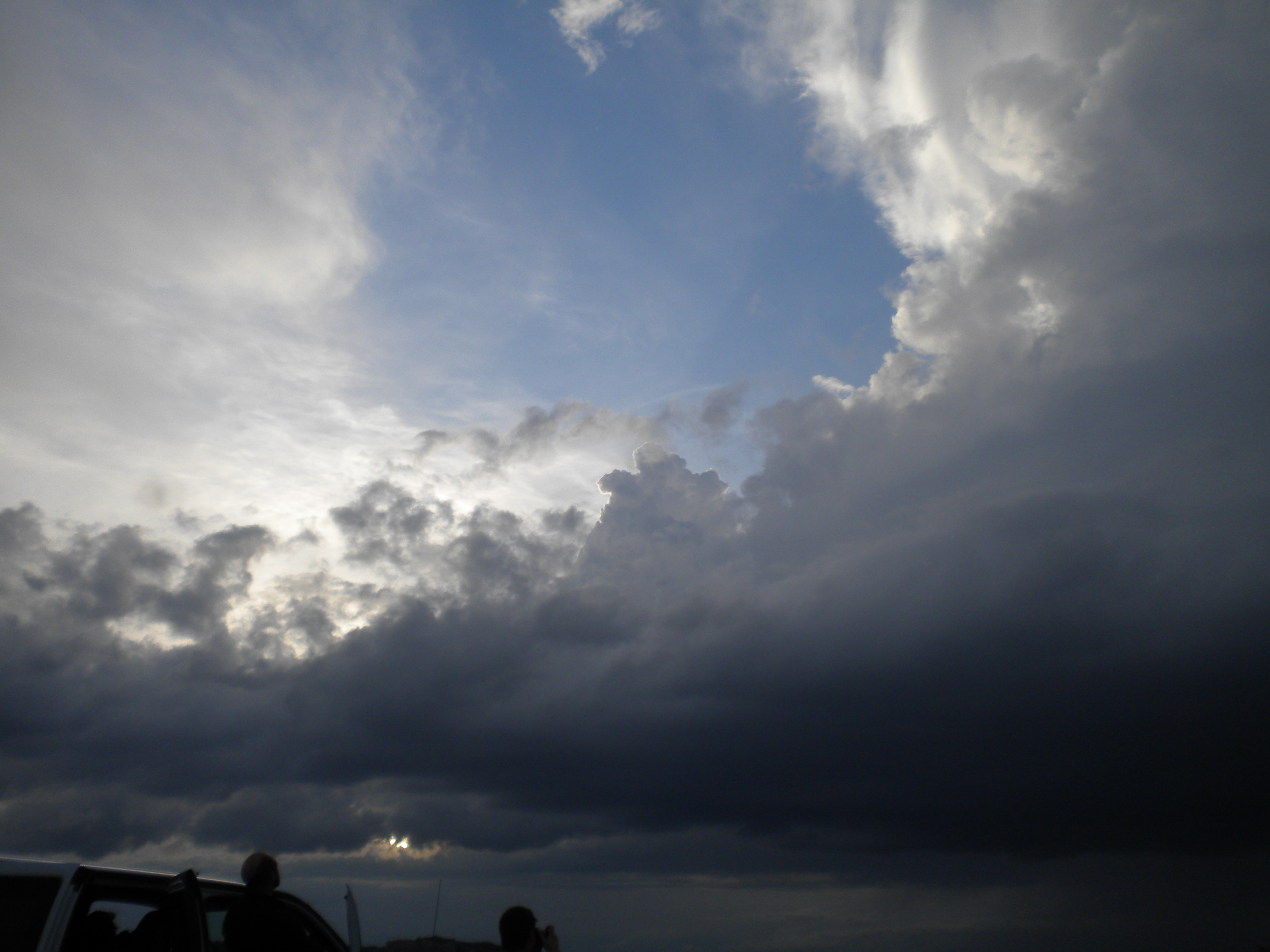
View of dying thunderstorm with the base of the storm still intact.

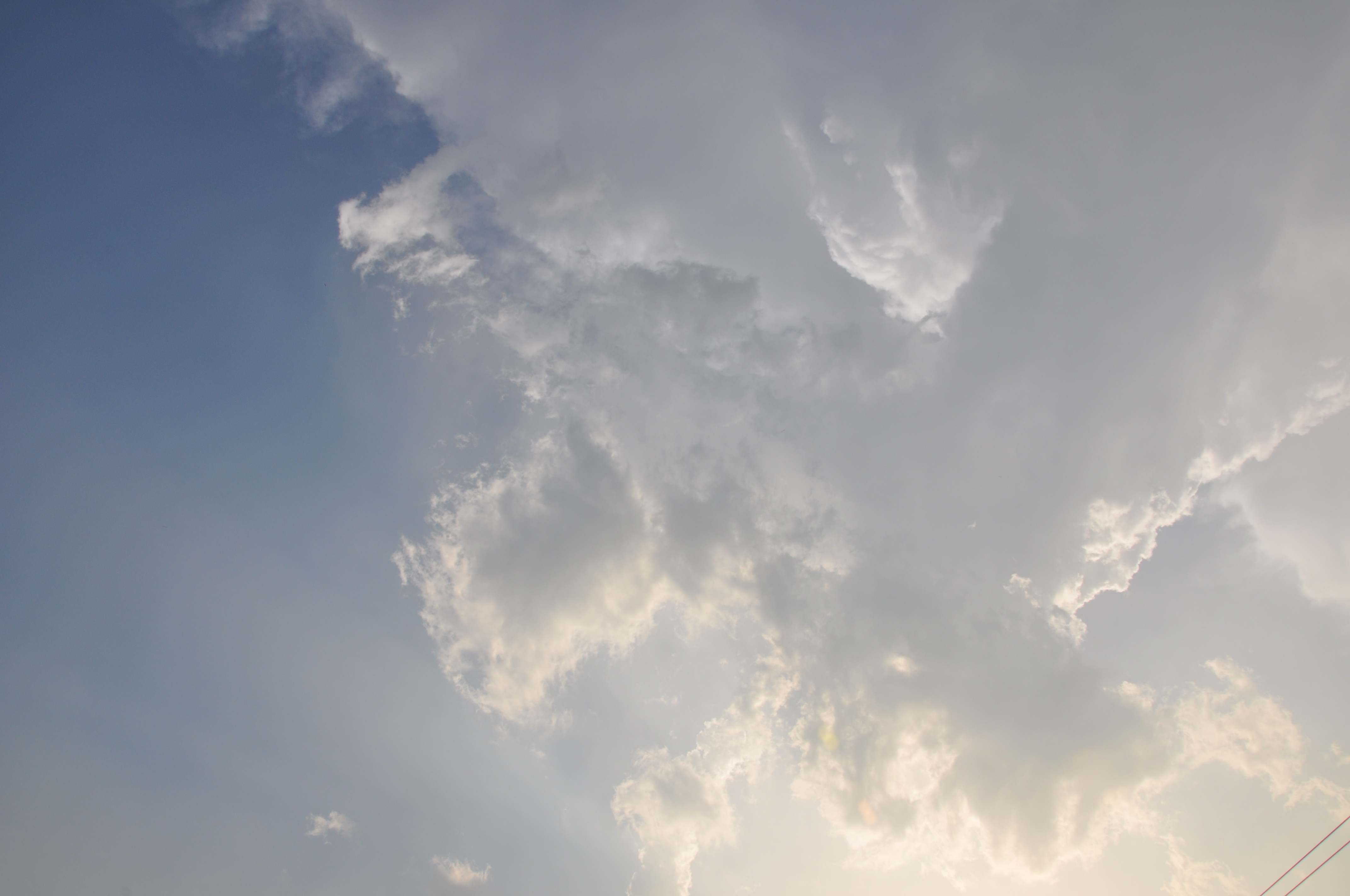
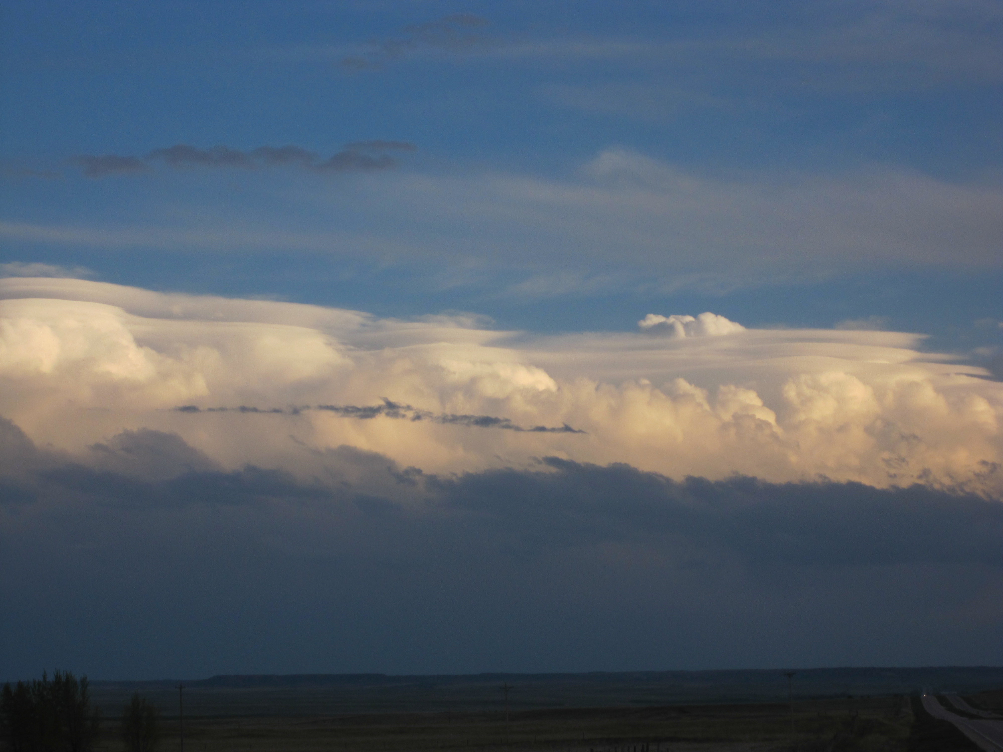
View of updraft tower twisted apart. The tilting of the updraft tower is visual confirmation of shear in the area. Anvil of thunderstorm is still present.

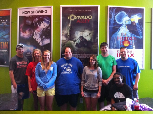
After abandoning the dissipating storm we headed to the University of Nebraska in Lincoln; home of the Huskees, to view their campus on the way to our hotel in Carter Lake Iowa.

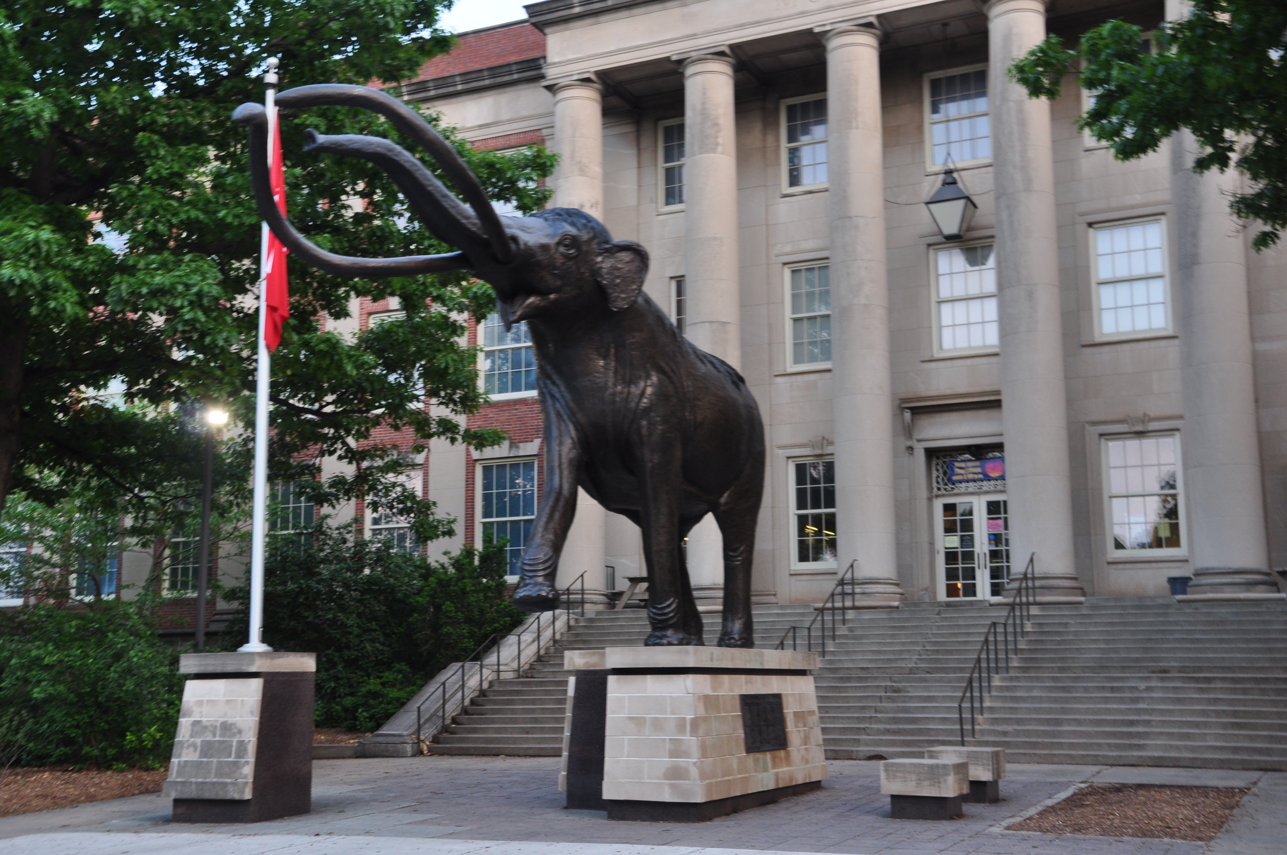
Picture from University of Nebraska campus

Always keep your eyes peeled when storm chasing.  It’s not always about the tornadoes.  While driving down the road passing time waiting for thunderstorms to initiate, a horseshoe vortex was noticed outside the driver side windows.

These vortexes are believed to develop when low level horizontal shear is lifted by thermals rising in the atmosphere bending the circulation into a horseshoe shape.  It’s not often they’re seen because of the environment they form in as well as the short longevity of their appearance.

Posted in Kentucky Weather | Comments Off on Field Methods– Day 11

Field Methods–Day 10

Our group woke up in Limon, CO with hopes of a chase day in southeastern Colorado. The outlook in that area was meager with a dominating cap (CIN) over the area preventing any convection from taking place. All other parameters, such as instability and shear were descent enough. Also the topography plays a key factor in storm development in this area due to lee cyclogenesis from the mountains. This is why we chose a target in the vicinity of Limon.  However, expectations for a storm were very low because the 700mb temperatures were at 14° C and temperatures around 17° C were advecting into the area. Temperatures of this range at the 700mb level are indicative of a very strong cap that will more than likely not be weakened enough for storm initiation. Despite the low chances of a storm, we decided to hang out in Limon long enough to see if just maybe the cap would erode away by late afternoon.

In the mean time we had a long lunch at a local restaurant called Oscar’s Bar and Grill. Then we went to a park in the area to play football. By 4:15 p.m. mountain time, the CIN was still very strong and no clouds were forming in the southeastern portion of Colorado. At this point, we decided to drive to Colby, KS in order to be in a better position for today, Sunday. No storms ever formed in southeastern Colorado area after we left.

In Colby we went to dinner at a local restaurant called Twister’s Bar and Grill. There we watched an 80’s hairband play music. They actually called all ten of us up onto the stage to sing with them! Unfortunately, none of us knew the words to the song.

This image captured from GR Earth at 5 pm shows the 700mb winds along with CIN values of -200J/kg or more indicating a very strong cap.

Photo By: Lindsay Rice

Posted By: Olivia Payne

Posted in Kentucky Weather | Comments Off on Field Methods–Day 10

Field Methods–Day 9

Mother nature was not allowing us to pursue our goal of catching stomrs.  The atmosphere was in the process of developing another system to eject out of the four corners region for this weekend.

So the group decided to take a day to go sight seeing.  We stayed the night in Alliance, NE where a unique sight was located, that place was Carhenge. A bit redneck and pointless but nonetheless a must see.  Our target for Saturday was situating us in east central Colorado, so we decided to go to the Rocky Mountain National Park.  On the way to the national park, we drove through Estes Park, CO where the Stanley Hotel is located.  Since most of the students and professors have seen the famous movie ‘The Shining’ starring Jack Nicholas in a thriller about a haunted hotel, we had to walk through and get a group photo.

Photo By: Dr. Joshua Durkee

Photo By: Dr. Joshua Durkee

Next, we continued on to the Rocky Mountain National Park where we saw an assortment of wildlife, Chipmunks to Elk, and beautiful scenery.  The group got a picture situated 10,000 feet above sea level, with the beautiful snow capped Rockies in the background.  Dr. Durkee also got extremely  close pictures of a chipmunk that was not afraid of us!

Photo By: Dr. Joshua Durkee

Photo By: Dr. Joshua Durkee

Tomorrow the class looks to be heading back towards the plains and out of Colorado, but since models are not in agreement, we are unsure of our exact target. Anywhere along I-80 looks good tomorrow. However, tomorrow is just a setup for the day after which looks even better. After a day of relaxing and sight seeing, I know for sure all of us are more than excited to get back to chasing storms.

Written By: Lee Campbell


Posted in Kentucky Weather | Comments Off on Field Methods–Day 9

Field Methods-Day 8 Recap

Cheyenne turned out to be a good pick, yet the cap that was literally putting a lid on convection was literally to much to overcome. We ended up seeing a couple of cells that popped up on the Wyoming/Nebraska Border. We pursued the cell to our north which first showed up at about 0030Z (730pm central). It turned out to be a fairly photogenic storm even though it did not amount to anything.

We also got some awesome pictures of some pileus clouds, which was definitely more interesting than seeing in a text book.

While we were waiting for the cap to break, we parked the van by a local playground for some entertainment. The most popular game played was football pig. Which has the same rules as HORSE, except played with a football and the goal is what you decide it to be (a bench, through a tire, etc.) Sometimes however, you just have to hit the swing set when you’ve been trapped in a van for eight days.

Tomorrow looks to be a down day as we look to stay the night tonight Alliance, NE.

Photos by Kyle Berry and Lindsay Rice

Posted in Kentucky Weather | Comments Off on Field Methods-Day 8 Recap

Field Methods-Day 8

After waking up in Scottsbluff, we assessed the latest weather data and today’s target looks very unique with respect to targets that we have previously picked. Today looks to be a very marginal day, as it is not a classic low pressure setup that we have encountered so far through this trip.

15Z Surface Analysis


Currently a very negatively tilted shortwave trough axis extends NW to SE across the upper rocky mountains. In response, upslope flow is currently taking place at the surface along the Front Range from Colorado to Wyoming. A moisture and instability axis is currently nosing in along the Front Range as well. Upslope, backed winds should raise dew points into the 50’s and cape values to around 1000 j/kg. Although these are very modest, the higher elevations and terrain features require less instability for convective initiation.
Our target for this morning is Cheyenne, Wyoming. This is on the southern fringe of our target area, due to the fact that the Cheyenne ridge acts as an area of increased topographic lift. We chose this area this morning due to the fact that one of the concerns for today is that all the parameters this morning are very marginal, yet there exists a strong capping inversion over the area. Hopefully the orographic lifting effects of the terrain give us a chance to chase today. For the mean time, since we are so close to our target, we will most likely take in some sights. A recap will come late tonight, hope to bring you some good pictures…..

Posted in Kentucky Weather | Comments Off on Field Methods-Day 8

Day 7 traveling across the plains

Wednesday the system we were tracking Tuesday had moved east through the mid south and Ohio valley. This brought cooler and more stable air to the plains which is not favorable for any thunderstorms. However that morning we identified the potential for an area of elevational lift over the front range Thursday. This coupled with some marginal instability, shear and moisture may be enough to find the storms today. The main target today (Thursday) will be over northwest Nebraska, eastern Wyoming and far western South Dakota. In order to be in position to reach the target, Wednesday was a travel day to Scottsbluff, NE. The biggest site along the way was the world’s largest ball of twine. Thanks to Lee Campbell for the photos below.

The long travel day also featured lunch at a regional restaurant called Runza which was a little hard on some stomachs but going back to Subway should help out the suffering. The remainder of our time out here will likely feature more days that aren’t as clear cut for severe weather unlike in the past week but this may end up working to our favor. Also looking ahead we have several travel options looking out a few days.

MWG

Posted in Kentucky Weather | Comments Off on Day 7 traveling across the plains

Field Methods–Day 6

Flash flood in Great Bend, KS

Today we left Wichita, KS towards our target a little farther west.  We traveled to Wellington, KS and waited for initiation.  The group agreed to stay around the Wichita area because we were in great position.  Many parameters were coming together, such as the amount of CAPE and helicity values.  We wanted to stay close to the surface low that was positioned in the panhandle of Oklahoma.  The dryline was positioned in that same area.  A few problems the group recognized were cloud cover and the track of the low.  The models were having problems with initiation time and the 500mb winds were backing (for convective initiation we want the winds at 500 mb to be veering).  Later, when we reflected on the day, we realized this was one of the major problems of the day.

We began heading west from Wichita and remained in the surrounding area for the most of the afternoon.  We drove through a few small towns multiple times, Great Bend, Lyons, etc. chasing the supercells that initiated today.  Throughout the day, many tornado reports popped up around the area we were chasing in.  When we drove through Great Bend, we were just south of the storm, and experienced a flash flood throughout most of the town.  In some areas, water was up to some car bumpers.  It was flowing through the streets and cars were moving slowly through the town.  Next, we entered Ellinwood, KS, where the precipitation began to pick up.  Our clear view of the supercell had now become rain wrapped and our visibility was greatly reduced.  After we drove through a heavy precipitation area and a small amount of hail, a tornado was reported with damage to a few homes behind where we had driven through.  We were not able to see anything because of the amount of precipitation. 

Although we did not see any of the reported tornados around our area, we saw some great supercell structure and a few funnel clouds with decent rotation.

We ended the day taking photos of a large shelf cloud and lightning from the supercell that we had out-drove. 

By: Lindsay Rice

Posted in Kentucky Weather | Comments Off on Field Methods–Day 6

Field Methods Class – Day 5 recap

The group started out the day in Bartlesville,OK with everyone focusing their attention to the west. One of the main features we were looking at was a 700MB shortwave that was moving out of the four corners region. This would play a important roll in enhancing the lift over the area. Once on the road the decision was made to goto Tonkawa, OK to further access the situation. Most of the other parameters were coming together with CAPE in the 3000 to 4000 J/kg and bulk shear in the 30 to 40 kt range. Just outside of Tonkawa we took note of a cell that began to rapidly rise. We started to make a move on this cell, but noticed it was not looking positive on radar. So we began to make a play on the storms to the south and west of our location. When we made it on these storms we were able to see a wall cloud, but we needed to take cover under a over hang in order protect ourselves from hail. Once clear we tried to make a play on the storm, but it also became to difficult to see.  The road network was also difficult to navigate.  We made a decision to move south to a more promising storm.


Large wall cloud Near Kingfisher, OK

After moving south we were able to intercept a storm just west of Kingfisher, OK. The storm produced a large wall cloud and at one point produced a brief funnel (wall cloud pictured above). The group then moved east to try and get out ahead of the storm. The clear slot began to close in and we had to go east and south quickly to avoid the large hail. The hail was 3.5 inches at times in the main core with quarter size hail hitting the group. Once we were able to get south and east visibility was poor due to rain. The storm was still wrapping tightly, but we just ran out of daylight. We also did not want to go any farther south due to staying in Wichita. The rotation on several of the storms was impressive and the group did see multiple wall clouds and one funnel cloud.  This made for a successful day even without tornadoes.  Today looks to be more promising.

Post by: Dustin Jordan

Posted in Kentucky Weather | Comments Off on Field Methods Class – Day 5 recap

Field Methods – Day 4 Recap

Posted by: Kate Wilson

After yesterday’s incredibly photogenic super cell thunderstorms, expectations were high. The parameters for today were also more favorable than the previous day. One surface low sat over eastern South Dakota, another over central Kansas. Warm, moist air was being drawn into the western Mississippi River valley, allowing surface dewpoints to reach upwards of 70 degrees. Instability was high, with CAPE values estimated to hit 500 J/kg by the afternoon across the western Mississippi River valley, alluding to a promising afternoon. With sufficient wind sheer and this high instability, a target could then be deliberated. Many students, including myself, considered Iowa as a potential target. However, this presented the issue of travel and distance, and it was decided that Kansas would be a wiser decision as it was closer in proximity and put us in better position for tomorrow.

Early in the afternoon, cells began to fire in the Coffeyville, KS area. It wasn’t long until we were in pursuit of one that had been severe thunderstorm warned within 20 minutes of initiation. We watched this cell develop and mature for several hours, which produced many wall clouds and funnels.  As we were observing these features, a strong rear flank downdraft (RFD) moved through.  It was this warm RFD to the east of our location that allowed an area of circulation to tighten enough to produce a tornado.  This was indicated on radar as a defined hook, and in a later scan showed a debris ball.  This debris ball was evidence of a tornado capable of extensive damage.  Later we discovered that these were this images of the large, damaging multi-vortex tornado that all but demolished the town of Joplin, Missouri. We abandoned this cell 10 miles from Joplin because there was no way to intercept it without going through a precipitation core containing large hail around 1.75 inches in diameter.  We were disappointed to learn that a tornado was so close but out of our reach.  However, the group was later relieved to have been out of the path of such a powerful tornado.

It wasn’t long until we had another complex of supercell thunderstorms in our sight. This lead us into Grove, Oklahoma, where we got trapped trying to avoid swaths of hail that kept forming on the tail-end of the cell. This caused us to take a detour across Cherokee Lake, where we saw twin waterspouts. On the other side of the lake we just came from, a stovepipe tornado was reported. Also, up the road a rain-wrapped cone was reported. Within one cell, four separate areas of rotation were determined, resulting in some tricky navigation for Dr. Durkee. By nightfall, the storm was still indicating areas of rotation and we pulled over to observe these features with frequent lightning illuminating the landscape. When this storm failed to produce a visible tornado, we decided to call it a day, but not after battling flash flooding and hail to reach our destination of Bartlesville, OK. Tomorrow appears even more promising, and the chase continues.

Posted in Kentucky Weather | Comments Off on Field Methods – Day 4 Recap