The extremely high amplitude trough that was located over our area towards the end of last week has moved out over the Atlantic, replaced by a similarly high amplitude ridge that has brought temperatures into the mid 70s for the past few days. While these temperatures are certainly warm, we are still well below the record values for this date. In 2002, a high amplitude ridge brought a blast of warm air from south Texas into the central plains on November 9. This air mass was then advected into the Bowling Green area, bringing with it high temperatures in the low 80s for much of the southeast — temperatures substantially higher than expected this time of year.
Will there be a cool down soon? Over the weekend, a positively tilted trough is expected to move into the area. There probably will not be enough instability in the air to create any severe weather, but a slow moving, rain intensive system is fairly likely. The GFS is currently calling for the heaviest precipitation from the associated cold front to fall in Arkansas and Mississippi; however, this does not rule out the possibility of rain next week, associated with much more seasonal weather. Due to the slow motion nature of this system, however, there is a good chance for the rain to persist for a few days.
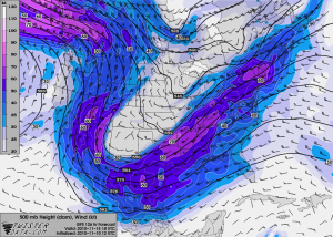
500 mb GFS forecast, 18 UTC, November 15, 2010