Snow showers to start the week!

The National Weather Service has issued a Winter weather Advisory as a mix of rain and snow showers will take place before your midday today. This is expected to turn into snow flurries afterwards. Temperatures will stay in the mid 30’s with a high of 37 and a low of 25. Definitely watch for slick spots on the road especially as temperatures dip below freezing during the late night hours. Overall, overcast conditions will dominate the day with snow accumulations being slightly under .5″.

Posted in Kentucky Weather | Comments Off on Snow showers to start the week!

Rainy Weekend!

Expect mostly sunny conditions for the majority of your Friday as a high pressure system dominates the southeastern portion of the country. The high for today is 43F with a low of 27F. Increasing winds from the SSE will bring some clouds in, which will cause for partly cloudy conditions on Saturday then showers likely after 1pm and will continue into the night as well. The high for Saturday is 49F with a low of 40F. Showers continue into Sunday with even a chance of snow showers by your evening hours. Definitely prepare for a soggy weekend and keep that rain gear around if you plan on being out and about. Also watch for slick spots on the road, especially as we hit those lows!

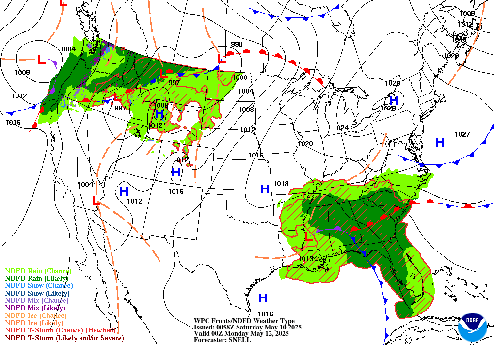
Forecast of Fronts/Pressure valid Sun 00Z
Courtesy: WPC
Posted in Kentucky Weather | Comments Off on Rainy Weekend!

Dry End to the Work Week

Good afternoon, everybody! If you aren’t a fan of rain or snow showers in the winter season, we have good news for you this blog post!

For today and tomorrow, our region will see an influx of sunshine and incline in temperatures thanks to a high pressure system making its way into the Midwest. However, we won’t have much of a break from wet weather, as more active weather looks to return to the forecast this weekend. Saturday, showers may start to pass through our area in the afternoon, with chances sticking around up until the early hours of the new week. As of now, anticipated precipitation totals remain at less than a tenth of an inch.

We hope you can get out and enjoy the sunshine while it lasts! Stay happy and healthy, readers!

Posted in Kentucky Weather | Comments Off on Dry End to the Work Week

Heads up: Snow Advisory!

The National Weather Service has put South Central Kentucky under a winter weather advisory due to a snow threat until 6PM CST! Snow showers are likely mainly after 3pm with accumulations expecting to be about an inch. Be aware of slick spots on the road if you plan on commuting! The high for today is chilly at 39F with a low of 32F, so make sure to stay bundled if you’ll be out at any point. As we progress into the late afternoon, expect a mix of rain and snow showers to occur before overcast conditions take over throughout the night. We catch a break from precipitation before it returns once again this weekend. Stay alert as we fine tune this out for you.

Stay safe and have a great rest of the day!

Posted in Kentucky Weather | Comments Off on Heads up: Snow Advisory!

Record High Precipitation Amounts

Welcome back to Western Kentucky University’s Meteorology Blog! We hope that you had a wonderful winter break and that you are having a great start to the new semester!

As you know, yesterday we had widespread showers move through the Midwest that produced impressive amounts of rainfall. In Warren county alone, precipitation totals ranged from 2 to a little over 3 inches (with localized totals potentially being higher) in the span of a 24-hour period. As always, flooding the main concern from this system was the potential for flooding, which did take place in many areas, as shown in the (comedic) social media post below.

This was brought to you by a community-driven forecast team known as @wxornotBG!

Fortunately, this is the most action that we will see for the remainder of the week. As of now, there are slight chances for light snow accumulations across the county for tomorrow, but other than that, expect a dry rest of the work week!

Stay happy and healthy, everyone!

Posted in Kentucky Weather | Comments Off on Record High Precipitation Amounts

More Sunshine to Come!

Are you loving this weather? We, who write for the the WKU Meteorology Blog, sure are! Fortunately, the influx of sunshine and rising temperatures will continue until tomorrow. Into the weekend, we may see showers due to the passage of a cold front, so make sure you get outdoors while you can to enjoy this weather while it lasts. For those of you that are students, we wish you the best of luck on finals!

Posted in Kentucky Weather | Comments Off on More Sunshine to Come!

This Day in Weather History

On this day, in 1995, a historical event took place in the northern Great Plains. According to the National Weather Service, not only were winds surpassing 30 to 60 miles per hour, but wind chills reached 40 to 70 degrees below zero. This was an outcome of a strong front sourced from the Arctic digging low enough to reach the top of our country.

Posted in Kentucky Weather | Comments Off on This Day in Weather History

Warming Up!

Warmer temperatures are expected as we continue the work week as we even saw some flurries last night! Snowy conditions have migrated to the east of us as high pressure moves into the area. This high pressure system will dominate most of the week, as we aren’t seeing any rain chances until Friday afternoon! Definitely a good week to be outdoors to get that yard work done. The high for today is 41F and the low is 26F. Winds will be out of the northwest at 6mph and remain calm throughout the day.

Stay warm and stay safe! Enjoy your Monday!

Posted in Kentucky Weather | Comments Off on Warming Up!

Rainy Start to the Weekend, Then Dry

Friday calls for light rain, accumulating to about a tenth of an inch for the day, with the heaviest rain staying south of us. There is a small chance that the rain showers will transition into a mix of light snow and rain, so definitely watch out for slick spots as you commute throughout the night. The high for today is 49F and the low is 35F, so bundle up!

This weekend looks clear as the Tennessee Valley becomes dominated by a high pressure system and the rain moves east. Temperatures are expected to remain chilly though as we head into the month of December. Mostly sunny skies through Saturday and Sunday, with highs staying in the mid 40’s and lows in the upper 20’s (Well below freezing!). You’ll want to bring those pets and vulnerable plants inside for the night.

Stay safe and bundle up! Have a great weekend.

Posted in Kentucky Weather | Comments Off on Rainy Start to the Weekend, Then Dry

Honoring an Icon for the Field

On this day, in 1838, Cleveland Abbe was born. Why does it matter? Well, this established astronomer and meteorologist was the only one that had any forecasting experience based on scientific principals when he worked for the U.S. Army Signal Corps. Being the only source of any sort of forecast, or as he called them, probabilities, he was nicknamed “Old Probabilities”, or “Old Prob” for short. The foundation of his public weather service served to be the model for the National Weather Service that we know today.

According to the National Oceanic and Atmospheric Administration, Abbe was known for his “congeniality, his willingness to instruct, and his piercing inquiries that continually challenged the intellect of his colleagues.”

Posted in Kentucky Weather | Comments Off on Honoring an Icon for the Field