Rare Tornado Outbreak of 1970

On this day, in 1970, the eastern-central region of Wisconsin saw a rare occurrence of four tornado touchdowns in the span of a day. By rare, we are referring to the abundance of high temperatures and moisture that this state saw on this day in order to promote the development of severe weather. Of the four twisters, the strongest destroyed Outagamie County, being ranked a F3. This particular storm cost over a half million of damage!

Below is a map that shows the tornado tracks of each tornado that touched down on this day in Wisconsin.
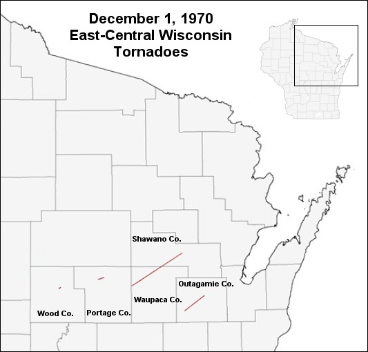
(National Weather Service)
Posted in Kentucky Weather | Comments Off on Rare Tornado Outbreak of 1970

The Season’s First Snow!

Get ready to see the season’s first snow as a mix of rain and snow move through the region for the beginning of your work week. Snow shower chances will be enhanced after 11am, and are expected to accumulate up to a dusting or so. The chances of it sticking are low as surface temperatures during the event are expected to remain above the freezing level. You will still want to remain cautious on the roads, especially those with shades, for possible slick spots during your walks or commute! The high for today is 40F and the low is 25F, with winds coming out of the NW, giving us that kick of cool air. The rest of the week looks clear as far as precipitation goes up until Thursday, where we’re looking at another chance of snow showers!

Stay safe and enjoy your day!

Posted in Kentucky Weather | Comments Off on The Season’s First Snow!

Today in Weather History

On this day, in 2007, football lovers across the country were gathered to watch Monday Night Football, though the weather had other plans for the viewers. There was an influx of heavy rain and lighting from a passing cold front, having delayed the game 25 minutes from its originally planned starting time. Moreover, the abundance of mud on the field made for both a messy and uneventful match between the Pittsburgh Steelers and Miami Dolphins that resulted in this being the lowest-scoring NFL games in history, with the Steelers claiming a win with a score of 3-0.

On a side note, have a wonderful Thanksgiving! We hope that you stay healthy and happy!

Posted in Kentucky Weather | Comments Off on Today in Weather History

Cold Front Brings About Wind Threat

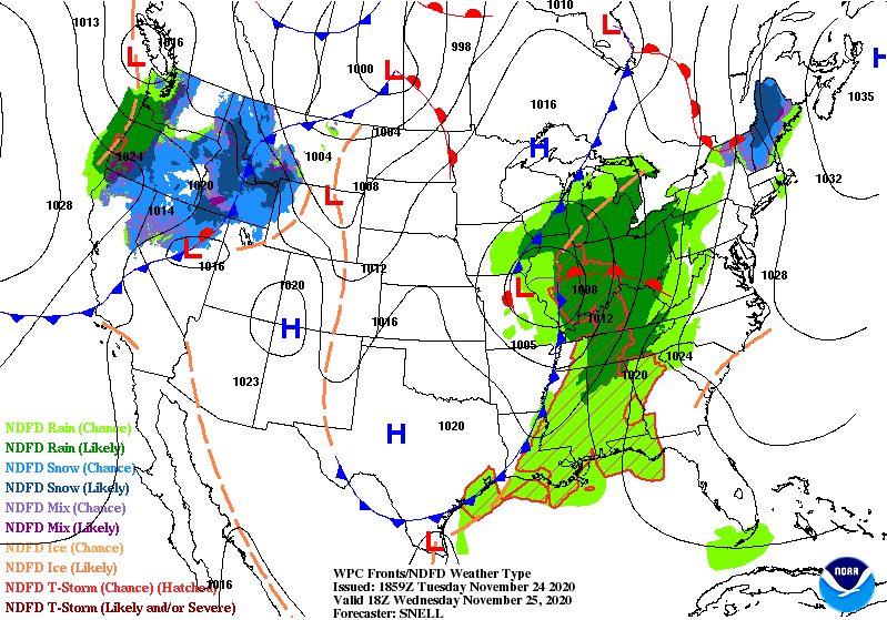
Tomorrow, a cold front will be passing through our area. As always, the chance for thunderstorms will accompany this. However, an additional threat has come to our attention, that being the wind. Ahead of the front, gusty winds will be moving into our region. These have the potential to gust 30-40 mph, with locally higher readings possible. We will see these peak in the morning, calm in the afternoon, and then pick back up in the evening as thunderstorms develop.

(Weather Prediction Center)

Fortunately, this will be brief, only lasting the duration of tomorrow. That means a dry and comfortable Turkey Day is to come! Stay safe and healthy!

Posted in Kentucky Weather | Comments Off on Cold Front Brings About Wind Threat

Warming up for the Weekend!

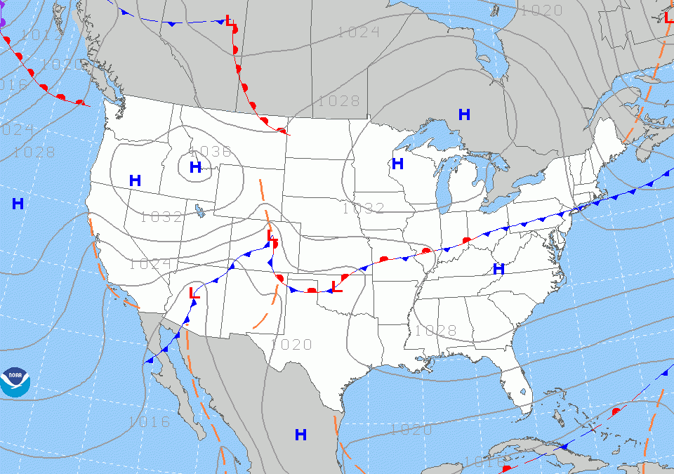
If you’ve been noticing that it feels much less frigidly cold outside, well that’s because our area is being dominated by a high pressure system. This will keep us mild, with a high of 68F and a low of 50F for your Friday! Expect partly cloudy conditions, but overall a great day to be outside. Winds will be variable and may become breezy, so definitely be aware if you are planning to any fire-related activities this weekend. Rain chances will be lining up behind a cold front that is expected to keep us indoors by the end of your weekend on Sunday, with about a quarter of an inch expected according to the GFS numerical model. Definitely be careful on the road if you plan to be commuting and stay safe!

Posted in Kentucky Weather | Comments Off on Warming up for the Weekend!

The Columbia Gorge Ice Storm

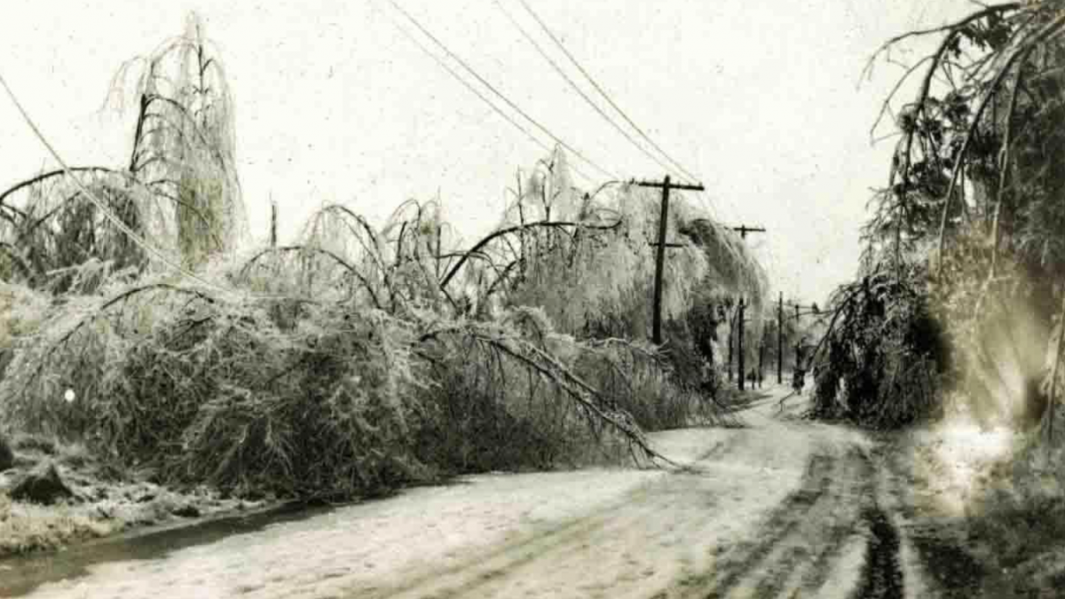
On this day, in 1921, the Columbia Gorge saw a historical ice storm. In all, according to the National Weather Service, snowfall amounts ranged from 54″ in The Dalles, 37.5″ in Hood River, and 27.5″ in the Cascade Locks. This left several trains with passengers on board stranded for days.

Below is a photograph of fallen trees and wires in Needham.

(Wicked Local)
Posted in Kentucky Weather | Comments Off on The Columbia Gorge Ice Storm

A Slight Warm Up

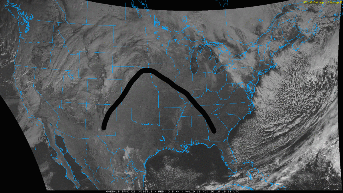
Good morning everyone! Hopefully, you put on a warm jacket before heading out as it is on the chilly side. While today it does look to stay on the cooler side, we should expect to see a gradual warm-up Thursday and Friday. Rain chances will stay out of the way as a high-pressure system will dominate the region until Saturday. Here’s the latest satellite image with the ridge associated with that high-pressure system marked:

Source: https://weather.cod.edu/satrad/

Saturday a stationary front will sit to the north of Kentucky and will bring a very slight chance for rain to Warren County but the greater chances will remain for counties along the Ohio River to the north.

For now there is not much to say but enjoy the warmer conditions and the sun!

  • SUMMARY:
    • Wednesday:
      • High: 56
      • Low: 38
    • Thursday:
      • High: 65
      • Low: 41
    • Friday:
      • High: 66
      • Low: 43

Stay safe, stay healthy, and have a great week!

Posted in Kentucky Weather | Comments Off on A Slight Warm Up

Today in Weather History

On this day, in 2013, our country saw a rather unusual tornado outbreak take place in the northern portion of the Midwest. What do I mean by unusual you may ask? Well, this time of the year, there normally isn’t the proper amount of moisture supplied in the atmosphere for severe thunderstorms, let alone tornadoes, to take place. However, a low pressure system across the plains was the source of high amounts of moisture, with dew points ranging in the mid-60’s. With the combination of this moisture, seasonal abundance of wind shear, and the passage of a cold front, ten tornadoes touched down in a single day in the state of Illinois. We lost three lives because of this, leaving one hundred and forty-two injured.

Posted in Kentucky Weather | Comments Off on Today in Weather History

Cooler Friday

A cold front has already passed through the region, leaving behind cooler but sunny conditions. The high for today is 60F and the low is 35F, with calm wind conditions. Saturday will also remain mostly clear, but rain chances will increase into the late afternoon and into Sunday. You will definitely want to keep that umbrella in hand as you motion through your weekend. Strong winds and some thunder is possible with this system, with gusts up to 35mph as a low pressure system settles over the great lakes. Stay safe!

Posted in Kentucky Weather | Comments Off on Cooler Friday

The 1970 Bhola Cyclone

On this day, in 1970, the country of Bangladesh saw one of the world’s deadliest natural disasters. This storm was ranked as an “extremely severe cyclonic storm” by the India Meteorological Department and a category four on the Saffir-Simpson scale. From the 3rd through the 13th, there was $86.4 million of damage and over 500,000 lives lost.

(WikiProject Tropical Cyclones/Tracks)
Posted in Kentucky Weather | Comments Off on The 1970 Bhola Cyclone