Shaking off the rain

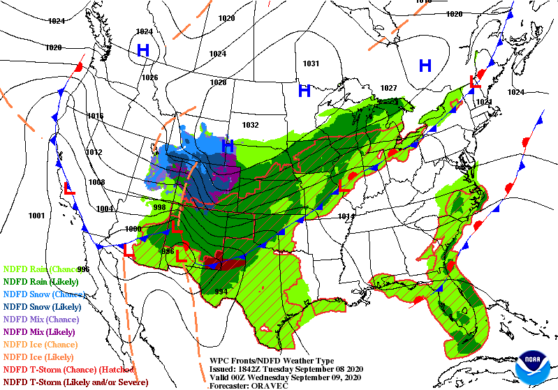
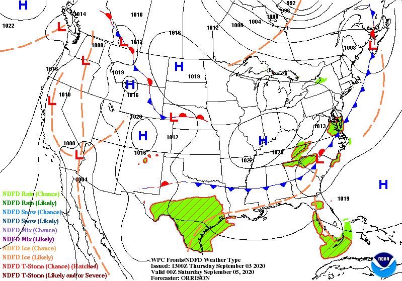
Kicking off the week to dry conditions as the last of the cold front passes through the eastern Tennessee Valley. High for today is 80°F and the low is 59°F. A high pressure system centered over the Great Lakes will allow for a sunny day. Overall, no significant rainfall threat in sight until Wednesday evening, so make sure to get that yard work in when you can!

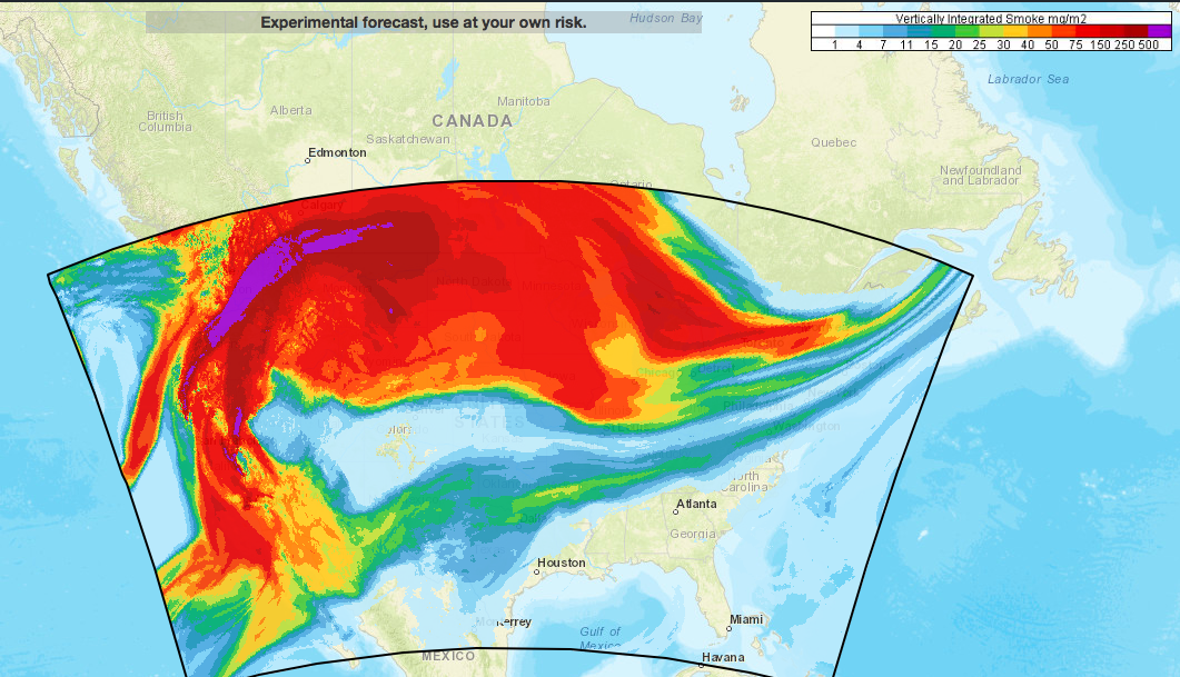
The west coast is still dealing with large fires spreading through dry vegetation. Below is the vertically integrated smoke HRRR model. It basically gives us insight as to how dense the smoke is and where it is traveling. The plume of smoke seems to be traveling into the eastern regions of CONUS, but the worst of it is in the northwest quadrant of the United States.

HRRR vertically integrated model for Monday September 14, 2020.

Posted in Kentucky Weather | Comments Off on Shaking off the rain

Here comes the rain

Staying on the warm side for Friday with a high of 89 °F under partly cloudy conditions. The day is expected to stay warm and dry for the day, so take advantage of that before we start experiencing rainfall in the next coming days. The low for Friday is 69°F.

Expect some scattered showers to come through the area as a frontal system arrives. The total precipitation is expected to reach almost 1″ in most of South Central KY according to the NAM model. Somerset is expected to get an impressive chug at almost 3″ for their rainfall totals. With that being said, be careful on the roads when commuting and definitely pack that umbrella with you as you go out and about your day. High for tomorrow is 87°F and the low is 70°F.

NAM total precipitation accumulations

Stay safe and have a great weekend!

Posted in Kentucky Weather | Comments Off on Here comes the rain

Friendly Reminders for Today

Good morning to you! Welcome back to the WKU Meteorology page. Today, we will see the same summery conditions that we’ve seen so far this week thanks to the placement of the stationary front. Expect a high in the upper 80’s, low in the upper 60’s, and sunny conditions throughout the day.

Moreover, the likelihood of heat disorders with prolonged exposure or strenuous activity is higher today as the heat index surpasses 90 degrees. On top of that, the UV Index will reach 8, only contributing to the precautions that are necessary to take today.

If you plan on spending any time outdoors, we advise for you to take the reminders below into consideration:

– Stay hydrated.
– Take breaks in cool, air-conditioned spaces.
– Wear SPF 15+, protective clothing, and sunglasses.
– Make attempts to avoid the sun between 10am and 4pm.

We hope you have a great day!

Posted in Kentucky Weather | Comments Off on Friendly Reminders for Today

Rinse and Repeat of Yesterday

Good morning everyone! Well as the stationary front continues to keep its place to the northwest of Kentucky.

Source: https://www.weather.gov/oun/sfcmaps

With that we will continue to have warm, dry conditions for the next few days. The next best chance for rain looks to be Saturday after the stationary front moves out and a cold front prepares to pass through Sunday.

Source: Created in IDV
  • SUMMARY:
    • Wednesday
      • High: 89
      • Low: 67
    • Thursday
      • High: 89
      • Low: 69
    • Friday:
      • High: 85
      • Low: 68

Stay safe, healthy, and have a great week!

Posted in Kentucky Weather | Comments Off on Rinse and Repeat of Yesterday

Repetitive Forecast for This Week

In all, this work week will have a consistent forecast of sunshine and dry conditions. We can blame this on a stationary boundary to our northeast that is making for the lack of activity in the atmosphere in our area. As you can see, the storm chances remain predominantly on the left of the front, and they will stay that way for the rest of the week.

(Weather Prediction Center)

So, what should we expect as far as the forecast goes?

– High’s in the upper 80’s.
– Low’s in the upper 60’s.
– Minimal cloud coverage.
– Moderate humidity.
– Little to no breeze.

Posted in Kentucky Weather | Comments Off on Repetitive Forecast for This Week

Cooler Nights, but Warmer Days

Get ready to crank up the heat for the start of your Labor Day celebrations. The high for today is 89°F with mostly clear skies due to a high pressure sitting right over the Tennessee Valley. Southwesterly winds are going to keep most of the day’s temperatures in the 80’s until right after sunset, which is when temperatures will start to decrease. Upstream convection may trigger some high clouds to be visible over the area but the day will remain mostly clear. The low for tonight is 64°F. Rain stays to the north for the day so definitely take advantage of that as you head outdoors for your Labor Day celebrations.

The ECMWF Hi-Res numerical model shows some snow possible for the rocky mountains out west of us. This is due to a dip in the jet stream, causing a large cool down in temperatures as we head out of the summer season for that region. We’ll have to keep a close eye on how that jet stream develops as it moves closer to our region to see if we’ll get to experience that dip in temperatures as well.

Posted in Kentucky Weather | Comments Off on Cooler Nights, but Warmer Days

Kicking it Off to a Nice & Dry Weekend

Prepare for the perfect labor day weekend as we head into those long awaited sunny and dry conditions. A cold front finished passing through the region this morning, leaving behind some much less muggy air. The low for tonight is a chilly 55°F with partly cloudy skies, so pack that light sweater with you on your late night commute.

Tomorrow’s high will be 81° with mostly sunny conditions for most of the day. The majority of the rain will stay northwest of us in North Central Iowa ad Southern Minnesota as they prepare for a slight risk of severe weather for their labor day weekend. Storms are expected to remain scattered and isolated throughout that region as the frontal boundary pushes through into the start of their week. Some precipitable water values even reaching as far as 2″ for the region.

Expect Sunday to stay warm and dry for the most part as a high pressure system takes over most of South Central KY. High for the day is 85°, and the low is 64°.

Our next chance of rain returns by the middle of next week as a cold front pushes through to bring us much cooler than average temperatures. As for now, take advantage of the nice weekend ahead!

Posted in Kentucky Weather | Comments Off on Kicking it Off to a Nice & Dry Weekend

Good News for Labor Day Weekend

If you have plans for this upcoming weekend, we have good news for you! We will see the return of those ideal summer conditions that we were hoping for by tomorrow, continuing throughout the weekend.

Tomorrow, in the morning, that troublesome cold front will be moving out of our area and towards the east coast. Therefore, leaving us with a high pressure approaching from the east. This will be a rather slow-moving system, moving through the Midwest throughout the weekend and at the start of next week.

(Weather Prediction Center)

As we move into the weekend, cloud cover will reduce substantially, as will the chances for any precipitation. In the afternoons, temperatures will reach comfortable values in the mid to upper 80’s, and cooler lows in the lower 60’s will take place at nighttime to end out each day. There will be little to no breeze to offer any relief from the sun’s rays, so be sure to stay hydrated if you plan on being outdoors.

We hope you have a wonderful Labor Day weekend! Stay safe!

Posted in Kentucky Weather | Comments Off on Good News for Labor Day Weekend

Cold Front Brings More Rain But Also Cooler Temps

Good morning everyone! Hopefully, the rain last night and this morning did not cause any problems. Over the last 24 hours, Bowling Green has received about an inch of rain with some spots receiving closer to half an inch.

Source: https://www.wpc.ncep.noaa.gov/noaa/noaa.gif

The cold front across states to our northwest will continue to move down and across the area over the next couple of days bringing continued chances of rain/storms with it. For today amounts will be from a quarter to half an inch with closer to 3/4 falling tonight. Tomorrow’s rainfall could be another quarter to half an inch. As always there is the potential for heavier rainfall in some areas, so please be aware of any localized flooding especially on roadways as this rainfall will be made in addition to that which fell last night/ this morning. Just because it looks like the water isn’t that deep doesn’t mean it isn’t.

Courtesy: IDV

As far as temperatures go, it looks like we may be finally headed towards more comfortable conditions. Highs look to be headed for the low 80s Friday and Saturday with dewpoints finally getting under 70 on these days. As far as today and tomorrow goes, highs should be in the mid 80s with mid 70 dewpoints leaving things still muggy and feeling like it’s in the low 90s. I think we can make it through a couple more funky days for a beautiful weekend! Just make sure to keep your umbrella/rain coat/pancho ready for today and tomorrow.

  • Summary:
    • Wednesday
      • High – 85
      • Low – 73
      • Precipitation – 1″ to 1.25″ with the potential for closer to 2″ in some areas and isolated storms
    • Thursday
      • High – 84
      • Low – 70
      • Precipitation – 1/4″ to 1/2″ with isolated storms
    • Friday
      • High – 82
      • Low – 57

Stay safe and have a great week!

Posted in Kentucky Weather | Comments Off on Cold Front Brings More Rain But Also Cooler Temps

A Split Forecast for the Start of September

For the first day of the month, we will see conditions that will differ from those expected for the following weekdays. We will stay relatively dry for half of the day, with partly cloudy skies and a light to gentle breeze for some relief from the patchy sunlight paired with oppressive humidity. Temperatures will peak at the mid-80’s this afternoon and stoop down to the mid-70’s by this evening. If you plan on spending any time outdoors throughout the day, we encourage for you to stay hydrated and wear light clothing to prevent from any heat-related illness.

Unfortunately, we will see cloud cover become more prominent as evening approaches. Around 4pm, the chances for scattered showers and thunderstorms will increase, as shown in the figure below. Although the severity of these will lack, we can’t rule out the possibility of gusty winds or brief moments of heavy rainfall.

Today’s projected scattered storms, from 12-5pm (HRRR Model, Pivotal Weather)
Posted in Kentucky Weather | Comments Off on A Split Forecast for the Start of September