Wild Weather Wednesday

Today’s Forecast

Good morning and happy Wednesday! I hope you’ve been enjoying these picture perfect days because we have some storms that will be moving into the area and lingering into Thursday night. The National Weather Service has us under a hazardous weather outlook for the main threats being heavy rain and gusty winds, especially on Thursday. For this morning, expect a 40% chance for showers. The high for today is in the mid-to-upper 80s with a low in the mid 60s. As we go into tonight, chances for rain and storms ramp up. Rainfall amounts fall between a tenth and quarter of an inch. Going into tomorrow, chances for showers and thunderstorms continue throughout the day, which could be an issue for the WKU vs. MTSU football game in the evening. The high for tomorrow is in the lower 80s with a low in the lower 60s. Rainfall amounts through Thursday night will be around a quarter and half an inch. Luckily, by Friday morning this system should be moved out and it will be mostly sunny with a high near 85.

Recent Wild Weather

Due to extremely low flows on the Mississippi River being caused by recent drought conditions, large amounts of saltwater has pushed its way upstream from the Gulf of Mexico. In just a short amount of time, it is already doing its damage by sullying the water supplies in south Plaquemines Parish. There is a growing concern about the ways in which the salt water could harm the water supplies all across the state of Louisiana. The saltwater intrusion has already advanced approximately 70 miles up the river from the Gulf of Mexico, and is projected to reach Belle Chasse in southern New Orleans by mid-October. In July, the Army Corps constructed an underwater sill, meant to block the saltwater flow. However, it was recently overtopped, prompting engineers to work on increasing its height by 25 feet. The solution is not expected to hold back the saltwater for an extended period of time and they are working together to find better solutions to solve these issues.

Wild Weather this Day in History

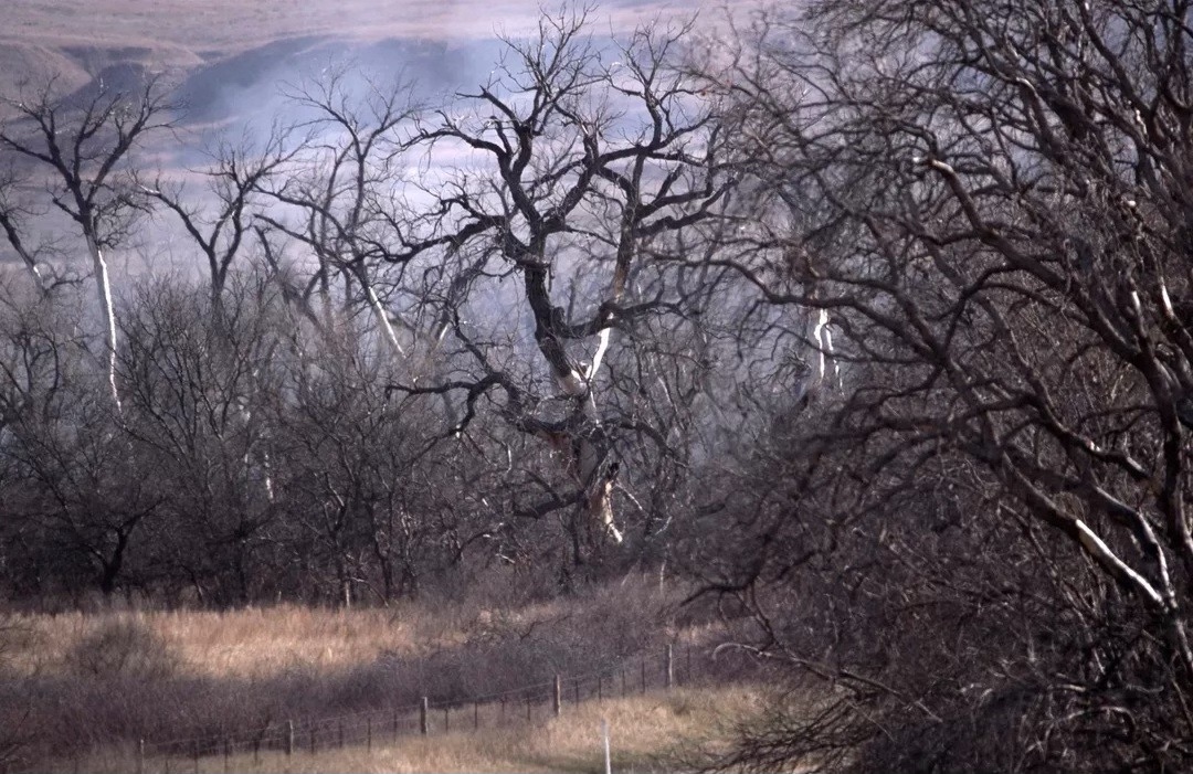
On September 27, 1983, in the evening hours, lightning struck a field of grass, and set it ablaze in the northwest region of Reliance, South Dakota. At its peak , the fire stretched 4 miles wide by 10 miles long. It burned up over 25,000 acres of land. At this time of year when we oftentimes see drier climates and hotter temperatures, the perfect landscape is created for a weather event like this one to occur. Lightning has a very high voltage, and if it strikes a very dry surface (like this field of grass) it will heat it up very quickly.

I hope you have an amazing rest of the week and stay safe as these storms roll through parts of the area!

Sources: https://www.cbsnews.com/news/new-orleans-drinking-water-threatened-saltwater-intrusion-looms-mississippi-river-drought/ https://www.weather.gov/abr/This_Day_in_Weather_History_Sep_27

Posted in Kentucky Weather | Comments Off on Wild Weather Wednesday

Happy Monday! 9/25

Happy first Monday of Autumn! I hoped you enjoyed your weekend! Did you see the Miami Dolphins football game? I am sure some of you are happy because of your fantasy league. Western Kentucky Football team is back in town this weekend, so come on down and support them! Now, let us take a look at the forecast ahead.

The Forecast: Wednesday we can expect thunderstorms late in the evening into Thursday morning. They will be scattered and there is a severe threat for damaging winds. The rest of the forecast, we can expect highs in 80s with lows around 60 degrees with mostly clear skies. It is going to be a warm and sunny week, makes you wonder if it is truly Autumn or if summer is here to stay.

Posted in Kentucky Weather | Comments Off on Happy Monday! 9/25

Wild Weather Wednesday

Today’s Forecast

Good morning and happy Wednesday! I hope everyone has had an amazing week so far and have been enjoying these cooler, sunny days. The first day of fall is only 3 days away so these cooler temps are likely to stay. Not much is happening weather wise as we head towards this weekend except for a continuation of mostly sunny skies in the day and clear skies at night. The high for today is 83 and the low is 56, so make sure to grab a jacket on your way out the door this morning. Expect similar temps throughout the rest of this week.

Recent Wild Weather

Our wild weather for this week may seem a little “corny”, but I promise you it’s nothing to take lightly. On September 15th, in Topeka, Kansas, a dust devil struck a freshly harvested corn field. A dust devil is a strong, well-formed, and relatively short-lived whirlwind. It can range in size from very small to very large. They are relatively harmless, although on rare occasion, they have become strong enough to pose a threat to both property and people. Dust devils typically form on fair weather days, including plenty of sunshine, warm temperatures, and light winds. They sweep in an upward motion as they travel across the ground, and in this case, it was picking up all the leftover cornstalks in its path. With fall just days away this was a scene that was definitely bringing all the fall vibes. See the link below for a cool video of the “corn devil”.

Wild Weather this Day in History

On September 20th, 1909, one of the deadliest hurricanes to ever hit the United States would make its way into the history books, being referred to as The Grand Isle Hurricane. This is where it first made landfall as a Category 3 hurricane, destroying everything in its path. It would continue its path through New Orleans causing extensive flood damage as a result of the fifteen-foot storm surge. The Grand Isle Hurricane would eventually dissipate over Missouri on September 22, but not before causing catastrophic damage including the loss of 371 lives and 265 million dollars in damage.

I hope everyone has an amazing rest of the week and continues to enjoy these beautiful days while we have them!

Sources: https://fox8.com/news/watch-corn-devil-forms-in-freshly-harvested-field/ https://www.youtube.com/watch?v=9OXQSbe0p8w https://devastatingdisasters.com/louisiana-hurricane-september-20-1909/ https://www.weather.gov/abr/This_Day_in_Weather_History_Sep_20#:~:text=1909%3A%20A%20large%20and%20deadly,in%20damage%20(2010%20USD).

Posted in Kentucky Weather | Comments Off on Wild Weather Wednesday

Happy Monday 9/18/23

Happy Monday everyone! I hope you had a good weekend! Whether you went to the WKU vs Ohio State game, went hiking, stayed inside, or just watched the NFL. This weekend’s weather almost felt like fall weather! This upcoming Saturday is the first day of fall! The Hilltoppers football will be back on the road next Saturday when they play the Troy Trojans at 11:00am. The week ahead promises to be a warm and dry week, so let us take a look.

Short Term: Today through Wednesday expect highs around 82 degrees with partly cloudy skies with times of clear skies, especially Tuesday. At night, expect lows in the lower 50s with some patchy fog expected Monday morning and Tuesday morning. Expect clouds to clear up at night leaving clear skies overnight on all three nights.

Later This Week: Expect mostly the same things for Thursday through Saturday. With highs closer to around 85 degrees and partly cloudy skies expected. Sunday we might have our first chance of rain in the next seven days. Expect lows around 60 degrees with mostly clear skies at night but Sunday with rain possible. Remember, Saturday is the first day of Fall!

Posted in Kentucky Weather | Comments Off on Happy Monday 9/18/23

Wild Weather Wednesday

Today’s Forecast

Good morning and happy Wednesday! I hope everyone has had a great week so far and are enjoying these cooler temps as we get closer to fall. As the last little bit of rain moves out of the area, sunny skies and cooler temps are expected to continue into this weekend. The cold front that triggered these sparse showers will aid in the cooling of the air and clear skies. With lower dew points, fog may form in some areas, but other than that, nothing else is on track to occur. Highs today are expected to reach the upper 70s and lows are expected to reach the lower 50s. Tomorrow expect temps to remain around the same as today.

Recent Wild Weather

Last week in Chippewa Flowage, Wisconsin, residents had to come together to push a giant floating island, or bog, to a new location. A bog is a floating freshwater wetland consisting of mud, vegetation, and wildlife. Bogs are typically found in cooler northern climates and tend to form in poorly draining bodies of water. They take hundreds to thousands of years to form and can remain on the surface of the water like an island, or sink completely to the bottom. Bogs are formed when lakes slowly fill with vegetation and (due to poor drainage) the flooding prevents a healthy flow of oxygen from the atmosphere. These bogs create islands capable of holding all sorts of plant and animal life. The larger bogs that form islands can become a nuisance at times due to the way that they drift about during times of heavy rains and high winds. However, rather than the removal of problematic bogs, wildlife authorities prefer they be dealt with in a way that won’t negatively impact wildlife. This week in Chippewa when a large floating island caused a local bridge to become blocked, around 20 local boaters came together to slowly push the island to a new location. This process isn’t as easy as it seems, and can only be done on a day when the wind is to their backs to assist in the push. They have become quite used to this process in areas where bogs are a common part of the landscape.

Wild Weather this Day in History

On September 13, 1944 the USS Warrington was in the Atlantic on its way to Trinidad, which unfortunately would be a destination it would never arrive to. This naval ship was put to sea the day after the attacks on Pearl Harbor. She was operated out of the Southern and Western Pacific completing escort and patrol missions for 16 months of World War II. The ship was returned to the US for repairs in New York City on September 10, 1944. Just days later the USS Warrington and its crew encountered a hurricane out at sea with 130 knot winds and massive waves that obliterated the hull of the ship. The USS Warrington began to take on large amounts of water causing their electrical system to shut down, cutting all power to the steering mechanism. The ship began sinking stern first about 175 nautical miles east-south-east of Great Abaco Island in the Bahamas. Most of the crew abandoned ship, but only 5 officers and 68 other crewman were recovered alive. 248 men were lost to the Great Atlantic Hurricane of 1944 in this tragic accident.

I hope you have an amazing rest of the week

Sources: https://startuppakistan.com.pk/this-giant-floating-island-has-to-be-pushed-by-boats-almost-every-year/ https://ericwiberg.com/2014/04/uss-warrington-dd-383-sunk-by-hurricane-13-september-1944-ne-of-bahamas

Posted in Kentucky Weather | Comments Off on Wild Weather Wednesday

Happy Monday! 9/11

Happy Monday! Today is the 22nd anniversary of the 9/11 terrorist attacks. One of the the most heroic stories I have ever read about was Orio Joseph Palmer story. He was a Battalion Chief of the New York City Fire Department who died while trying to reach civilians trapped inside the South Tower. Orio Palmer was one of the few firefighters that reached the 78th floor of the South Tower, the floor where the plane had struck the building before it collapsed. What is crazy is after taking an elevator to the 41st floor, Palmer climbed 37 flights of stairs with approximately 50 pounds of gear on. Can you imgaine! That is a real life hero to me, they still honor him to this day. Some fire departments do climbs like that on or around 9/11 to honor him. Let us take a look at the forecast ahead.

Monday: High of 88 with partly cloudy skies.

Monday Night: Low of 65 degrees with mostly clear skies with clouds moving in late.

Tuesday: Overcast with scattered showers throughout the day, high of around 72.

Tuesday Night: Clouds move out early for clear skies overnight, low of around 60 degrees.

Wednesday: Sunny, with a high of around 80 degrees.

Posted in Kentucky Weather | Comments Off on Happy Monday! 9/11

Wild Weather Wednesday

Today’s Forecast

Good morning and happy Wednesday! I hope everyone has had a great week so far! Chances for thunderstorms this morning is likely, as well as, a chance of scattered thunderstorms throughout the evening. The National Weather Service has us under a hazardous weather outlook for this afternoon and early evening with the primary threats being locally damaging winds, as long as, some chances for hail and localized heavy rainfall. Thursday looks to be a much better day with sunny skies, calm winds, and a high near 83.

Recent Wild Weather

Well, we can’t look back at last week’s wild weather without talking about Hurricane Idalia. Last Wednesday, Idalia made landfall on Florida’s Keaton Beach as a category 3 storm. It had sustained winds of 125 mph, and a 6 foot storm surge due to its heavy rains accompanying Idalia. It left its mark on Florida, Georgia, and South Carolina before it weakened into a tropical storm. Along its path it produced a number of issues including: flooding, power outages, beach erosion, major structural damages, and even loss of life. One of the wildest things I saw being reported on was the reversal of the Steinhatchee River in the Big Bend region of Florida. This is a phenomenon that occurs when extremely strong winds push massive waves in the opposite direction of the normal river flow, forcing the flow to then go backwards until either the normal river flow or the elevation of the land interrupts the process. As the Steinhatchee River reversed, it also rose over 8 feet during the process. Additionally, it made sailboats unable to clear the bridges, ripping off their masts as they attempted to pass under. The reversal of a river flow can be temporary or even become permanent. The town of Steinhatchee has a long way to go to recover from the damage caused by Hurricane Idalia, and the effects it had on the Steinhatchee River.

Wild Weather this Day in History

While we are on the subject of hurricanes, let’s talk about how many have been recorded on September 5th alone. There have been 4 hurricanes to make landfall on this day in history in the US. In 1933, (before we were naming hurricanes) a Category 3 hurricane made landfall on South Padre Island, Texas. The storm caused 40 fatalities and nearly $17 million in damages. In 1950, Hurricane Easy hung over Tampa Bay dumping massive amounts of rain totaling in at 45.20 inches, and causing 3.3 million dollars in damage. In 1996, Hurricane Fran made landfall in Cape Fear, North Carolina. Fran was responsible for 26 deaths and, at the time, was the most expensive natural disaster in North Carolina’s history. In 2017, Hurricane Irma became a category 5 hurricane with maximum sustained winds of 180 mph. Irma is one of the strongest hurricanes ever observed in the open Atlantic Ocean. We are still in hurricane season until November 30th, with the Atlantic’s next major hurricane expected by this weekend.

I hope everyone has an amazing rest of the week and can avoid any possible damages from these potential storms!

Sources: https://www.dailymail.co.uk/news/article-12462411/amp/Hurricane-Idalia-REVERSES-Florida-river-ships-moorings-devastated-homeowners.html https://www.weather.gov/abr/This_Day_in_Weather_History_Sep_05

Posted in Kentucky Weather | Comments Off on Wild Weather Wednesday

Happy Labor Day!

Happy Labor Day! I hope you enjoyed a three-day weekend and the sunny skies! Did you see WKU football won their first home football game? Or the fact we are less than a week from the NFL kickoff? Let us look at the forecast for the next few days.

Monday Night: Low of 72 degrees with mostly clear skies.

Tuesday: Mostly cloudy with a high of 90 degrees.

Tuesday Night: Party cloudy skies with a low of around 70 degrees.

Wednesday: Thunderstorms, especially in the morning becoming more widespread in the afternoon, cloudy otherwise. High of around 86 degrees.

Posted in Kentucky Weather | Comments Off on Happy Labor Day!

Wild Weather Wednesday

Today’s Forecast

Good morning and happy Wednesday! I hope everyone had a great summer and has been enjoying some of the cooler temps since this past week! Today will be very similar to yesterday. Temps and dewpoints will continue to drop a little, giving us the perfect summer conditions. It’ll be sunny throughout the day with a high of 84 and tonight will be mostly clear with a low of 58. Tomorrow remains around the same with sunny skies, a high of 80, and a low of 57.

Recent Wild Weather

On August 25th, in Des Moines, IA, pillows of clouds were seen stretching across one highway. This phenomenon is known as a gravity wave and was caused by storms in northern Iowa. Gravity waves are waves in the atmosphere and happens when air rises and falls in a stable layer of the atmosphere. Regions with upward-moving air create rows of low-hanging clouds. At a local news channel, these ripples could be seen on their radar. 45 minutes after storms rolled in, an outflow boundary was seen on the radar. Within half an hour later, many outflow boundaries could be seen, which is what caused the gravity waves to appear.

Wild Weather this Day in History

On August 30th, 1838, Rhode Island was hit by a major tornado, one of the worst in the states recorded history. The tornado struck around 3 o’clock in the afternoon, so many people were out and about. Increasing rapidly to a size of 600 feet wide and causing a path of destruction 25 miles long, this tornado uprooted trees, destroyed many homes, sucked water out of ponds, and injured 5 people. Luckily, this tornado managed to avoid hitting a local railroad department where many people were waiting for the train.

Have an amazing rest of the week and continue to enjoy these warm sunshiny days!

Sources: https://weather.com/news/weather/video/gravity-wave-captured-in-highway-time-lapse https://who13.com/news/iowa-news/gravity-waves-cause-dramatic-morning-clouds-across-central-iowa/#:~:text=DES%20MOINES%2C%20Iowa%20%E2%80%93%20A%20round,phenomenon%20known%20as%20gravity%20waves.&text=The%20above%20photos%20were%20captured,to%20take%20a%20waterfall%20shape.http://reportertoday.com/stories/How-Rehoboth-Survived-Three-Tornadoes,12090 https://www.weather.gov/abr/This_Day_in_Weather_History_Aug_30#:~:text=1838%3A%20A%20major%20tornado%2C%20possibly,were%20waiting%20for%20a%20train.

Posted in Kentucky Weather | Comments Off on Wild Weather Wednesday

Meteorology on a Monday 8/28

Welcome back to another fall! I hoped you survived the heat wave because I barely did! Labor Day is just around the corner and so is the first WKU football game of the season! Let us take a look at the week ahead.

Monday Night: Partly cloudy skies with a low of 66 degrees.

Tuesday: Partly cloudy with a high of around 85 degrees with a chance of a rain shower.

Tuesday Night: Clear skies with a low of around 60 degrees.

Wednesday: Sunny with a high of around 80 degrees.

The rest of the week and weekend appear to have plenty of sun and 80s. No more 90s with heat indexes of 100, hopefully.

Posted in Kentucky Weather | Comments Off on Meteorology on a Monday 8/28