I hope you all had a cozy Thanksgiving with a fire, turkey, ham, or maybe just a nice day off, with some chilly weather to set the mood. I was able to get some great deals on Amazon on Black Friday, I hope you all did the same to get those Christmas presents. Now, as we transition into the Christmas season, it’s the perfect time to start playing those festive tunes. Even though there’s no snow in the immediate forecast, the weather can always surprise us. Let’s dive into what the upcoming week looks like. Shall we see what the weather forecast has in store for us?
The Highs: After a very cold start to the week, we can expect highs to around 60 degrees for the rest the week. This week looks great with highs in the 60s and partly cloudy skies.
The Lows: The lows through Friday night will be around 50 degrees before a cooling trend of lows moving towards around 40 degrees Sunday night and Monday night.
What To Watch For: Thursday night we can expect rain on and off most of the evening before moving out Friday before noon. Friday will then be cloudy for the rest of the day.
Good morning and happy Wednesday! I hope everyone has had an amazing week so far! Today and tomorrow will be beautiful, perfect fall days. With highs in the upper 60s and lower 70s and lows in the mid 40s to mid 50s, fair weather will be expected. Friday will be much cooler and rainy as a cold front pushes through tomorrow night into Friday. With the cold front out of our area, Saturday will be cooler with highs in the mid 50s, but lots of sunshine.
Recent Wild Weather
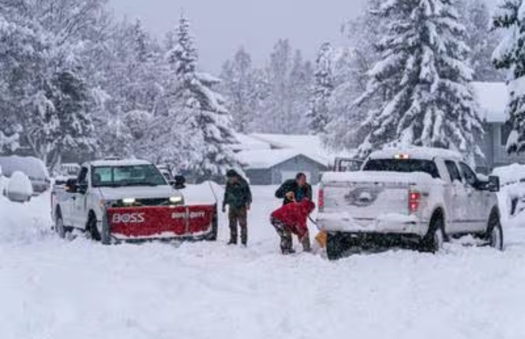
This week Alaska had to declare a state of emergency as they battled record snowfall amounts in the course of just a 24 hour period. On average Anchorage, Alaska residents will typically see somewhere around 12 inches of snowfall during the month of November. This past week, in the span of just 2 days, twice that amount would come down. On Wednesday the single-day record was broken with 9 inches being recorded in a 24 hour period. Some parts of the city would see close to 30 inches of snow in total resulting in road closures, schools closings, and power outages. This winter is already expected to be a wild and perhaps unpredictable winter in America’s northernmost state. Perhaps this is a sign of the winter season to come. This winter is an El Niño year, and that could disrupt traditional winter weather patterns across the country. The last El Niño winter was 2018-2019 and resulted in an ice storm that brought snow and ice as far east as Charleston, SC. The one in 2023-2024 is expected to be stronger. Only time will tell what this year’s winter season will bring!
Wild Weather this Day in History
On November 15, 1987 a massive thunderstorm that would end up producing 49 tornadoes began it’s track across the South-Central parts of the US. The string of tornadoes would eventually touchdown in four states including: Oklahoma, Texas, Louisiana, and Mississippi. This occurred in a 34 hour period causing 11 deaths and 303 injuries. Within these 49 tornadoes there were four F3, twelve F2, twenty seven F1, and six F0 tornado recordings. An F3 tornado causes severe damage that can include: exterior walls and roofs being blown off homes, metal buildings collapsing or becoming severely damaged, forests and farmlands flattened, etc. These storms also produced very heavy rain and dropped a large amount of that in Louisiana. The largest amount being recorded in Olla at 14.66 inches.
I hope everyone has an amazing rest of the week and can enjoy these nice days before some rain moves in!
What another great start to another great week! I hope you enjoyed your weekend! I didn’t, my favorite NFL team lost on Sunday. Over the weekend Western Kentucky University celebrated its homecoming with the traditional parade and football game, which both had some nice weather for! This up coming weekend is the last home football game so come out and support the hilltoppers! Also this upcoming weekend is the last weekend Jackson’s Orchard will be open, it closes on the 18th. Let us take a look at the forecast for the upcoming week.
The Highs: We can expect highs around 70 degrees through Thursday with some pasting clouds, otherwise clear skies for most of the week.
The Lows: We also expect lows around 45 degrees most nights through Wednesday night and clear skies. Then rain moves in Thursday night.
Watch Out: Expect scattered rain showers starting Thursday night lasting through Friday. With this rain a cold front will be moving through, dropping our temperatures just in time for the weekend. Starting Friday the highs will be around 58 degrees through the weekend, with lows around 34 degrees but with clear skies!
Good morning and happy Wednesday! I hope everyone has had an amazing week so far and enjoyed these more fall-like temperatures. Today will be another sunny, warm day with near-record temps. Highs will reach into the lower 80s with lows in the lower 60s. As a front makes its way into our area, tonight will have a slight chance for showers. As this front pushes through, temps will be dropping and rain chances will be increasing. Tomorrow and tomorrow night hold the biggest chances for rain, with Friday having a smaller chance. Temps will reach into the upper 60s tomorrow and upper 50s by Friday. The weekend will have much better, but cooler weather as this front has moved out.
Recent Wild Weather
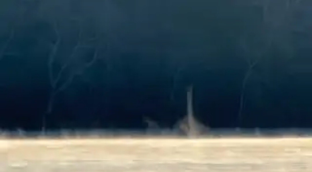
Early in the morning hours on November 3rd, in Greensboro, North Carolina, a strange sight could be seen. On the surface of the water there were steam devils forming and swirling about. This happens when cold air moves over a warmer body of water. Then, as the steamy fog forms and creates water vapor it gets sucked into the vortex with the cooler air and created the swirling steam devils. These typically appear over larger bodies of water such as lakes and oceans. They can get as vertically high as 1600 feet and can be as wide as 160 to 600 feet in diameter. That’s pretty impressive, although not dangerous enough to cause any real damage since they aren’t nearly as strong as either a waterspout or tornado.
Wild Weather this Day in History
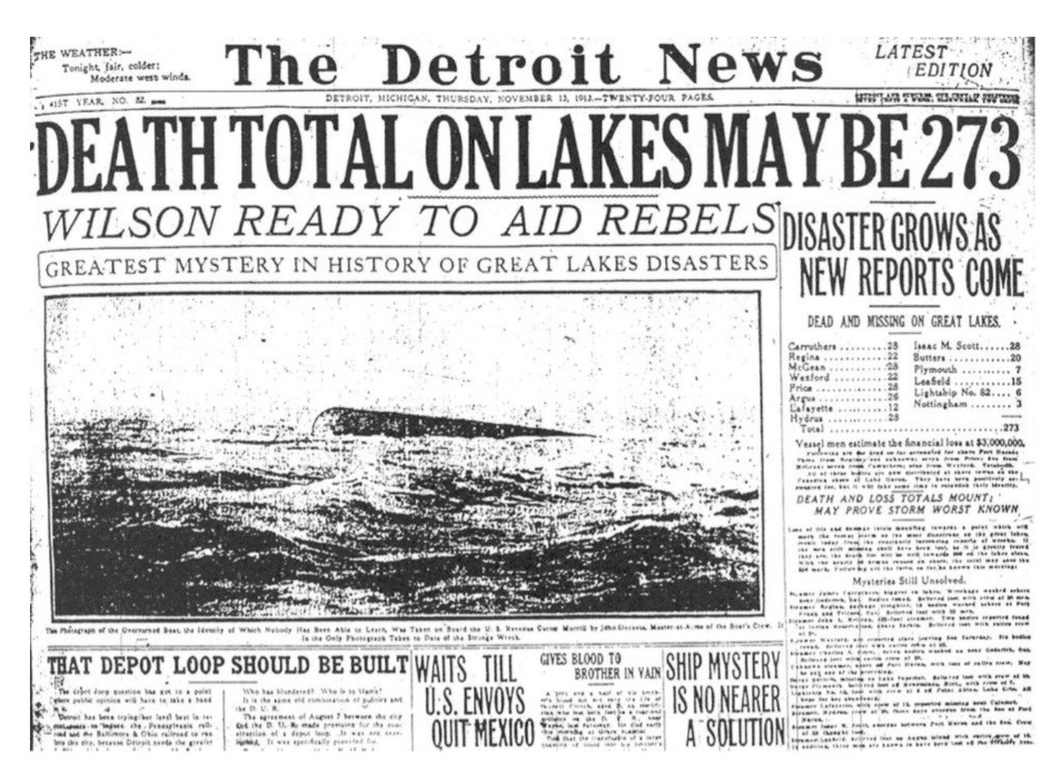
Storms along The Great Lakes have haunted sailors for over a century. There have been so many dangerous and devastating storms on the Great Lakes that it was the eventual inspiration to create the NWS. On November 8, 1913 a blizzard was hitting that would cause devastation to the entire Great Lakes region. It packed with it blizzard-like conditions and hurricane-force winds as two low pressure centers merged and rapidly intensified over Lake Huron. It would be responsible for sinking 19 ships and stranding countless others. It became known as the “White Hurricane” and sadly claimed the lives of an estimated 250+ people. It remains the largest inland maritime disaster in U.S. history.
I hope you have an amazing rest of the week and can stay dry as this front pushes through!
Happy Monday everyone! Today Western Kentucky University basketball beat Kentucky Wesleyan 64 to 90 in their first basketball game of the year! This weekend is WKU’s homecoming so come on down to see the homecoming parade on Friday or the football game on Saturday! Jackson’s Orchard is closing on November 18th for the season so head on out there if you haven’t gotten the chance yet to, the apples are amazing! Let us take a look at the forest ahead!
This week we can expect a warm start to this week with the warm air peaking with a high of 80 degrees on Wednesday. Then on Thursday and Friday the cooler air returns with cloudy skies and highs in the upper 60s. We could have scattered showers on Thursday night but that is only chance of rain this week. Next week we could be looking at another cool week and maybe some actual rain!
Good morning and happy Wednesday! I hope everyone has managed to stay warm throughout this cold front that has pushed in winter temps! If you hate the cold, you’re in luck because things start to warm up as we move into this weekend. Beautiful, sunny skies are expected to continue through the rest of the week with highs creeping back up to the mid 60s. For today, expect highs in the upper 40s with lows still dipping down near below freezing. Tomorrow expect highs in the mid 50s with lows in the low 30s. Friday and Saturday reach mid 60s to lower 70s with lows in the 40s.
Recent Wild Weather
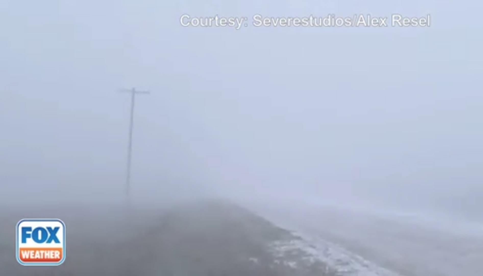
On Monday, a snow squall ripped across South Dakota. This system caused serious hazardous conditions as the visibility was dropped to nearly nothing. What is a snow squall and what makes it different from a normal snowstorm? Squalls are mainly different from a snowstorm in that they are very short lived and because they can cause what is known as a flash freeze. This is when temperatures fall at such a rapid rate that roadways are glazed over really quickly. This situation makes for a very treacherous roadway, and makes controlling a vehicle nearly impossible. As this winter storm continues to track across the central Plains, it is bringing with it heavy snow, gusty winds, and blowing snow to southern South Dakota.
Wild Weather this Day in History
This week for your bit of Wild Weather Wednesday this day in history…I am actually able to share my own account of wild weather. On November 1, 2014, just outside of my hometown of Knoxville, Tennessee, the unexpected happened. The Great Smoky Mountains would get an unseasonable dumping of snow just hours after kids had finished up their trick-or-treating. Mt. LeConte would see an impressive 22 inches overnight bringing perhaps one of the prettiest days I’ve ever seen in the mountains. When we heard that snow had fallen overnight, my mom decided that we had to go see this rare sight. We made our way into Cades Cove on what was peak weekend for fall foliage viewing (which is already busy without the added snowfall event), and I will never forget the scene. All of the fall colored trees with their brilliant reds, oranges, and yellows were set on a backdrop of snow capped mountains. The higher into the mountains you climbed the more you would see those fall color trees draped in white. I am so glad that I was able to witness this incredibly rare moment of truly wild weather. Sitting in standstill traffic was more than worth it, and I would do it all over again. This particular storm continued east eventually dumping 6″ of snow in Gilbert, South Carolina.
Personal photos taken in the Great Smoky Mountains 11/1/14
I hope everyone has an amazing rest of the week and can continue to stay warm as a cooler season begins to move in!
Happy Monday! Or maybe not if you hate the cold. We are off to a cold start to this week and the cold air will be gone by the end of the week. Halloween will be feeling like winter outside, if only the warm air stuck around for a few more days! This is upcoming weekend we fall back a hour so we get a hour more of sleep! Let us take a look at the forecast for this cooler and sunny week ahead.
Freeze Warning: In affect from 10pm tonight through 9am Tuesday, due to the temperatures dropping to the lower 20s. That means a hard freeze tonight so bring in or cover those plants and maybe leave the sinks dripping so the pipes do not freeze. Trust me, that is not fun when they freeze.
Overall for this week, we can expect sunny skies everyday, so very dry week. Expect highs around 50 degrees and lows around 28 degrees through Thursday. After Thursday, temperatures warm up. Friday and through the weekend, highs around 65 degrees and lows around 45 degrees. We can expect partly cloudy skies for the weekend. The weather is really stagnate right now, so I wonder when the snow will start?
Good morning and happy Wednesday! I hope everyone has had an amazing week so far! Today should be another beautiful and warm day with highs in the upper 70s. Gustier winds are possible, but shouldn’t be anything too extreme. As we go into tonight, it will be mostly cloudy with lows in the upper 50s. Tomorrow should be another dry day with temps reaching the upper 70s. Increasing cloudiness is expected as a cold front will be approaching the area early next week. Chances for showers move in Friday and through this weekend with temps gradually decreasing.
Recent Wild Weather
Last Tuesday in Great Falls, Montana, a low pressure system sweeping across the northern plains brought 60+ mph wind gusts into the area. High wind issue alerts were sent out to the local area, and Great Falls reported a peak gust of 62 mph from their local airport weather station. These high winds carried with them large quantities of tumbleweed into residential areas of Great Falls. The tumbleweed was covering sidewalks and yards. There were tumbleweed piles so high that they topped some of the homes, even covering up roofs. There were homes not even visible, almost making it as though they had disappeared. What is tumbleweed? Tumbleweeds begin as little green shrubs referred to as Russian thistle. There are several species that turn into “tumbleweeds”, but Russian thistle is an icon of the American West. When the Russian thistles die they detach from their roots, and become tumbleweeds. High winds can carry these tumbleweeds for miles, and along the way they drop thousands of seeds aiding in the reproduction process.
Wild Weather this Day in History
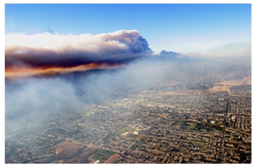
October 25, 2003 (my birth year)…a fire broke out in Cuyamaca Mountains in California. The fire spread very quickly due to extreme Santa Ana Winds. The fire, later named The Cedar Fire, would eventually spread over 273,256 acres and destory over 2,800 structures. The Cedar Fire remains the largest recorded wildfire in California history. It caused 2 billion dollars in damage and costed the, 27 million dollars to put out! In the process 15 lives were lost in The Cedar Fire.
I hope everyone has an amazing rest of the week and can soak up some of the last warm days we’ll be having this season!
Another warm October Monday here, and a warm week this is shaping up to be. The Hilltoppers football play on Tuesday night at home, and there is a concert before the game. Jordan Davis will be the pregame concert in the lot across from the stadium. Let us take a look at the warm week ahead.
The week ahead will a nice fall week of fall weather with highs every day around 80 degrees and lows around 60 degrees, mostly everyday we can expect partly cloudy skies. It is a pretty boring week when it comes to weather but this does appear to be the last week of 70 degree weather we can expect for a while. For next week, we can expect a colder week with possibly a wet Halloween.
Good morning and happy Wednesday! Hopefully most of you have enjoyed these cooler fall-like weather days. If you haven’t, you’re in luck. As a warm front moves through later tonight and into tomorrow, temperatures will rise to the upper 60s and lower 70s. Unfortunately, this will bring more rain into our area as well. Before the warm front moves through our area, expect most of today to be sunny with some clouds here and there. As we go into tonight, chances for showers rise, but ultimately remain low. Temps will get up to the lower 70s and fall to the lower 50s. Going into tomorrow and tomorrow night, showers are likely and temps will get up to upper 60s/lower70s and fall down to the lower/mid 50s.
Recent Wild Weather
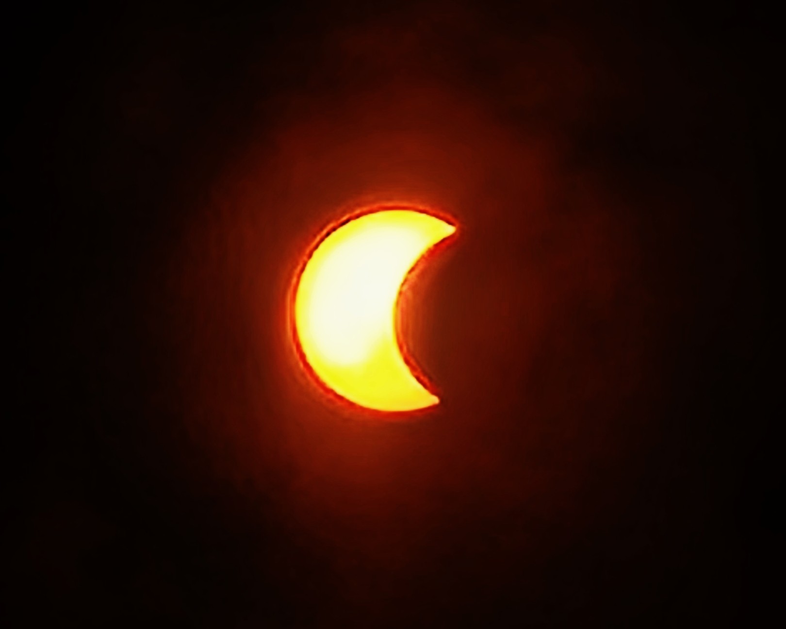
This week’s wild weather brought us a ring of fire! Well, some of us! This year’s annual solar eclipse was on Saturday, October 14th and began over the Pacific Ocean. It would eventually reach land over Oregon and stretch all the way to Texas in the United States. From there it continued on its path south to Central America and Brazil. Unless you were in the direct path of this year’s annual solar eclipse, you would only get the viewpoint of a partial solar eclipse. The entirety of the event lasted over 3 hours, but the annularity (the maximum point of the eclipse) only lasted for 5 minutes. Where we are located here in Bowling Green I was not able to see the eclipse due to the heavy cloud coverage, nor did I have my solar eclipse glasses with me to protect my eyes even if I had a good view of it. It is imperative to wear protection on your eyes, as prolonged exposure to the sun can cause retinal burns or even blindness. Luckily, my eyewear was back at home with my mom in Knoxville, Tennessee and she was sending me updated pictures as the event occurred. Fun fact: in my hometown of Knoxville, TN, during the annual solar eclipse of 2017 (that we were in the direct path of) the school system that I attended school in closed for the day so we could all enjoy this rare occurrence. That is a really cool experience that I will never forget.
Photo taken of the eclipse above Albuquerque, New Mexico
Photo taken of the eclipse above Knoxville, Tennessee
Wild Weather this Day in History
On October 18, 2007 an EF3 tornado made landfall in Nappanee, Indiana in the late evening hours. It would reach maximum intensity winds estimated at 165mph. The tornado was on the ground for about 2 miles, extending to a maximum width of a half mile as it passed over the city. It caused widespread severe damage to homes and businesses alike along its path. Over 100 structures suffered significant damage or were completely destroyed in Nappanee. The tornado would continue moving northeast of Nappanee, and eventually weaken to EF1/EF0 before lifting. Amazingly enough, only minor injuries were reported from this extremely damaging weather event.
I hope everyone has an amazing rest of the week and can keep dry from all the rain!